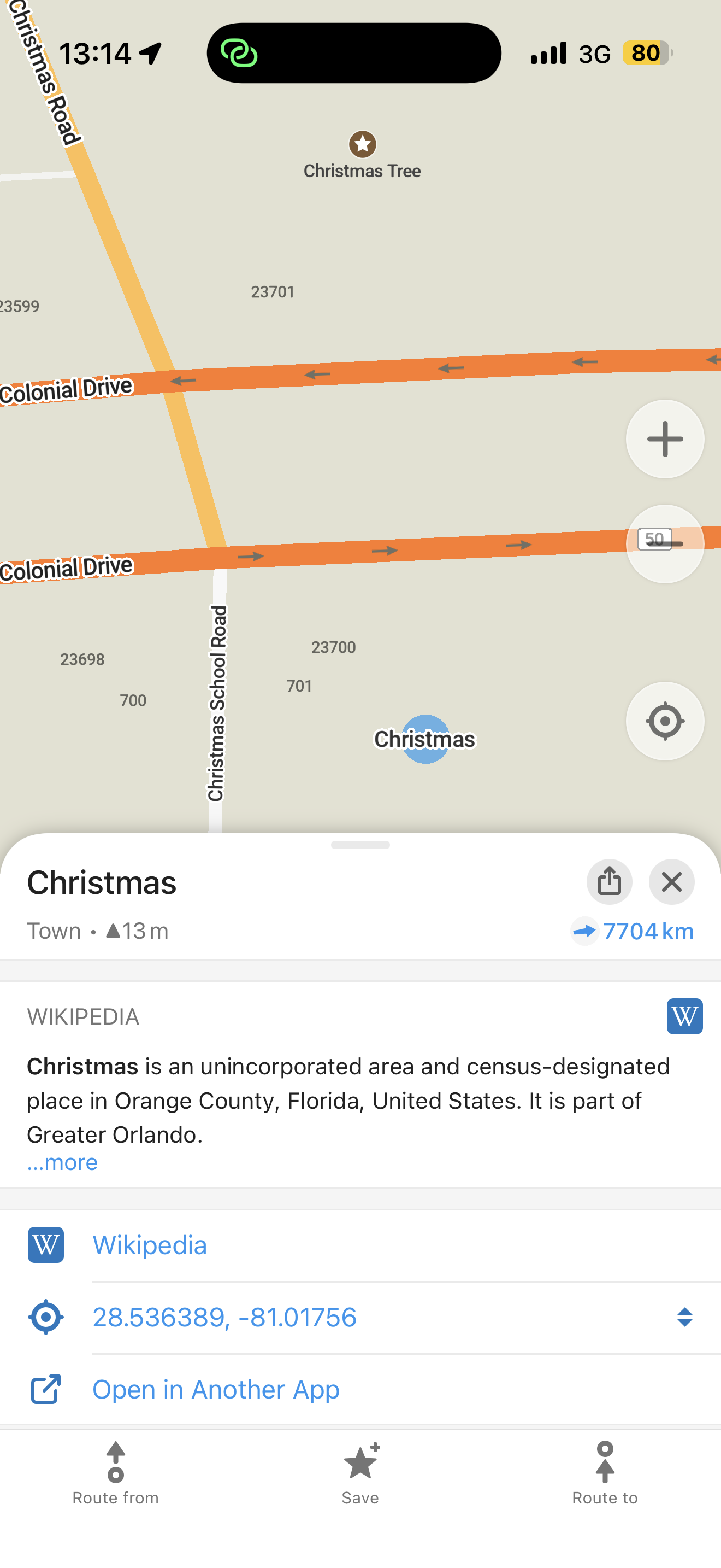
Organic Maps: Nejnovější zprávy a aktualizace od našeho týmu
Satelitní snímky, trasy veřejnou dopravou, alternativní trasy, nové rozhraní vyhledávání a plánování tras pro Android, podpora velkých písem pro zpřístupnění v iOS a další novinky v červnové aktualizaci 2026
V červnové aktualizaci Organic Maps je k vyzkoušení spousta zajímavých nových funkcí a oprav chyb, včetně:
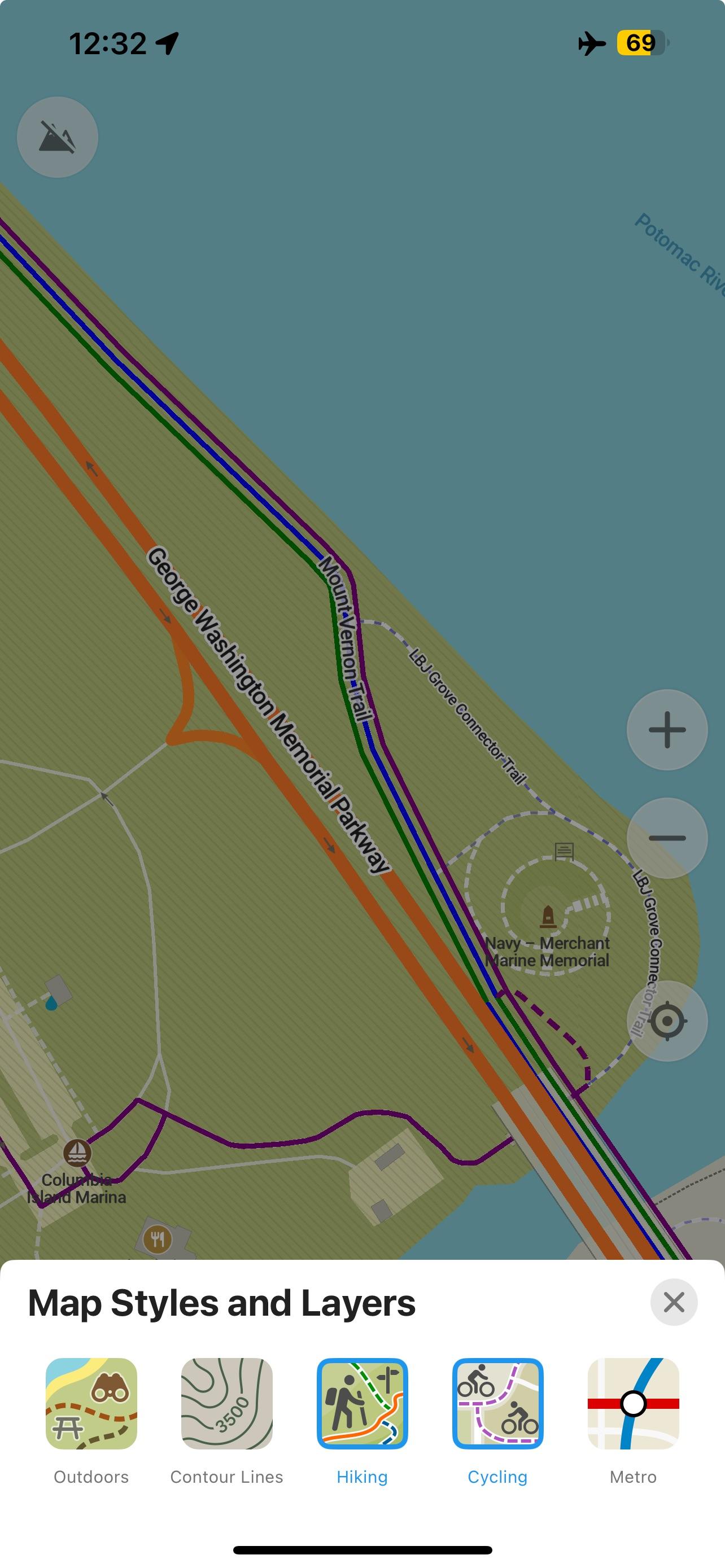
- Satelitní snímky
- Trasy veřejnou dopravou
- Alternativní trasy
- Nové rozhraní vyhledávání a plánování tras pro Android
- Podpora velkých písem pro zpřístupnění v iOS
Získej ji na adrese https://get.omaps.org nebo v obchodech App Store, Google Play, Huawei AppGallery, Obtainium, Accrescent a F-Droid a dej nám vědět, co si myslíš!
Podrobný seznam změn
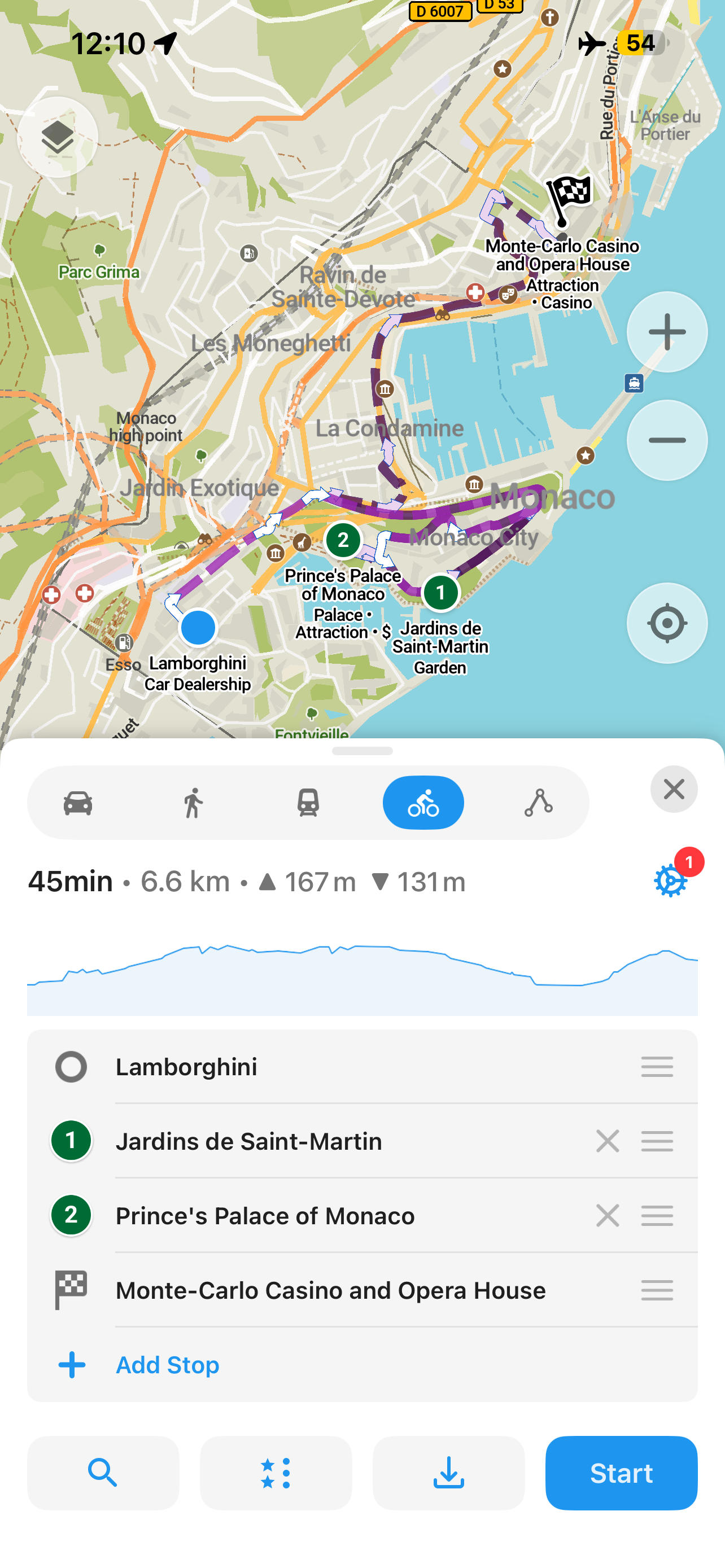
- NOVÉ! Plánování tras veřejnou dopravou metrem, městskou rychlodráhou, autobusem a tramvají (Viktor Govako)
- NOVÉ! Alternativní trasy: kromě nejrychlejší trasy aplikace nyní zobrazuje i nejkratší trasu (Viktor Govako)
- NOVÉ! Upozornění na schody, brány a závory na pěších a cyklistických trasách (Viktor Govako)
- NOVÉ! Pro záložky lze vybrat libovolnou barvu (Alexander Borsuk, Mikhail Listratsenka)
- NOVÉ! Podpora souřadnicových systémů British National Grid (OS Grid), Irish Grid a Irish Transverse Mercator (ITM) (Alexander Borsuk)
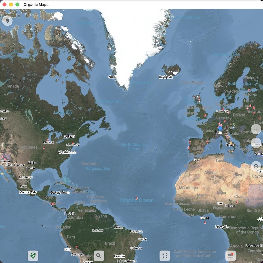
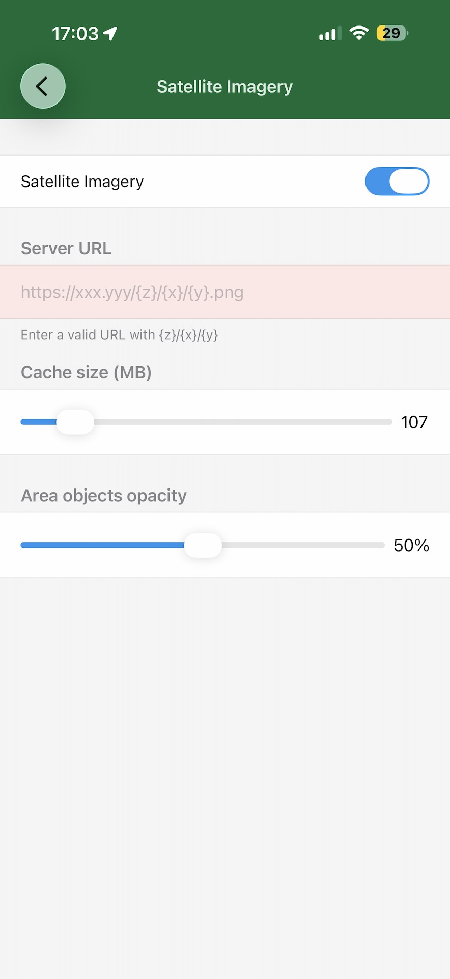
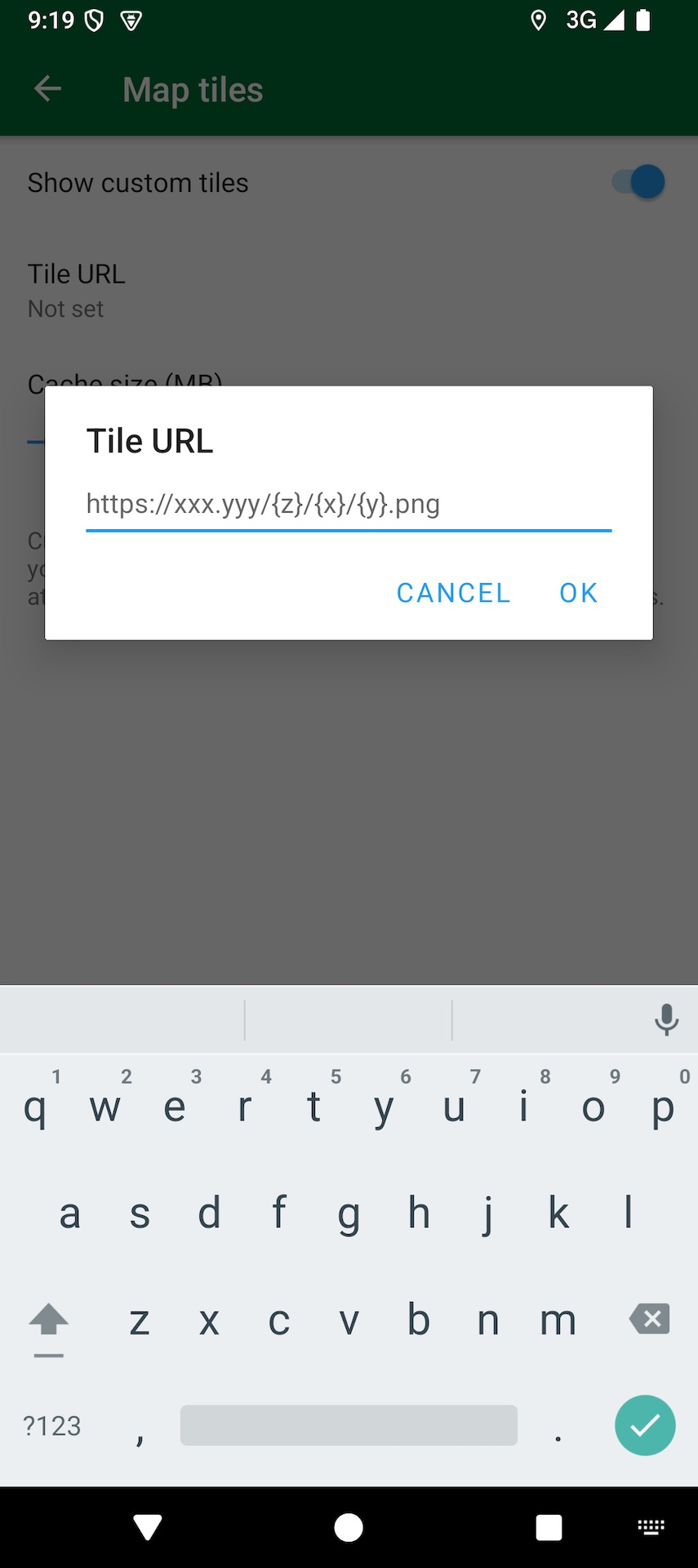
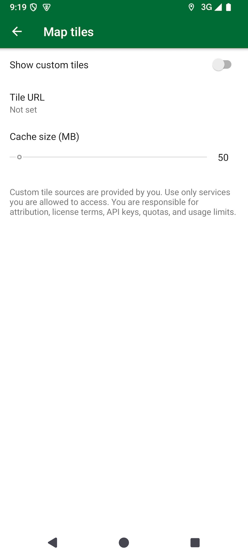
- EXPERIMENTÁLNÍ: Satelitní snímky zapneš v nastavení Organic Maps zadáním vlastní adresy URL serveru rastrových dlaždic. Na vlastním serveru stále pracujeme, proto prosím najdi veřejně dostupný server, jehož URL obsahuje zástupné symboly
{x},{y},{z}(Viktor Govako, renderexpert) - Data OpenStreetMap aktualizována k 24. červnu (Viktor Govako)
- Data Wikipedie aktualizována k 20. červnu, včetně článků v italštině (Alexander Borsuk)
- Zadáním
?map-download-server:https://your-server.com/do vyhledávacího okna přepíšeš servery Organic Maps pro stahování map. Zadáním?no-map-download-servertoto přepsání odebereš (Alexander Borsuk)
Vykreslování mapy a styly
- Hezčí vzory pro pláže, písek, suť, holou skálu, sady a vinice, a také šrafování chráněných území a mokřadů (Alexander Borsuk)
- Plynulejší zakřivené textové popisky silnic a řek (Viktor Govako)
- Řeky, potoky a mokřady mají v tmavém režimu vyšší kontrast a jsou viditelnější (Alexander Borsuk)
- Nové a vylepšené ikony pro vyhledávání kategorií a výsledky vyhledávání na mapě (Anton Makouski)
- Vylepšené tvarování a vykreslování vícejazyčného textu (Alexander Borsuk)
- Různé opravy chyb a vylepšení výkonu (Viktor Govako)
Záznamy tras, záložky a plánované trasy
- Záznamy tras ve formátu GeoJSON nyní při importu a exportu zachovávají nadmořskou výšku a časové značky (Alexander Borsuk)
- Opraven pád po přesunutí záznamu trasy do jiného seznamu (Viktor Govako)
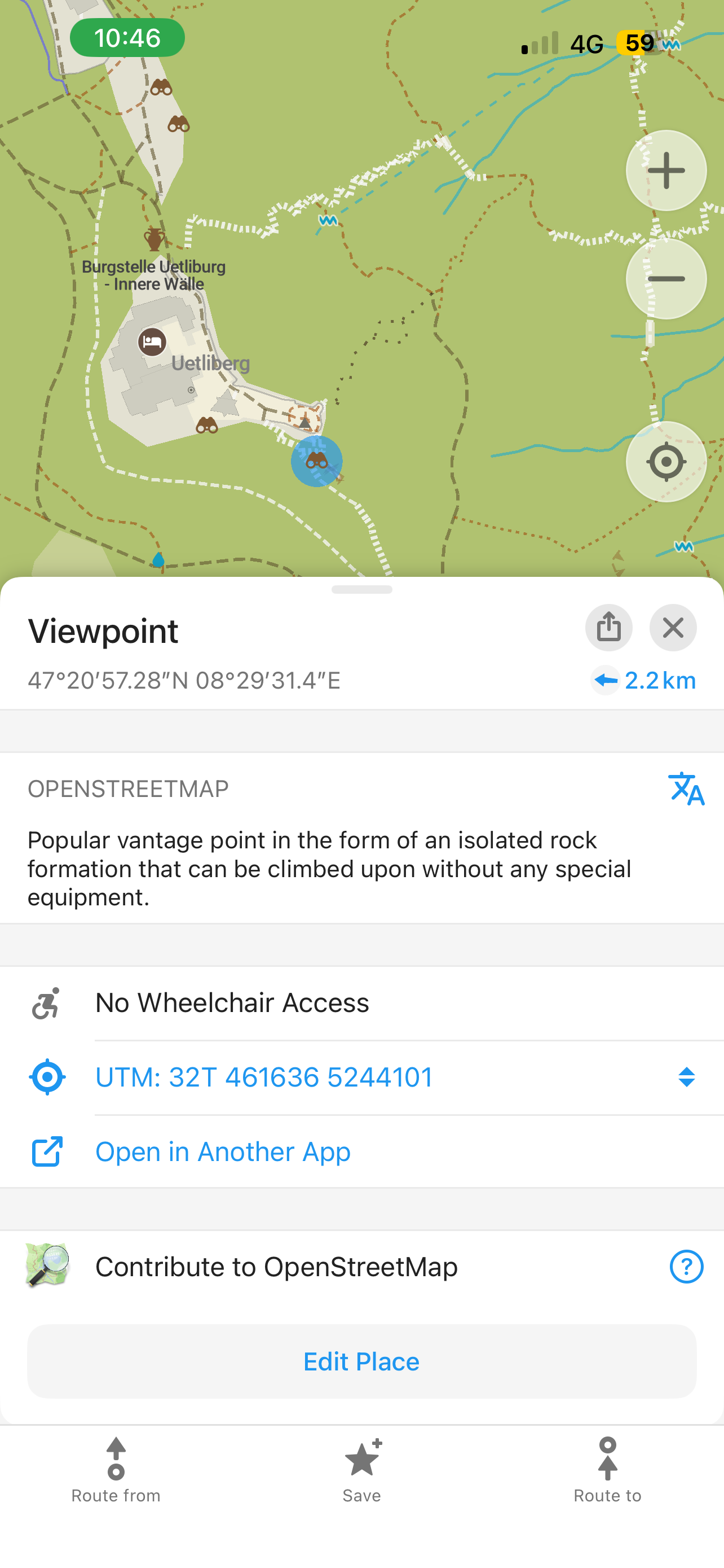
- U památek se nyní zobrazují webové stránky (Viktor Govako)
- U nepojmenovaných výsledků vyhledávání se nyní zobrazují názvy provozovatelů. Například nepojmenovaný bankomat nyní zobrazí svou banku (Anton Makouski)
- Editor: opraven text popisu pro úpravy/sady změn bytových domů v OpenStreetMap (titanniya542-spec)
- Vylepšená detekce HTML v popisech záložek a záznamů tras (Alexander Borsuk)
iOS
- NOVÉ! Podpora zpřístupnění pro Dynamic Type a velká písma (Kiryl Kaveryn)
- NOVÉ! Klepnutím lze vybírat mezi překrývajícími se záznamy tras a plánovanými trasami (Kiryl Kaveryn)
- Vylepšené vykreslování HTML v popisech záložek a záznamů tras (Kiryl Kaveryn)
- Čistší stylování tabulek v uživatelském rozhraní (Kiryl Kaveryn)
Android
- NOVÉ! Rozhraní vyhledávání (Kavi Khalique, Mikhail Listratsenka, Alexander Borsuk)
- NOVÉ! Rozhraní plánování tras (Rishan, Mikhail Listratsenka, Alexander Borsuk)
- Vylepšené vykreslování HTML v popisech záložek a záznamů tras (Mikhail Listratsenka)
- Zmenšena velikost APK (Alexander Borsuk)
- Ikona hlasu se zobrazuje jako neaktivní, když není k dispozici žádný modul převodu textu na řeč (Mikhail Listratsenka)
- U dlouhých popisů záložek a záznamů tras se nyní zobrazuje tlačítko „…více“ (Mikhail Listratsenka)
- Různé opravy uživatelského rozhraní a oprava API pro vracená ID bodů (Mikhail Listratsenka)
Desktop
- Podpora přepínání zobrazovaného souřadnicového systému (Alexander Borsuk)
- Informace o vybraném místě se nyní zobrazují vlevo (Viktor Govako)
- Opravena poloha kontextové nabídky (Osyotr)
- Opraveno zasekávání přihlášení do OpenStreetMap a úprav ve verzích Qt 6.4 a starších (Alexander Borsuk)
- Opraveno neočekávané přepínání stylu mapy během navigace na macOS (Alexander Borsuk)
- Opraven pád při zavírání aplikace pro macOS po exportu souboru KMZ (Alexander Borsuk)
Překlady
- Hlasová navigace krok za krokem v kantonštině (Alexander Borsuk)
- Aktualizované německé a francouzské překlady (Wuzzy, Alexander Borsuk)
- Opraveny nesprávné překlady hlasového pokynu „na ulici“ pro čínštinu, srbštinu a katalánštinu (Alexander Borsuk)
Zapoj se do beta testování, vyzkoušej si nové funkce v předstihu a nahlas problémy:
Děkujeme všem našim uživatelům a přispěvatelům, i těm, kteří darují a udělují Organic Maps 5 hvězdiček v obchodech s aplikacemi. Společně můžeme vytvořit nejlepší mapovou aplikaci!
S láskou, Tým Organic Maps


Organic Maps Beta 2026.06.15: satelitní pozadí, plánování tras veřejnou dopravou, nové vyhledávání a další
Stáhněte si nejnovější beta verzi Organic Maps na adrese https://beta.omaps.org/ nebo stáhněte si APK:
- Mapová data OSM ke dni 12. června
- NOVÉ! Volitelné satelitní pozadí mapy (v nastavení OM vyhledejte položku „Mapové dlaždice“)
- NOVÉ! Plánování tras veřejnou dopravou s metrem, městskou dráhou, autobusy a tramvajemi
- NOVÉ! Nejkratší trasa jako alternativa k nejrychlejší trase
- NOVÉ! Upozornění na trase na schody, brány a závory na mapě
- NOVÉ! Šrafování a výplň plošných objektů symboly (včetně lesů)
- NOVÉ! Hromadný výběr stop a tras
- NOVÉ! Vlastní server pro stahování pomocí ladicího příkazu vyhledávání (
?map-download-server) - NOVÉ! iOS: Přístupnost pomocí velkého písma
- NOVÉ! Android: Přepracované uživatelské rozhraní vyhledávání
- NOVÉ! Android: Podrobné pokyny k plánování tras veřejnou dopravou
… a mnoho dalších vylepšení a oprav chyb!
Chcete více skvělých funkcí a méně chyb? Přispějte na podporu vývoje!
Glyfy pro jednotlivé lokality CJK na Android, přizpůsobení trasy (výběr barvy Android, úprava popisu iOS) a nové atrakce tematických parků v příští aktualizaci Organic Maps
Seznamte se s další květnovou aktualizací Organic Maps s opravami a vylepšeními (další podrobnosti níže). Tým Organic Maps je vděčný všem, kteří projekt podporují, daruje, šíří slovo, píše dobré recenze a přispívá k tomu. Přijdou další nové funkce, včetně vylepšené veřejné dopravy, zůstaňte naladěni!
Aktualizaci získáte na https://get.omaps.org nebo na App Store, Google Play, Huawei AppGallery, Obtainium, Accrescent a F-Droid.
Všechny platformy
- OSM mapové podklady ke dni 27. května 2026 (Viktor Govako)
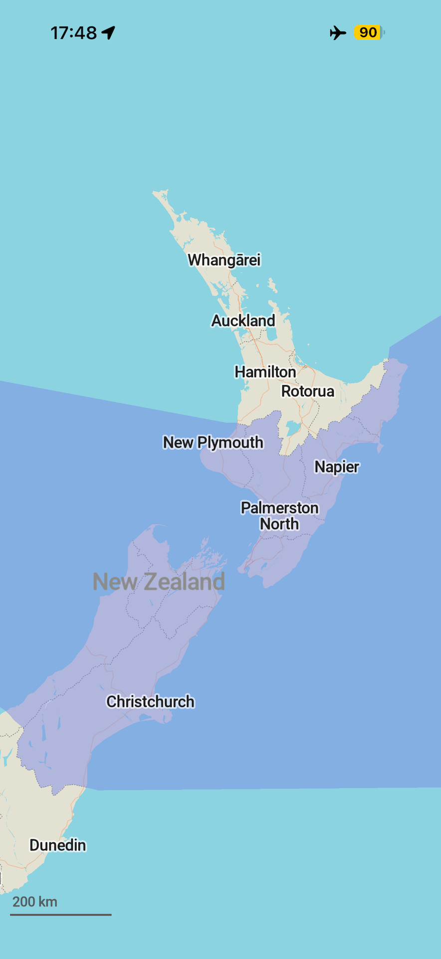
- Přidány silniční štíty Austrálie a Nového Zélandu (Viktor Govako)
- Přidány ikony míst pro boule, cyklistiku a motoristický sport (Viktor Govako)
- Přidány slavnostní brány, tobogány, zábavní parky a horské dráhy (David Martinez)
- Vylepšená gesta prstem pro ovládání mapy v perspektivním zobrazení během režimu navigace (Viktor Govako)
- Opraveny trasy veřejné dopravy pro nádraží a další objekty v oblasti (klepnutím na stanici nebo zastávku zobrazíte linky) (Viktor Govako)
- Opraveno vykreslování rychlostních omezení pro rychlostní radary (Alexander Borsuk)
- Opraveno zvětšení antimeridiánu s více než jednou kopií světa (Alexander Borsuk, Viktor Govako)
- Přesnější zobrazení adres ulic a domů (Viktor Govako)
- Opraveny zbytečné animace mapy (Mikhail Listratsenka)
- Vylepšení stability a výkonu (Alexander Borsuk, Viktor Govako)
Překlady
- Vylepšeny překlady do francouzštiny (Meenphie)
- Vylepšené překlady italštiny (Andrea Pappacoda)
- Vylepšené překlady španělštiny (Jesús L. Pinzolas)
- Vylepšené překlady ukrajinštiny (Nnifria)
- Vylepšené překlady katalánštiny, aktualizované překlady několika názvů zemí a regionů, opravená synonyma pro vyhledávání
leisure=track(Alexander Borsuk) - Opraveny překlady pro
disused:bridgeadisused:tunnel(alnzrv)
iOS
- NOVÉ! Nyní jsou podporovány textové a HTML popisy tras, stejně jako popisy záložek. Popis přidáte stisknutím ikony tužky. (Kiryl Kaveryn)
- Převod textu na řeč (TTS) nyní vybírá nejlepší nainstalovaný hlas pro daný jazyk (Rozšířený / Prémiový). Postup stažení kvalitnějšího hlasu naleznete v části Nastavení Organic Maps. (Kiryl Kaveryn)
- Opravena chyba při přejmenování trasy, kdy se nový název správně neaktualizoval (Kiryl Kaveryn)
- CarPlay: opraveno tlačítko pro vrácení mapy na aktuální polohu (Kiryl Kaveryn)
- Opravena chyba při přidávání záložky na turistické nebo cyklistické trase (Alexander Borsuk)
Android
- NOVÉ! Nyní jsou podporovány textové a HTML popisy tras, stejně jako popisy záložek. Popis přidáte stisknutím ikony tužky. (Mikhail Listratsenka)
- NOVÉ! Pro trasy můžete zvolit libovolnou barvu, nejen omezenou podmnožinu (Mikhail Listratsenka)
- Uživatelé korejštiny, čínštiny a japonštiny nyní uvidí správné fonty podle lokalizace zařízení (Alexander Borsuk)
- Opraveny problémy se stránkou místa tras a tlačítkem „Otevřít v" (Mikhail Listratsenka)
Linux a macOS
- Do komentářů k souborům
.desktopbyly přidány překlady do čínštiny (DeepChirp)
Zapojte se do beta testování a vyzkoušejte první funkce a nahlaste problémy:
Cestujte snadno a hledejte svá dobrodružství se Organic Maps! ✈️🚅🚌🚢🌴🗺️🌎
Tým Organic Maps
Klepnutím na zastávku veřejné dopravy zobrazíte na mapě linky, popisky záložek se už nepřekrývají a květnová aktualizace Organic Maps přináší menší regiony ke stažení ve Vietnamu, Malajsii a jižní Číně
Květnová aktualizace posouvá Organic Maps o krok blíž k plné podpoře veřejné dopravy. Zastávka autobusu, vlaku, trajektu nebo tramvaje je výchozím bodem pro linky, které přes ni vedou – když tedy na zastávce klepnete na linku, zobrazí se tato linka vlastní barvou po celé délce na mapě. Připravujeme také skutečné online jízdní řády, takže nezapomeňte přidat nebo aktualizovat data o veřejné dopravě v OSM ve svém okolí, pokud jste to ještě neudělali!
Jako vždy moc děkujeme našim přispěvatelům a vám za kladné recenze, dary a podporu.
Získejte květnovou aktualizaci na https://get.omaps.org nebo v App Store, Google Play, Huawei AppGallery, Obtainium, Accrescent a F-Droid.
Hlavní novinky
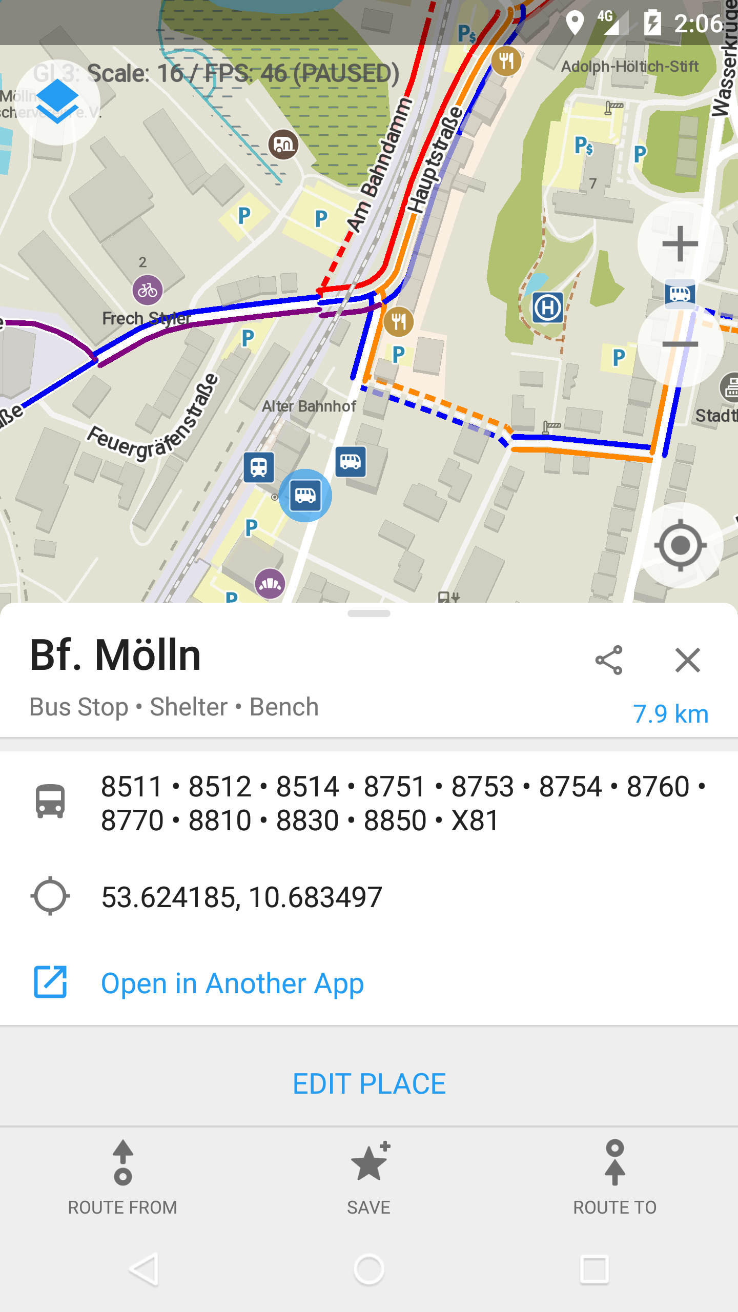
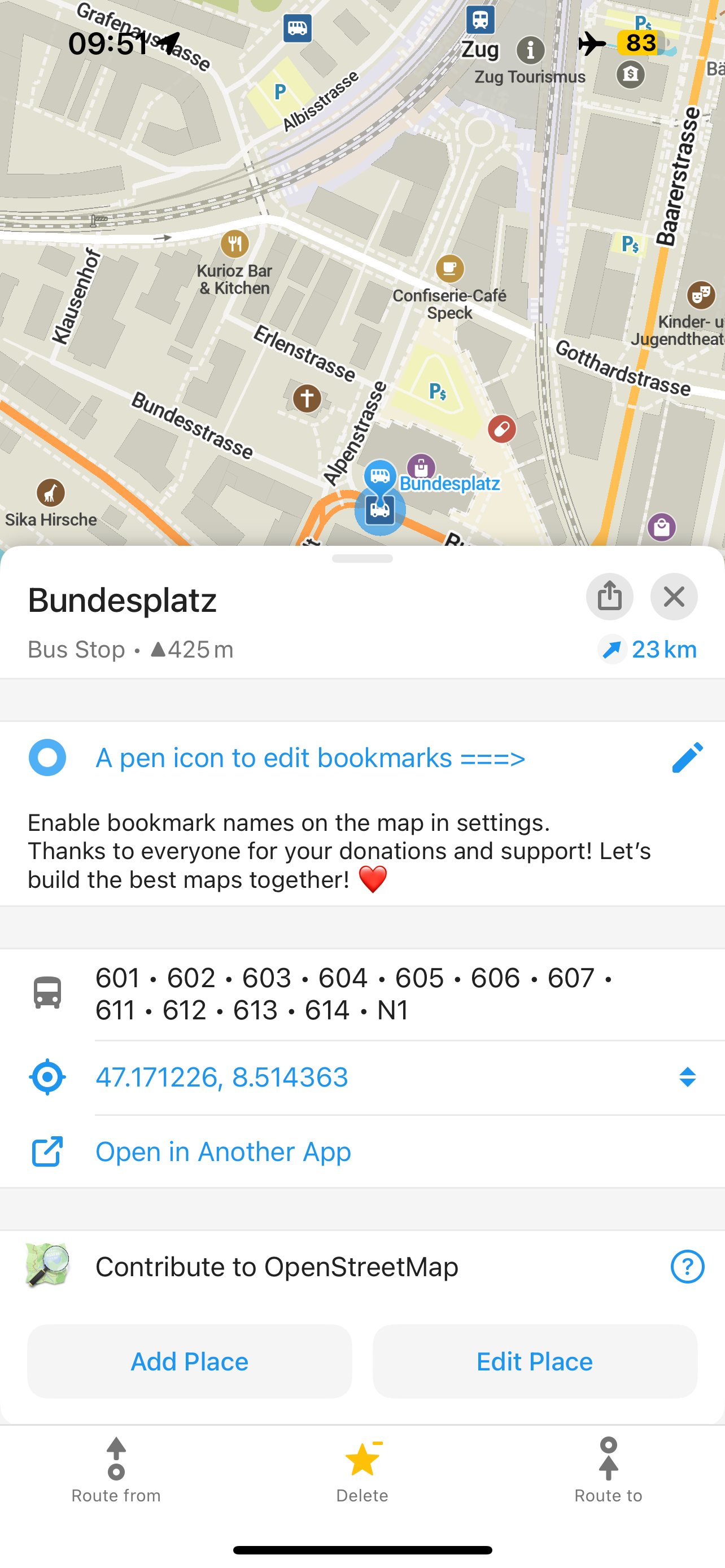
- Klepněte na mapě na zastávku autobusu, tramvaje, vlaku nebo trajektu a Organic Maps zvýrazní celou linku veřejné dopravy, kterou lze vybrat ze seznamu zobrazených linek a tras.
- Přehlednější popisky záložek a čitelnější mapa. Nové umístění popisků zabraňuje tomu, aby se názvy záložek navzájem překrývaly, pěší zóny jsou o něco tmavší a barvy tras byly upraveny pro lepší kontrast jak na světlém, tak na tmavém motivu.
- Jemnější rozdělení regionů v Asii. Vietnam a Malajsie jsou nyní rozděleny na menší mapy, takže si můžete stáhnout pouze oblast, kterou potřebujete, a Hongkong, Macao a Hainan jsou nyní odděleny od provincie Kuang-tung.
Poznámky k vydání
Všechny platformy
- NOVÉ! Klepněte na zastávku veřejné dopravy a vyberte číslo linky, aby se na mapě zvýraznila celá trasa veřejné dopravy, podobně jako ve vrstvě mapy metra (Viktor Govako, Kiryl Kaveryn, Mikhail Listratsenka)
- NOVÉ! Popisky záložek na mapě se nepřekrývají (Viktor Govako)
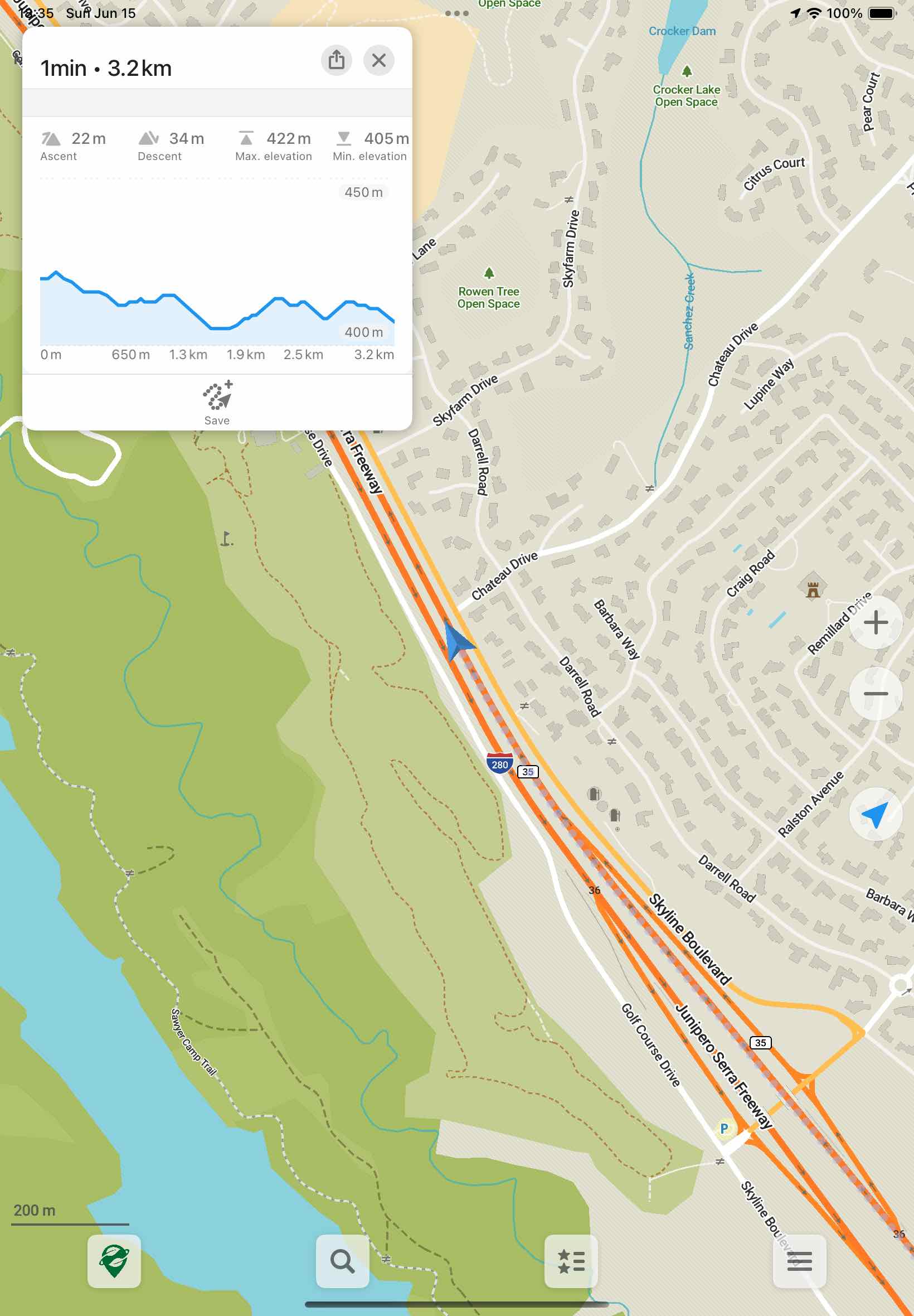
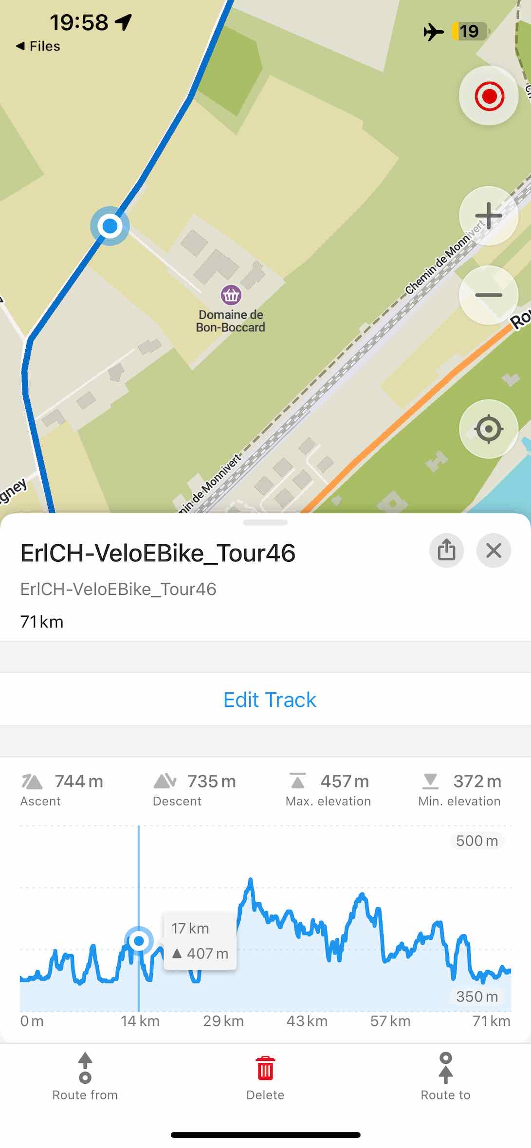
- Opraveny výpočty nastoupaných a sestoupaných metrů v grafech tras, aby lépe odpovídaly hodnotám z jiných oblíbených aplikací (Viktor Govako)
- Dálkové linky veřejné dopravy a další mapové relace jsou nyní přes hranice map spojeny do jedné souvislé linie (Viktor Govako)
- Vietnam a Malajsie jsou rozděleny na menší, samostatně stahovatelné regiony (Viktor Govako)
- Hongkong, Macao a Hainan jsou odděleny od provincie Kuang-tung a sousední hranice byly aktualizovány (Viktor Govako)
- Aktualizovány izolinie (vrstevnice) pro Indonésii, Malajsii, Tanzanii, Thajsko a Vietnam (Viktor Govako)
- Navigace: obnovené trasy nyní vynechávají průjezdní body, které jste již minuli (Viktor Govako)
- Přidány ikony pro aktivní sopky a přístupová místa k vodním cestám; lodní rampy jsou nyní vyhledatelné (David Martinez)
- Přidány vodní dýmkárny (alnzrv)
- Přidány budovy ve výstavbě (Viktor Govako)
- Přidáno „Lookout“ jako vyhledávací synonymum pro vyhlídky (alnzrv)
- Přidáno „pkwy“ jako synonymum pro americké ulice (Viktor Govako)
- Barvy pěších zón byly mírně ztmaveny pro lepší čitelnost (Viktor Govako)
- Víceřádkový text je nyní na mapě správně oříznut (Viktor Govako)
- Názvy ulic již neobsahují duplicitní části (Viktor Govako)
- Opraven import souborů KMB (Alexander Borsuk)
- Aktualizovány překlady napříč kategoriemi, synonymy pro vyhledávání a řetězci uživatelského rozhraní (Alexander Borsuk, Viktor Govako)
- Přeloženy popisy Nového Jižního Walesu a Severního teritoria (alnzrv)
- Vylepšena stabilita a výkon, včetně tvarování písma, ukládání glyfů do mezipaměti a ořezávání linií tras (Viktor Govako, Alexander Borsuk)
iOS
- NOVÉ! Do informačního panelu během navigace bylo přidáno tlačítko pro záznam trasy (Kiryl Kaveryn)
- NOVÉ! V navigačním panelu přibyly dva další kroky pro podrobnější informace o nadmořské výšce a trase (Kiryl Kaveryn)
- Aktualizován styl výškového profilu v navigačním panelu se správným zobrazením tras se zápornými nadmořskými výškami (Kiryl Kaveryn)
- Opraven nesprávný seznam záložek zobrazený ve verzi TestFlight (Alexander Borsuk)
- Větší tlačítko Stop a větší dotykové cíle pro tlačítka na spodním panelu během navigace: ztlumení TTS, nastavení, záznam trasy (Kiryl Kaveryn)
- Vylepšena animace rozbalitelné sekce popisu na stránce místa (Kiryl Kaveryn)
- Stránka místa se už nezavírá po ukončení posouvání výškového profilu, neočekávaně neposkakuje a při úpravách s vysunutou klávesnicí ponechává název viditelný (Kiryl Kaveryn)
- Opraveny problémy s barvami výškového profilu a kruhového ukazatele průběhu při změně vzhledu systému (Kiryl Kaveryn)
- Opraveny pády při mazání trasy nebo záložky, která již neexistuje (Kiryl Kaveryn)
Android
- NOVÉ! Trvalý panel nadmořské výšky a vylepšený výškový profil trasy se správným rozložením RTL (Eric Jau, Mikhail Listratsenka)
- Uložený stav trasy se nyní zachovává i při otočení zařízení (Mikhail Listratsenka)
- Jedna sjednocená referenční linie trasy na stránce místa (Mikhail Listratsenka)
- Větší poloměr rohů u spodních panelů, tlačítek a kreslených prvků pro jednotnější vzhled (Mikhail Listratsenka)
- Opraveny chyby rozložení kolem systémových lišt a navigační lišty (Mikhail Listratsenka)
- Vylepšené zobrazení článků z Wikipedie s lepším formátováním, systémovými barvami a podporou tmavého režimu (DeshDeepakKant, Mikhail Listratsenka)
- Přidány svislé oddělovače mezi segmenty vícedílných tras na výškovém profilu (Mikhail Listratsenka)
- Vylepšeno chování posouvání výškového profilu (Mikhail Listratsenka)
- Opravy rozložení zprava doleva (RTL) (Mikhail Listratsenka)
Linux a Mac OS
- Přidán výběr linky veřejné dopravy, který umožňuje zvolit konkrétní linku po výběru zastávky (Viktor Govako)
- Tlačítka akcí trasy se zobrazují přímo na stránce místa (Viktor Govako)
- Ze stránky místa byly odstraněny duplicitní otevírací hodiny (Viktor Govako)
- Značka mezilehlého bodu trasy na POI nebo adrese nyní zobrazuje název místa (Viktor Govako)
- Stahování map pokračuje tam, kde bylo přerušeno při řádném vypnutí (Alexander Borsuk)
- Organic Maps nyní funguje na ovladačích OpenGL ES 3.0 (Alexander Borsuk)
Zapojte se do beta testování, vyzkoušejte si nové funkce a nahlaste nám případné problémy:
Milujeme naše uživatele ❤️ a milujeme to, co děláme
Tým Organic Maps
Pěší a cyklistické trasy s výškovými grafy, chytřejší vyhledávání adres v USA, plynulé obtékání mapy na antimeridiánu a další novinky v dubnové aktualizaci Organic Maps
Tato dubnová verze je kromě mnoha oprav chyb a vylepšení postavena na třech jednoduchých pravdách: turisté chtějí vědět, kolik nastoupají, každý chce, aby vyhledávání adres prostě fungovalo, a nikdo by neměl mít pocit, že padá z okraje mapy. Díky našim přispěvatelům, vašim skvělým recenzím, darům a podpoře jsme zvládli vyřešit všechny tři — a ještě mnohem víc.
Ať už vás jaro láká na nové stezky, nebo podzim na jižní polokouli vyzývá k poslední dlouhé vyjížďce, doufáme, že vám tato aktualizace usnadní a zkrášlí další cestu.
Dubnovou aktualizaci získáte na adrese https://get.omaps.org nebo v obchodech App Store, Google Play, Huawei AppGallery, Obtainium, Accrescent a F-Droid.
Nejdůležitější novinky
- Klepněte na trasu, uvidíte stoupání. Pěší a cyklistické trasy lze nyní vybírat přímo na mapě. Klepnutím na trasu ji zvýrazníte a okamžitě uvidíte její výškový profil.
- Dva miliony dalších adres v USA a chytřejší vyhledávání. V aplikaci jsou nyní k dispozici další adresy zpracované z dat sčítání lidu TIGER. Kromě chytřejšího porovnávání čísel domů to zlepšuje výsledky vyhledávání všude. Nezapomeňte, že přidání chybějících adres do OpenStreetMap je vždy nejlepší způsob, jak vyhledávání zlepšit.
- Mapa bez okrajů. Organic Maps nyní plynule přechází přes antimeridián (±180° zeměpisné délky). Přetahujte a otáčejte mezi Čukotkou a Aljaškou nebo mezi Novým Zélandem a Fidži bez neviditelných stěn a nepříjemných resetů — Tichý oceán konečně působí kulatě.
- Přebarvěte celou kategorii najednou. Jedním klepnutím změníte barvu všech záložek a/nebo tras v kategorii — drobnost, která promění nepřehledný archiv výletů z minulého léta v něco, co skutečně chcete znovu otevřít.
Poznámky k vydání
Všechny platformy
- NOVINKA! Lepší vyhledávání v USA díky dalším dvěma milionům adres zpracovaných z dat sčítání lidu TIGER (Viktor Govako)
- NOVINKA! Vylepšené vícebarevné vykreslování pěších a cyklistických tras; klepnutím na trasu ji vyberete a zobrazíte její výškový graf (Viktor Govako)
- Data OpenStreetMap aktualizována k 4. dubnu
- Data Wikipedie aktualizována k 1. dubnu
- Upravena aproximace nastoupaných a naklesaných metrů v grafech tras tak, aby lépe odpovídala hodnotám zobrazeným v jiných aplikacích (Viktor Govako)
- Po výběru aktuální polohy na mapě můžete nyní do OpenStreetMap přidat nové místo (Mikhail Listratsenka)
- Přidány ikony pro food courty a městské brány (David Martinez)
- Přidány podkategorie obchodů s oblečením: dámské, pánské, dětské, svatební, sportovní a spodní prádlo, a také typy kanceláří (Viktor Govako)
- Aktualizované kategorie vyhledávání: přidán „Chléb“ pro pekárny, kuchyně „shawarma“ a další vylepšení synonym (Viktor Govako)
- Mapa se nyní při přetahování a otáčení správně napojuje na antimeridiánu (±180° zeměpisné délky) (Alexander Borsuk, Viktor Govako)
- Cyklistická navigace nyní při nízkých rychlostech používá směr podle kompasu (HossamSaberr)
- Vylepšené vyhledávání adres podle čísla domu (Viktor Govako)
- Opravena systémová chyba při plánování tras poblíž některých regionálních hranic (Viktor Govako)
- Opraveny výsledky vyhledávání, když mají město a stát stejný název (Viktor Govako)
- Přidána synonyma amerických ulic: highway, hwy, freeway a fwy (Viktor Govako)
- Opraveno nezarovnání nitkového kříže editoru při stisku tlačítka „Přidat místo" (José Araújo)
- Opraveno zobrazení otevíracích hodin pro místa s posunem dle východu/západu slunce (Alexander Borsuk)
- Opraveno vypadávání bodů v záznamu GPS trasy mezi segmenty (Alexander Borsuk)
- Opraveno zpracování letního času pro časová pásma (Andrei Shkrob)
- Opraveny barvy linek metra v Sydney (Alexander Borsuk)
- Opraven import GeoJSON (Alexander Borsuk)
- Vylepšená stabilita a výkon (Alexander Borsuk, Viktor Govako)
- Aktualizované překlady (Alexander Borsuk, Viktor Govako, přispěvatelé Weblate)
iOS
Upozornění pro majitele starších iPhonů a iPadů: vzhledem k nedávným změnám v TestFlight a App Store podporuje tato verze pouze iOS 15 a novější. iOS 12, 13 a 14 již nejsou podporovány. Dříve nainstalované verze Organic Maps budou na starších zařízeních nadále fungovat, ale nové mapy, funkce a opravy budou nyní přicházet pouze na iOS 15 a vyšší.
- NOVINKA! Změna barev všech záložek a tras v kategorii najednou (Kiryl Kaveryn)
- Vylepšené zobrazení HTML obsahu s tabulkami a obrázky v detailech záložek (Alexander Borsuk, Kiryl Kaveryn)
- Přidány svislé oddělovače pro vícesegmentové trasy ve výškovém grafu (Kiryl Kaveryn)
- Opraven výběr bodu ve výškovém grafu pro interpolované body (Kiryl Kaveryn)
- Vylepšená gesta modálních oken: přichycení k nejbližšímu kroku, zavření při posunu od okraje a obnovení předchozího stavu při opětovném otevření (Kiryl Kaveryn)
- Nyní můžete spustit platnou trasu, i když jste vyzváni ke stažení dalších map (Kiryl Kaveryn)
- Zvětšena dotyková plocha tlačítek v navigační liště „Přidat místo" (Noahdyn)
- Opraven pád při exportu tras (Alexander Borsuk, Kiryl Kaveryn)
- Opraveno vyhledávání v seznamu záložek a tras při klepnutí z detailu místa (Kiryl Kaveryn)
Android
- NOVINKA! Změna barev všech záložek a tras v kategorii najednou (Mikhail Listratsenka)
- NOVINKA! Naplánovaný režim vzhledu v Nastavení pro automatické přepínání světlého/tmavého motivu na základě východu a západu slunce (Dzmitry Strekha)
- Přidána historie naposledy použitých kategorií v editoru map (Mikhail Listratsenka)
- Přidána ikona tramvaje pro tramvajové zastávky vybrané na mapě (Mikhail Listratsenka)
- Skrytí tlačítka stahování, pokud jsou již všechny mapy stažené (Mikhail Listratsenka)
- Opraveno nahrávání úprav map do OpenStreetMap (Viktor Govako)
- Opraveno sdílení souborů do Google Drive a dalších aplikací (Alexander Borsuk)
- Opraven opětovný import záložek při znovuotevření aplikace z nedávných aplikací (Alexander Borsuk)
- Otevírání vyhledávacích URL OpenStreetMap, jako je
openstreetmap.org/search?query=Pizza, nyní spouští vyhledávání v Organic Maps (Rawdyrathaur) - Opraveno několik pádů (Alexander Borsuk)
Desktop (Linux a Mac OS)
- Přidána možnost vybrat vodicí trasu pro plánování trasy (Viktor Govako)
- Opraveno ukládání nebo export záložek a tras, který v některých jazykových prostředích vytvářel nefunkční soubory kvůli desetinným oddělovačům závislým na místním nastavení (Alexander Borsuk)
Zapojte se do beta testování, vyzkoušejte si nové funkce a nahlaste problémy:
S láskou a péčí ❤️ Tým Organic Maps
Podmíněná rychlostní omezení, podrobnější izolinie pro Čínu, rozdělení/menší regiony Tanzanie, obchody s kůží a další novinky v březnové aktualizaci Organic Maps
Březnová aktualizace Organic Maps si vyžádala více času kvůli opravám a revizi Google Play. Aktualizace Accrescent stále není hotová kvůli problémům s obchodem s aplikacemi Accrescent. Aktualizaci získáte na https://get.omaps.org nebo na App Store, Google Play, Huawei AppGallery, Obtainium, Accrescent a F-Droid.
P.S. Pokud máte zájem o sadu SDK pro iOS/Android/Linux/MacOS/Windows s offline mapami, které můžete znovu použít ve svých projektech, kontaktujte nás e-mailem na adrese [email protected].
P.P.S. Věděli jste o rozhraní API, které již můžete ve své aplikaci používat, pokud je nainstalována také aplikace Organic Maps? Podívejte se na něj zde: https://omaps.app/api
Poznámky k vydání
- Mapová data OSM k 10. březnu
- Data Wikipedie k 1. březnu
- Podrobnější výškové izolinie pro čínské provincie (ZiyiGaoCN)
- Přidána podpora podmíněných rychlostních omezení (Abdelhadi Wael, Viktor Govako)
- Přidány obchody s kůží a náboženským zbožím (Viktor Govako)
- Přidány řady stromů (Viktor Govako)
- Přidána nástupiště zastávek veřejné dopravy bez blízkých autobusových zastávek (Viktor Govako)
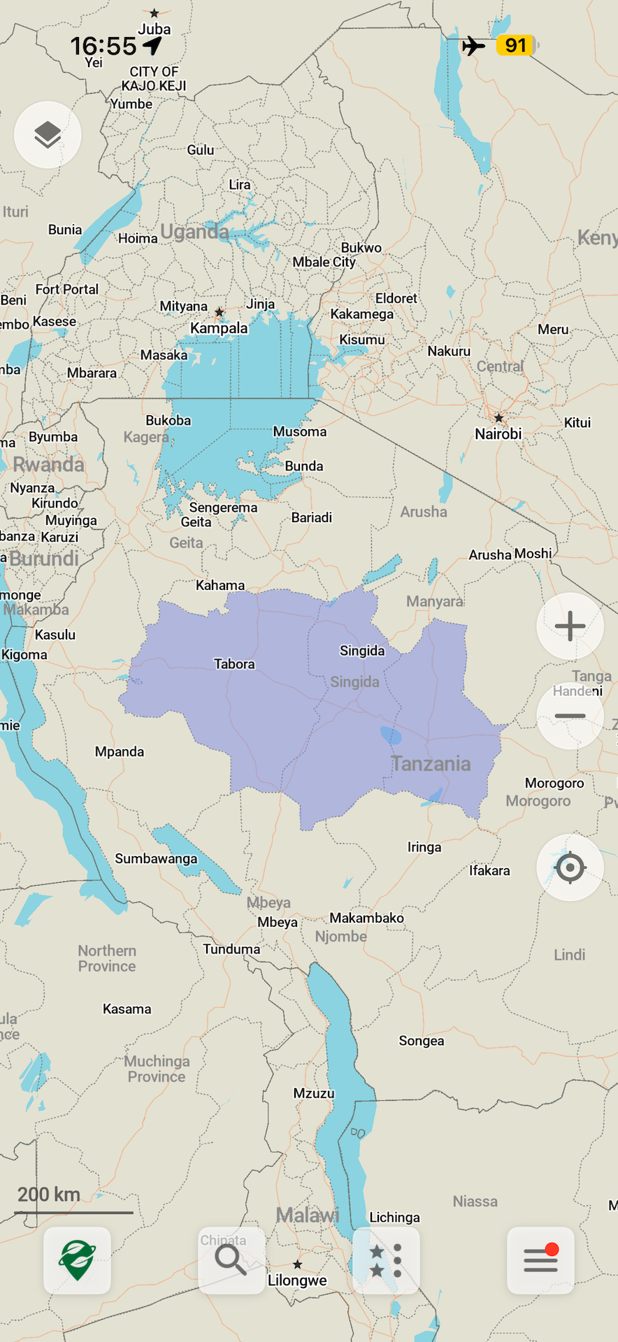
- Rozdělení Tanzanie na menší regiony (Emile Villette, Viktor Govako)
- Opraven výpočet postupu stahování země (Kiryl Kaveryn)
- Opraveno několik pádů, zlepšena stabilita a výkon (Alexander Borsuk, Viktor Govako)
iOS
- Přidána historie naposledy použitých kategorií v editoru (Rahul Kolluru)
- Vylepšeno gesto přejetí prstem nahoru na obrazovce plánování trasy (Kiryl Kaveryn)
- Opravena pozice pravítka pro CarPlay (Kiryl Kaveryn)
Android
- Vylepšeno zobrazování otevírací doby podniků (Anton P)
- Přidána šedá ikona pro skryté seznamy (Alexander Borsuk)
Překlady
- Vylepšené popisy zemí (alnzrv)
- Použity opravy rumunského překladu od Eugena Dedu (Alexander Borsuk)
- Aktualizovány názvy zemí (Viktor Govako)
- Aktualizovány překlady od přispěvatelů Weblate (Viktor Govako)
- Opraven ukrajinský překlad (Nnifria)
Zapojte se do beta testování a vyzkoušejte první funkce a nahlaste problémy:
Každý dar a příspěvek nám pomáhá vytvořit lepší, na soukromí zaměřenou, bezplatnou a open-source alternativu k mapám Apple a Google.
Jako vždy, s láskou a péčí ❤️ Tým Organic Maps
Aktualizace Organic Maps z února 2026
Díky našim přispěvatelům je pátek vhodný čas na aktualizaci Organic Maps! Získejte aktualizaci na https://get.omaps.org nebo v App Store, Google Play, Huawei AppGallery, Obtainium, Accrescent a F-Droid.
Pokud chcete vidět jízdní řády veřejné dopravy v reálném čase ve vašem městě v jedné z nadcházejících aktualizací, prosím:
- Pošlete nám zdroje statických a reálných GTFS kanálů od vašich místních dopravních podniků, abychom je mohli otestovat a integrovat.
- Zkontrolujte, zda data OpenStreetMap ve vaší oblasti zahrnují všechny zastávky autobusu/tramvaje/vlaku s nezbytnými značkami na https://gtfs-osm-matcher.organicmaps.app/.
Poznámky k vydání
- Data mapy OSM k 16. únoru
- Data Wikipedie k 1. únoru
- Černé turistické a cyklistické trasy jsou nyní viditelné v tmavém motivu (Viktor Govako)
- Přidány další služby pro auta: opravy, servis a díly (Viktor Govako)
- Opraven přístup pro jízdní kola na některých typech cest (Viktor Govako)
- Opraven výpočet průměrné rychlosti (Viktor Govako)
- Vylepšené řazení výsledků vyhledávání pro kategorie (Viktor Govako)
- Přidána uzbecká kuchyně (alnzrv)
- Přidány lanové dráhy na mapě (Rawdyrathaur)
- Opraveny odkazy Wikimedia s "?" v názvu (alnzrv)
- Podpora souborů GPX s "+" v souřadnicích (Alexander Borsuk)
iOS
- Přidáno ověření prohlížeče OSM a logo (Rahul Kolluru)
Android
- Rozbalitelná otevírací doba (Rover track)
- Opraveno zobrazení otevírací doby (DaN0mic)
- Opraven problém se zaměřením na vstupní text dialogu (Alexander Borsuk)
- Zobrazení a použití nadmořské výšky MSL pro zaznamenané trasy na Androidu 14+ (Alexander Borsuk, Viktor Govako)
- Opraven import KML, KMZ, GPX, GeoJSON z WhatsApp (Sergiy Kozyr)
- Opraven pád aplikace (Alexander Borsuk)
- Podrobnější chybové zprávy přihlášení OSM (Owm Dubey)
- Vylepšený výkon stránky místa (Owm Dubey)
- Opravena ikona viditelnosti seznamu záložek/tras na starších zařízeních Android (Owm Dubey)
Překlady
- Odstraněny duplicitní názvy měst v některých regionech mapy (alnzrv)
- Opraveny hebrejské hlasové pokyny (mattanelkaim)
- Opraveny překlepy v korejštině (Parkjju)
- Přidána ruská synonyma vyhledávání (ednzxt)
- Vylepšené německé hlasové pokyny (Navigator72)
- Opraven chybějící překlad pro nepoužívaný železniční tunel (pranjaldubey022)
- Opraven překlad země v rumunštině (Eugen Dedu)
- Přidány překlady do laoštiny a arménštiny (Viktor Govako)
- Přidány chybějící arménské překlady (Alexander Borsuk)
- Aktualizovány překlady od přispěvatelů Weblate (Viktor Govako)
Připojte se k beta testování, abyste vyzkoušeli rané funkce a nahlásili problémy:
Každý dar a příspěvek nám pomáhá budovat lepší, na soukromí zaměřenou alternativu k Apple a Google Maps.
S péčí a láskou, Tým Organic Maps
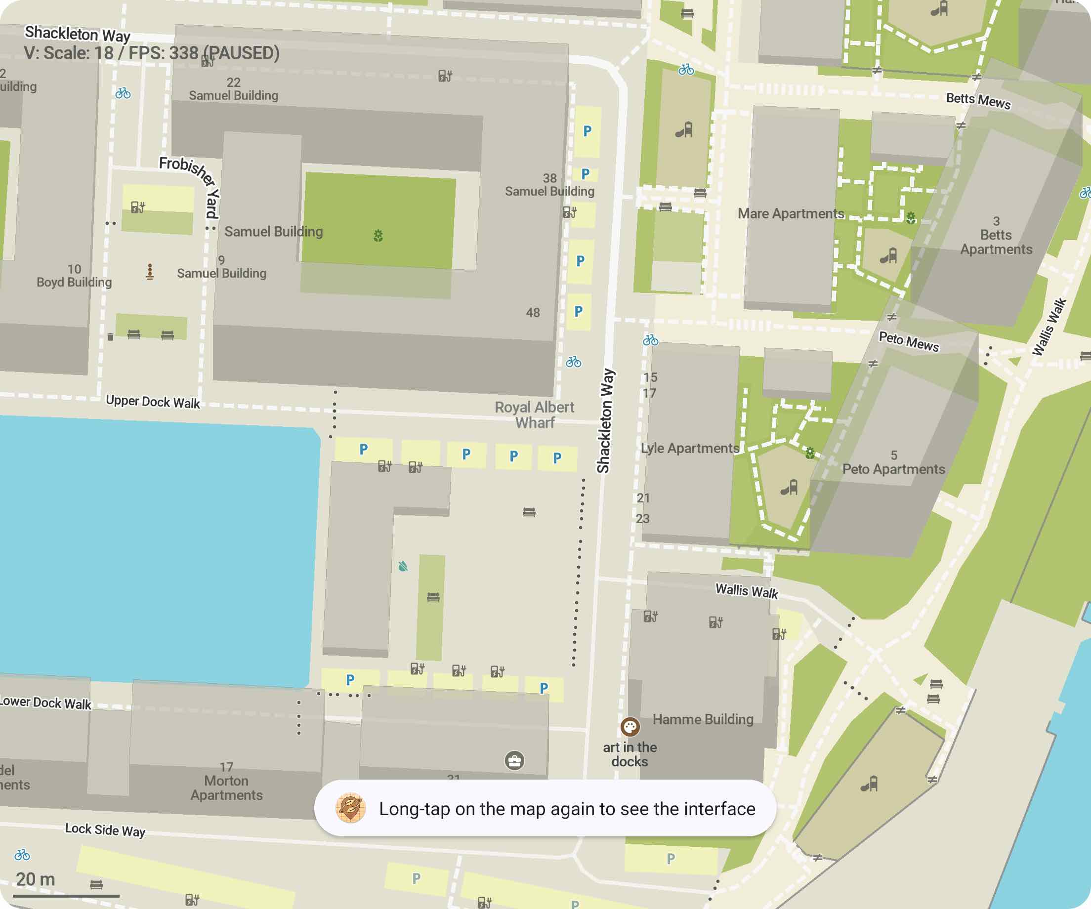
Jak přiblížit nebo oddálit jednou rukou v Organic Maps
Jak přiblížit nebo oddálit jednou rukou v Organic Maps
- Rychle dvakrát klepněte kamkoli na mapě, ale po druhém klepnutí prst nezvedejte.
- Pohybem prstu nahoru nebo dolů oddálíte nebo přiblížíte.
Gesto dlouhého podržení: zobrazí nebo skryje rozhraní.
Rychlejší mezistátní a meziregionální trasy v aktualizaci Organic Maps ze 26. ledna
Je čas aktualizovat Organic Maps! Rychlejší mezistátní a meziregionální trasy, čerstvá mapová data OSM a mnoho oprav chyb pro Android ve druhé aktualizaci aplikace v roce 2026.
Nainstalujte si ji z get.omaps.org nebo z App Store, Google Play, Huawei AppGallery, Obtainium, Accrescent a F-Droid.
Co je nového
- Trasy mezi zeměmi se vytvářejí rychleji a už v některých případech nezpůsobují pády kvůli nedostatku paměti (Viktar Havaka)
- Aktualizovaná data OpenStreetMap k 25. lednu (Viktar Havaka)
- Podpora exportu GeoJSON pro záložky a trasy (Sergiy Kozyr, Alexander Borsuk, Viktar Havaka)
- Opravené a aktualizované odkazy na webové stránky Organic Maps (Alexander Borsuk)
Android
- Rozšířená otevírací doba pro zobrazení celého týdne (rovertrack)
- Rozdělení možnosti světlého/tmavého motivu aplikace do nastavení vzhledu a navigace (Dzmitry Strekha)
- Klepnutí na ikonu záložky v seznamu záložek umožňuje změnit její barvu (Abdelhadi Wael)
- Vylepšené rozhraní na šířku pro vybrané místo na mapě (Rover track)
- Opraven nefunkční editor pro místa s neplatnými telefonními čísly (Abdelhadi Wael)
- Opraven pád na zařízeních Android 12 (Alexander Borsuk)
- Opraveno ořezávání dlouhých názvů ulic v záhlaví navigace (pranjaldubey022)
- Opraven překryv navigačního panelu na malých obrazovkách (Anton P)
- Opraven pád vyhledávání na Android 5 a 6 (Alexander Borsuk)
- Opraveny překlady FAQ na Android 5 (Alexander Borsuk)
- Opravena chyba „Nedostatek volného místa" při aktualizaci map (Alexander Borsuk)
Překlady
- Opravené a aktualizované překlady od přispěvatelů Weblate (Viktar Havaka)
- Aktualizované rumunské hlasové pokyny TTS (R. Ravzan)
- Vylepšené popisy zemí (alnzrv)
- Opravené rumunské a mexické španělské překlady (Alexander Borsuk)
- Přidány chybějící překlady pro nepoužívané mosty (Alexander Borsuk)
Připojte se k beta testování, abyste mohli vyzkoušet nové funkce a nahlásit problémy:
Přispějte a přidejte se k vytvoření lepší alternativy map Apple a Google zaměřené na ochranu soukromí.
S láskou, Tým Organic Maps
Barvy tmavého motivu s vyšším kontrastem, kapacita parkování, půjčoven a nabíjení a další v lednovém vydání 2026
Začněme rok 2026 aktualizací Organic Maps, kterou umožnili všichni naši přispěvatelé! Nainstalujte si ji z https://omaps.app/get nebo z App Store, Google Play, Huawei AppGallery, Obtainium, Accrescent a F-Droid
Poznámky k vydání (všechny platformy)
- Barvy tmavého motivu s vyšším kontrastem (David Martinez)
- Aktualizovaná data OpenStreetMap (11. ledna) (Viktor Govako)
- Přidáno albánské hlasové vedení (TTS) (Alexander Borsuk)
- Přidána bulharská vyhledávací synonyma (Clippy)
- Kasina vyloučena z kategorie „Zábava" (Clippy)
- Snížena tloušťka linek metra (Manik)
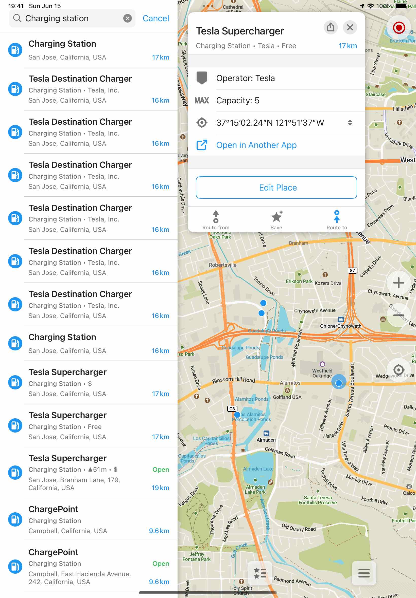
- Přidány informace o kapacitě do výsledků vyhledávání pro parkování motocyklů, půjčování kol, nabíjení kol a nabíjení aut (David Martinez)
- Přidáno patro do výsledků vyhledávání (David Martinez)
Překlady
- Přidány albánské překlady aplikace (Alexander Borsuk)
- Aktualizovány FAQ a přidány překlady FAQ pro arabštinu, češtinu, nizozemštinu, perštinu, řečtinu, hebrejštinu, hindštinu, maďarštinu, indonéštinu, italštinu, litevštinu, maráthštinu, švédštinu, telugštinu (Alexander Borsuk)
- Vylepšeny německé překlady aplikace a FAQ (DaN0mic)
- Vylepšeny latinskoamerické španělské překlady aplikace (Alexander Borsuk)
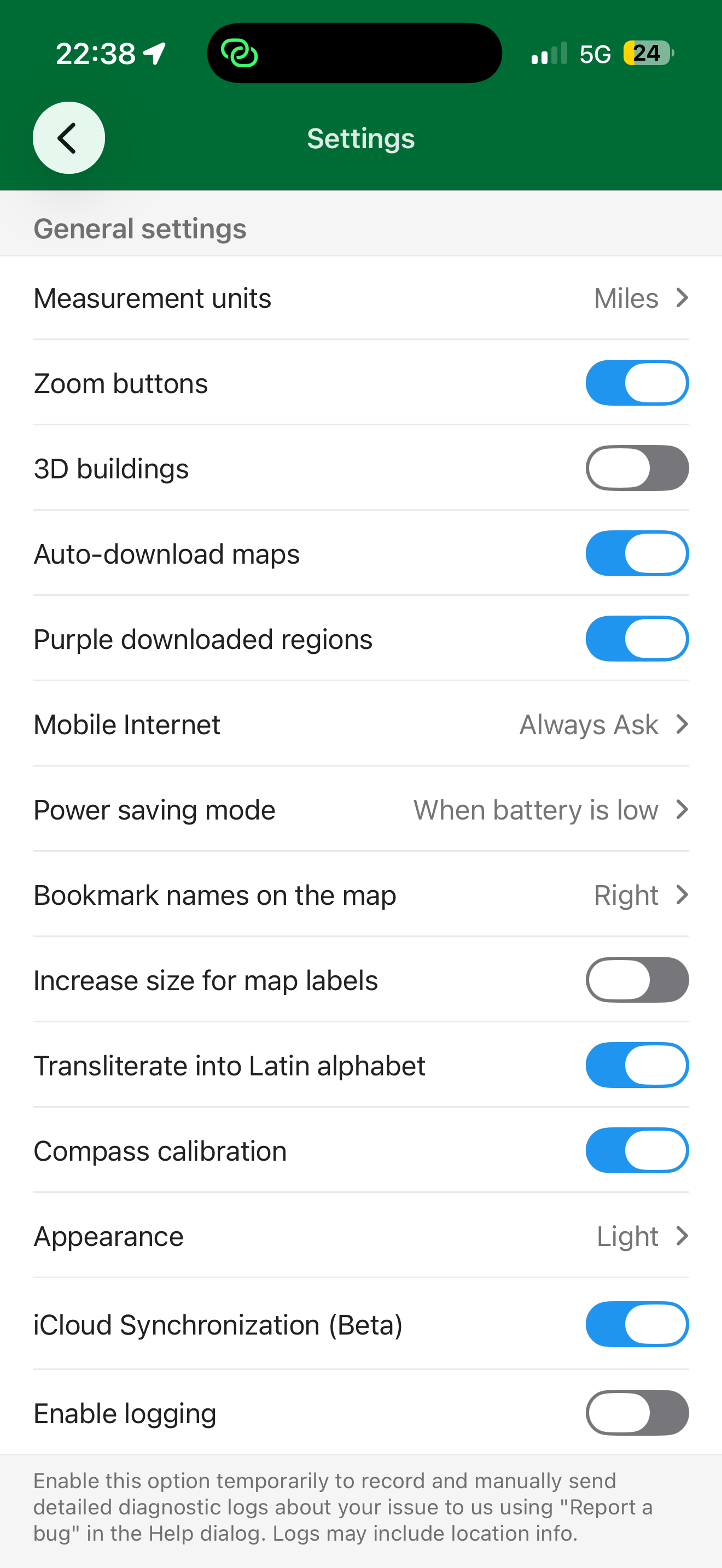
- Nastavení „Tlačítka přiblížení" přejmenováno pro větší jasnost (Alexander Borsuk)
- Opravy překladů od přispěvatelů Weblate pro různé jazyky (Viktor Govako)
Změny pouze pro iOS
- Širší tlačítka plánování trasy (Kiryl Kaveryn)
Změny pouze pro Android
- Přidána podpora Google Asistenta pro navigaci a vyhledávání (skirm-tech)
- Aktualizováno nastavení motivu navigace „Automaticky", aby sledovalo tmavý/světlý režim systému (Dzmitry Strekha)
- Opraveno pád při spuštění navigace (Owm Dubey)
- Opraveno pád při nahrávání poznámek do OpenStreetMap (Prakamy Awasthi)
- Opraveno pád v Android Auto (Alexander Borsuk)
- Opravena chybějící hlasová oznámení TTS (Alexander Borsuk)
Připojte se k beta testování, vyzkoušejte nové funkce a nahlaste problémy:
Organic Maps existuje díky vašim darům a příspěvkům ❤️
Tým Organic Maps
Google Summer of Code 2026: Výzva pro mentory a studenty
Pokud máte zájem zapojit se do programu Google Summer of Code (GSoC) 2026, podívejte se prosím na některé nápady na projekty zde nebo předložte své vlastní. Uchazeči s již sloučenými pull requesty budou mít větší šanci na přijetí 😉
Pokud dobře znáte Organic Maps a máte zájem mentorovat studenty GSoC, ozvěte se nám také!
Organic Maps 2025: Ohlédnutí za rokem
Jak se rok 2025 chýlí ke konci, rádi bychom se ohlédli za uplynulým rokem, zhodnotili naše úspěchy a podělili se s vámi o několik postřehů.
Navzdory mnoha výzvám jsme se vrátili na správnou cestu a letos vydali 13 verzí aplikace s mnoha vylepšeními. Bylo představeno několik významných funkcí, včetně globálních turistických a cyklistických tras z OpenStreetMap a prvního kroku k navigaci ve veřejné dopravě zobrazováním čísel autobusů na zastávkách. Pokračující práce na Android SDK (které doplňuje stávající API), vykreslovacím jádru a dalších klíčových komponentách nám umožní představit nové funkce v roce 2026.
V letošním roce jsme dosáhli ještě silnějšího růstu naší instalační základny ve srovnání s předchozími lety a rok jsme zakončili s celkovým počtem téměř 2 milionů stažení v App Store a téměř 3 milionů stažení na Google Play, přičemž na prvních místech jsou evropské a severoamerické země. Odhadujeme, že dalších nejméně 1 milion stažení a instalací Organic Maps pro Android pochází z jiných zdrojů, což celkový počet zvyšuje na přibližně 6 milionů stažení na všech platformách od spuštění aplikace před 5 lety.
Mezi další významné úspěchy v roce 2025 patří:
- 1 000 Pull Requests vytvořeno a 808 sloučeno v roce 2025 z celkového počtu 5 000.
- 800 nových problémů vytvořeno a 482 opraveno/uzavřeno v roce 2025 z celkového počtu 6 000.
- 1 500 commitů od 100 přispěvatelů v roce 2025 z celkového počtu 8 600 commitů od zahájení projektu v roce 2020.
- Projekt dosáhl 1 244 forků a 12 411 hvězdiček na GitHubu, což naznačuje silný zájem vývojářů a reálné využití.
- V průběhu roku 2025 se celkový počet hodnocení v App Store zvýšil ze 4 100 na 11 100, což znamená, že aplikace získala v roce 2025 více než dvakrát tolik nových hodnocení než ve všech předchozích letech dohromady, což odráží silné uznání od vás, našich milovaných uživatelů.
- Uživatelé Androidu také projevili zvýšenou angažovanost s 5 300 novými hodnoceními v roce 2025, čímž dosáhli celkového počtu 16 500 ❤️
- V roce 2025 jsme odeslali 4 000 e-mailů podpory a odpověděli na 2 500 recenzí na Google Play a App Store.
- Uživatelé po celém světě stáhli z našich serverů v roce 2025 10 petabajtů mapových dat.
- Díky vám rostou i naše statistiky na sociálních sítích (sledujte nás, pokud ještě ne! 😊):
- Připojte se k 2 600 beta testerům na iOS a téměř 2 000 na Androidu, kteří nám pomáhají testovat nové funkce a hlásit problémy.
- Téměř 1 000 uživatelů se zúčastnilo hlasování o nejžádanější chybějící funkci, přičemž veřejná doprava se umístila na 1. místě, dopravní informace na 2. místě a lepší vyhledávání na 3. místě.
- Podporujeme místní komunity Organic Maps na Telegramu. Připojte se k našim anglicky, německy, francouzsky, italsky, španělsky, turecky, ukrajinsky, rusky, čínsky, arabsky a perský mluvícím komunitám.
Nic z toho by nebylo možné bez vás: našich uživatelů, našich přispěvatelů, našich podporovatelů. Každý commit, oprava chyby, dar a dokonce i hvězdička na GitHubu, hlas na Telegramu nebo hodnocení v obchodě nám pomáhá přiblížit se k našemu cíli zpřístupnit bezplatné, open-source mapy chránící soukromí všem. Děkujeme!
Šťastný nový rok 2026! 🎄🎁🎉
Tým Organic Maps

Vánoční edice Organic Maps ve vydání z 16. prosince
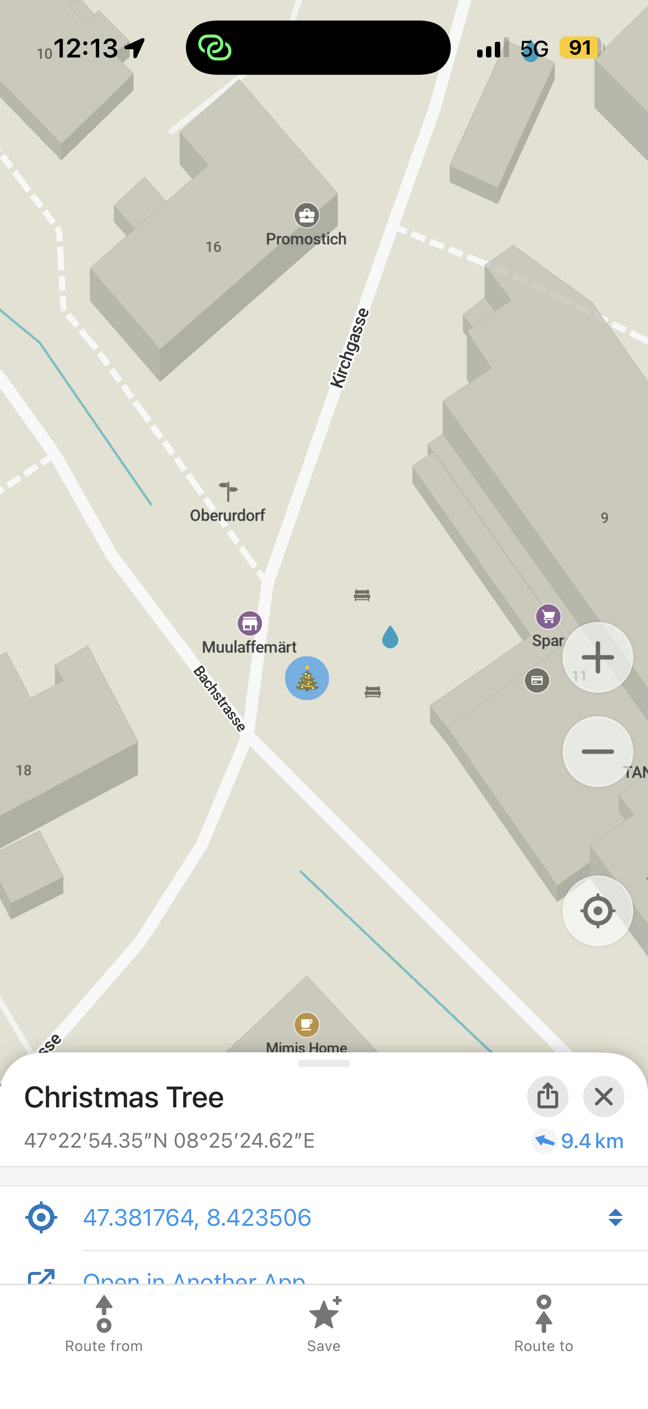
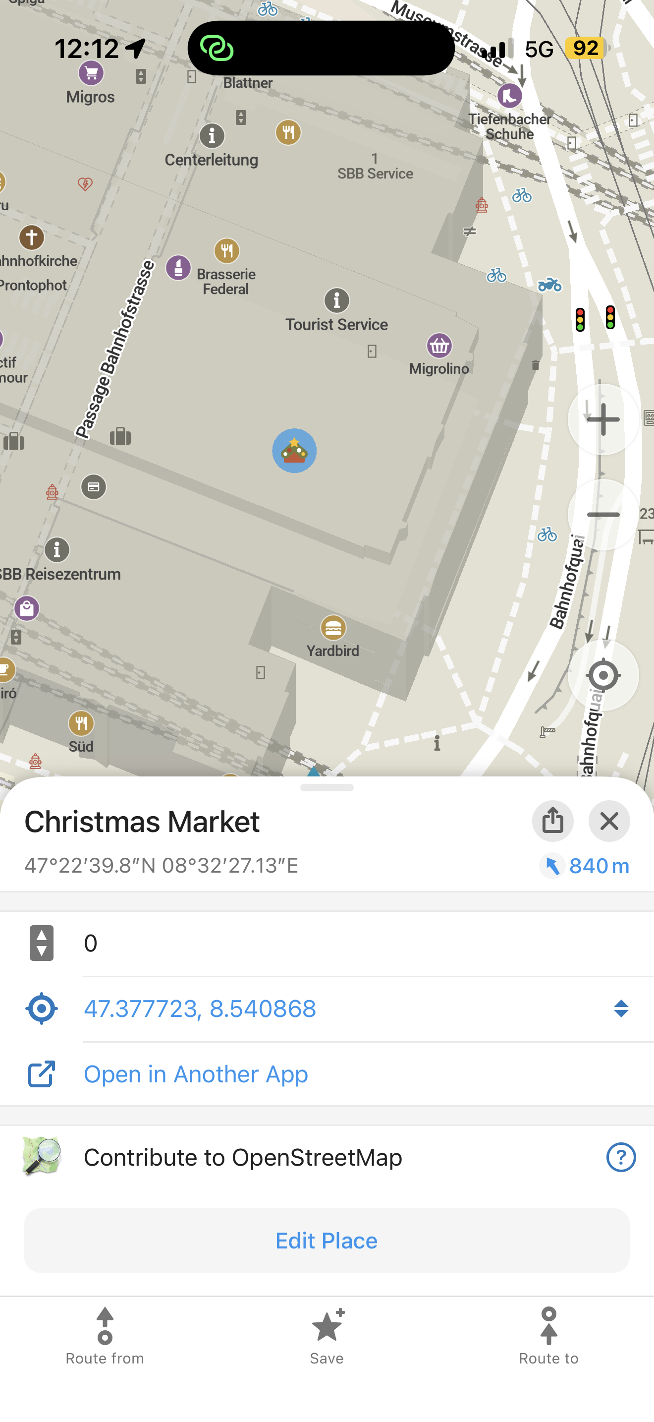
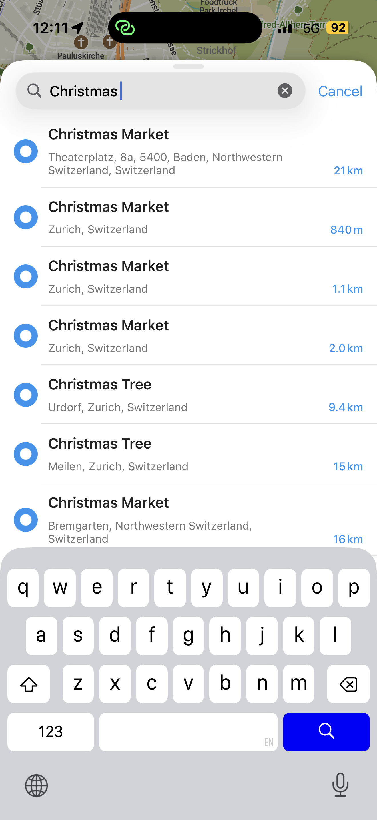
Veselé Vánoce a šťastný nový rok od týmu Organic Maps. Hledáte vánoční atmosféru? Vyhledejte Vánoční trh nebo Vánoční stromek a zobrazte si je na mapě. Pokud se ve vaší oblasti nic nezobrazí, přidejte chybějící prvky na OpenStreetMap.org a vylepšete mapu pro všechny!
Nainstalujte si Organic Maps z https://omaps.app/get nebo z App Store, Google Play, Huawei AppGallery, Obtainium, Accrescent a F-Droid
Poznámky k vydání
- Vánoční stromky a trhy se nyní zobrazují na mapě (Viktor Govako)
- Data OpenStreetMap jsou aktuální k 14. prosinci 2025 (Viktor Govako)
- Hranice a popisky národních parků jsou na mapě světa méně výrazné (Viktor Govako)
- Vyhledávání v litevštině nyní funguje správně (Alexander Borsuk)
- Ukrajinské překlady jsou vylepšeny (Nnifria)
- Německé, maďarské, litevské, španělské a turecké překlady jsou vylepšeny (přispěvatelé Weblate, Viktor Govako)
- Hlasové pokyny TTS pro kruhové objezdy v chorvatštině jsou opraveny (@chupocro, Alexander Borsuk)
iOS
- Výsledky vyhledávání nyní zobrazují kapacitu parkoviště pomocí emoji (David Martinez)
- Opraven problém s CarPlay na iOS 12 (Kiryl Kaveryn)
- Opraveno několik vizuálních problémů na iPhonu a iPadu (Kiryl Kaveryn)
- Vyhledávání v seznamu záložek nyní najde jména s diakritikou a písmeny s háčky/čárkami (Kiryl Kaveryn)
- Importované nebo nahrané trasy kratší než 10 minut zobrazují trvání v minutách a sekundách (Kiryl Kaveryn)
- Animace tlačítek a spodní lišty jsou vylepšeny (Kiryl Kaveryn)
- Zpráva s připomenutím vrstevnic při spuštění aplikace je odstraněna (Kiryl Kaveryn)
Android
- Výsledky vyhledávání nyní zobrazují kapacitu parkoviště (Bicky Rawdyrathaur, David Martinez)
- Senzor polohy auta v Android Auto je deaktivován, aby se předešlo problémům s polohou (Andrei Shkrob)
- Nahrávání trasy pokračuje, i když je aplikace ukončena nebo zavřena (Alexander Borsuk)
Připojte se k beta testování, vyzkoušejte rané funkce a nahlaste problémy:
Organic Maps existuje díky vašim darům a příspěvkům. Děkujeme! ❤️
Tým Organic Maps
Nová verze Organic Maps 2025.11.25: Články z Wikipedie v turečtině, japonštině a čínštině, nastavení pro zobrazení stažených oblastí a další!
Pátek! Je čas nainstalovat novou aktualizaci Organic Maps z https://omaps.app/get nebo z App Store, Google Play, Huawei AppGallery, Obtainium, Accrescent a F-Droid.
Poznámky k vydání
- Články z Wikipedie pro místa jsou nyní k dispozici v turečtině, japonštině a čínštině. Zadejte
?wikido vyhledávání a najděte místa s články na mapě. (Alexander Borsuk) - Přidáno nastavení, které vizuálně zvýrazňuje stažené oblasti na mapě fialovou barvou. (Viktor Govako, Kiryl Kaveryn, Alexander Borsuk)
- Data OpenStreetMap aktualizována k 23. listopadu 2025. (Viktor Govako)
iOS
- NOVINKA! Název záložky nebo trasy můžete upravit přímo na stránce s informacemi o místě klepnutím na název. (Kiryl Kaveryn)
- Přidána podpora pro iOS 26 a macOS 26 „Liquid Glass". (Kiryl Kaveryn)
- Dlouhým stisknutím názvu nebo adresy vybraného místa nebo záložky ji zkopírujete do schránky. (Kiryl Kaveryn)
- Klepněte na název seznamu na stránce s informacemi o místě a vyberte nový seznam pro záložku nebo trasu. Pomocí nového vyhledávání rychle najdete požadovaný seznam. (Kiryl Kaveryn)
- Opraveno rozložení mapy během navigace na iPadu, aby trasa zůstala jasně viditelná. (Kiryl Kaveryn)
- Opraveny animace postranních tlačítek a opravena barva tlačítka „Stáhnout mapy" v tmavém motivu. (Kiryl Kaveryn)
Android
- Přidány posuvníky na obrazovku Hledání a obrazovku „Záložky a trasy". (shantanu1k)
- Vylepšeno zpracování přehrávání zvuku a přerušení. (Andrei Shkrob)
- Opraveny pády na obrazovce profilu editoru. (Alexander Borsuk)
- Opraveny pády během stahování map. (Viktor Govako)
Další vylepšení
- Přidány vlastní emotikony na stránku s informacemi o místě. (David Martinez, Manish Rathaur, Andrei Shkrob)
- Zvýšen jas a kontrast silnic v tmavém režimu vozidla. (Manish Rathaur)
- Směrování pro cyklisty nyní v Rakousku přeskakuje jednosměrné obytné ulice. (Viktor Govako)
- Vylepšen import GeoJSON, včetně záložek
Saved Places.jsonz Google Takeout (Sergiy Kozyr) - Soubory
.jsonlze nyní také importovat jako soubory.geojson. (Alexander Borsuk) - Když přesunete trasu do seznamu, tento seznam se stane výchozím pro nové záložky a trasy. (Kiryl Kaveryn)
- Aktualizovány překlady pro více jazyků, včetně opravy pro hebrejštinu. (Alexander Borsuk, Michael Zeevi)
- Zjednodušeny pokyny pro kruhové objezdy. (Viktor Govako)
Předchozí poznámky k vydání
Přečtěte si předchozí poznámky k vydání, pokud jste je zmeškali.
Program beta testování
Připojte se k beta testování a získejte předběžný přístup k novým funkcím a pomozte nám dříve najít chyby:
Organic Maps by nebylo možné bez vašich darů, příspěvků a podpory ❤️
S péčí a láskou, Tým Organic Maps
Podrobnější mapa světa se zvýrazněnými staženými regiony, podpora podmíněného trasování a další novinky ve vydání Organic Maps z 11. listopadu 2025
Poznámky k vydání
Všechny platformy
-
NOVINKA! Zvýraznění stažených regionů na mapě světa (Viktor Govako)
-
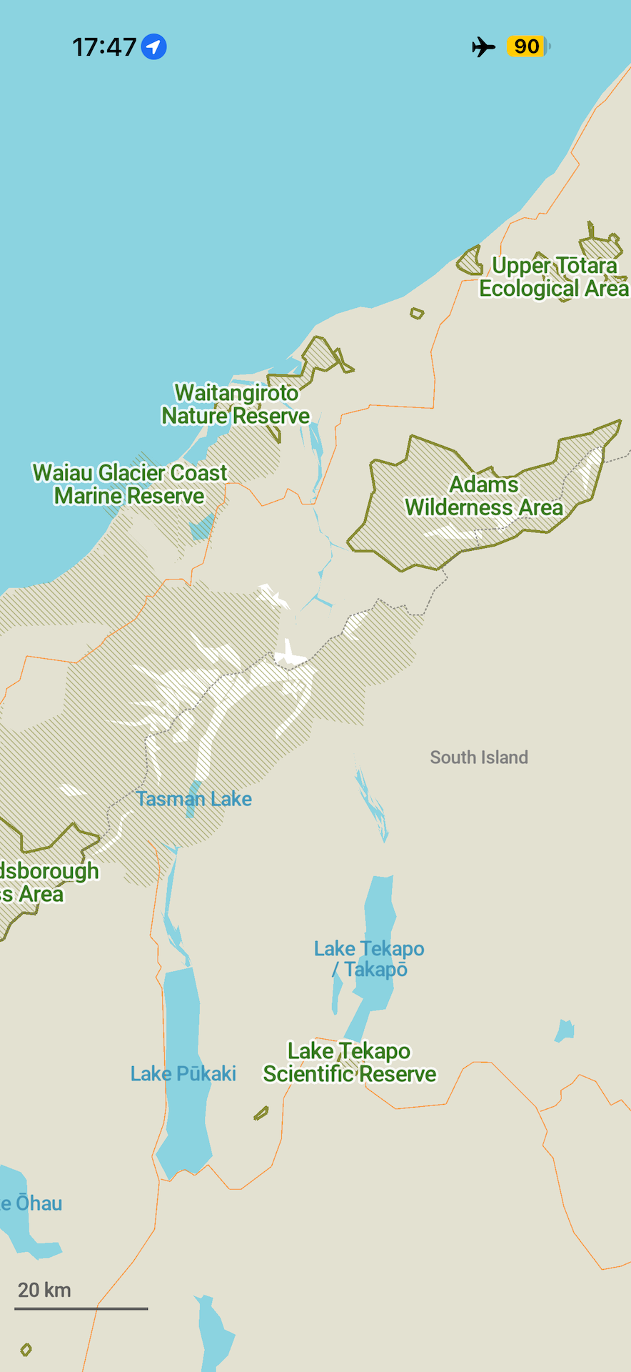
NOVINKA! Zobrazení a vyhledávání přírodních rezervací, národních parků, chráněných území, domorodých území, nebezpečných oblastí a jezer na mapě světa od úrovně přiblížení 8 (Viktor Govako)
-
NOVINKA! Trasování nyní podporuje časy uzavírek silnic (Viktor Govako)
-
Data OpenStreetMap k 9. listopadu 2025 (Viktor Govako)
-
Opraven problém s výchozími a lokalizovanými názvy ulic při úpravě adres a nahrávání změn do OpenStreetMap (Viktor Govako)
-
Opravena úroveň přiblížení použitá při klepnutí na výsledky vyhledávání z mapy světa (Viktor Govako)
-
Opraveny případy, kdy nastavení automatického přiblížení navigace nefungovalo (Viktor Govako)
iOS
- Po smazání seznamu záložek nebo seznamu tras (pomocí tlačítka "Více") se aplikace nyní správně vrací na předchozí obrazovku (Kiryl Kaveryn)
- Přidány odkazy na sociální sítě TikTok, Threads a Bluesky na obrazovku "O aplikaci" (Kiryl Kaveryn)
- Přidána možnost "Nahlásit chybu" do rychlých akcí ikony aplikace na domovské obrazovce (Kiryl Kaveryn)
- Opraveny různé pády aplikace a CarPlay (Kiryl Kaveryn)
Android
- Aktualizováno nastavení převodu textu na řeč (TTS) (Andrei Shkrob)
- Opraven pád Android Auto (Andrei Shkrob)
- Android Auto vždy používá režim trasování pro automobily (Andrei Shkrob)
- Použití překladů do tradiční čínštiny pro regiony Hongkong (zh-HK) a Macao (zh-MO) (Alexander Borsuk)
Dejte nám prosím vědět, zda můžete spustit Organic Maps na jakémkoli zařízení x86 (včetně Chromebooků) s podporou OpenGL ES 3.
Mapa a styly
- Prohozeno vykreslování "opuštěných" a "nepoužívaných" železnic (Lukas Hamm)
- Do mapy přidáni hodináři a studentské ubytovny (David Martinez)
- Přidány ikony cestovních kanceláří (David Martinez)
- Změněna barva ikony toalety na šedou (David Martinez)
- Aktualizovány ikony audiologa, podiatra, optometristy a sluchadel (David Martinez)
- Opravena ikona půjčovny kol v tmavém režimu (David Martinez)
- Dřívější zobrazení názvů států USA a Kanady na mapě světa (od úrovně přiblížení 5) (Viktor Govako)
Překlady
- Přidána slovinská synonyma pro vyhledávání a povoleno vyhledávání kategorií ve slovinštině (Alexander Borsuk)
- Opraveny překlepy, nesprávné překlady a synonyma pro vyhledávání a přidány chybějící překlady pro arabštinu, bulharštinu, dánštinu, němčinu, řečtinu, španělštinu, perštinu (fársí), finštinu, maďarštinu, indonéštinu, japonštinu, korejštinu, litevštinu, lotyštinu, norštinu (bokmål), nizozemštinu, rumunštinu a slovinštinu (Alexander Borsuk)
- Přidány specializované překlady pro mexickou španělštinu (es-MX) a brazilskou portugalštinu (pt-BR), odlišné od standardní španělštiny (es) a portugalštiny (pt) (Alexander Borsuk)
- Opraveny hlasové pokyny TTS v češtině (jxsv)
- Povoleny hlasové pokyny TTS pro estonštinu (et), galicijštinu (gl), hebrejštinu (he) a litevštinu (lt) (Sergiy Kozyr)
- Aktualizované překlady (Sergiy Kozyr, přispěvatelé Weblate)
Desktop
- Zobrazení prvků mapy světa — jako jsou přírodní rezervace a jezera — v kontextové nabídce na desktopu (Viktor Govako)
- Přidáno nastavení pro povolení nebo zakázání zvýrazňování stažených regionů na mapě (Viktor Govako)
Předchozí poznámky k vydání: organicmaps.app/news/2025-10-23
Získejte nejnovější verzi Organic Maps z App Store, Google Play, Huawei AppGallery, Obtainium, Accrescent a F-Droid.
P.S. Připojte se k beta testování, získejte přístup k novým funkcím a pomozte nám najít chyby a problémy:
Děkujeme, že používáte Organic Maps a podporujete projekt!
Tým Organic Maps
Vydání 23. října: Organic Maps jako výchozí navigační aplikace v EU na iOS, zobrazování dopravních značek na Androidu a další vylepšení a opravy
Ve vydání z 23. října jsme se zaměřili na opravy a vylepšení. Podívejte se na podrobný seznam níže.
Pro ty, kteří to zmeškali, předchozí aktualizace ze 7. října přidala import GeoJSON, statistiky záznamu tras, zobrazení rychlostního limitu v Android Auto, zobrazení popisných značek OSM (zadejte ?description do vyhledávacího pole, abyste je viděli), uložení záložky na trase na iOS a mnoho dalších vylepšení.
Všechny platformy
- Čerstvá data OpenStreetMap z 21. října 2025 (Viktor Govako)
- Zobrazování názvů vstupů/výstupů metra na mapě (Viktor Govako)
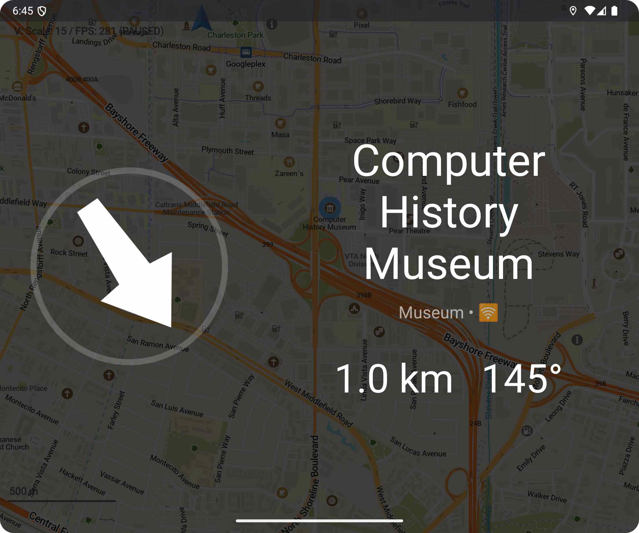
- Nové typy POI a ikony: monitorovací stanice, dopravní ostrůvky, zařízení pro Kneippovu vodní léčbu, miniaturní železnice (Viktor Govako), kempy ve stylu outdooru, letištní terminály, vnitřní herní prostory, telekomunikační obchody, půjčovny lodí, skluzavky, aktualizované ikony pro likvidaci odpadu a skládky (David Martinez)
- Slovinské překlady rozhraní aplikace (Alexander Borsuk) a hlasové TTS vedení pro navigaci (Erik Bucik)
- Na některých zařízeních/obrazovkách je mapa v centrech měst nyní méně přeplněná (Viktor Govako)
- Opraveno otáčení mapy na špatných kompasových senzorech při chůzi v režimu navigace pro pěší (Viktor Govako)
- Vylepšené informace zobrazované po výběru řeky nebo úseku vodní cesty (Viktor Govako)
- Lepší vyhledávání nabíjecích stanic pro elektromobily s vylepšenými synonymy ve všech jazycích (Alexander Borsuk)
- Opraveno vyhledávání emoji s selektory variant (Alexander Borsuk)
- Opraveno příliš mnoho výsledků vyhledávání zobrazených pro některé dotazy s úplnou shodou adresy (Viktor Govako)
- Import GeoJSON z https://umap.openstreetmap.fr/ by nyní měl zachovat všechna metadata (Shubh Kesharwani)
- Další barvy jsou podporovány pro značené stezky pro vrstvu mapy turistických tras (Viktor Govako)
iOS
- Uživatelé v EU mohou nastavit Organic Maps jako výchozí navigační aplikaci v nastavení iOS → Aplikace → Výchozí aplikace → Navigace (Kiryl Kaveryn)
- Opravena bílá na bílé stavová lišta v režimu navigace (Kiryl Kaveryn)
- Zvětšeno tlačítko Spustit navigaci (Kiryl Kaveryn)
- Odstraněn prázdný prostor při plánování trasy na iPadu (Kiryl Kaveryn)
- Organic Maps vás může požádat o hodnocení v App Store. Vaše dobré recenze motivují náš tým!
Android
- Dopravní značky se nyní zobrazují v navigačních pokynech (Andrei Shkrob)
- Vylepšení informací o záznamu tras (Kavi Khalique)
- Organic Maps funguje na některých starších zařízeních Intel x86 (Andrei Shkrob)
- Opraveny hlasové TTS pokyny, které v některých případech nefungovaly (Andrei Shkrob)
- Lepší úvodní obrazovka při spuštění (Andrei Shkrob)
Android Auto
- Obnovení trasy po zrušení (Andrei Shkrob)
- Opraveny pády na některých zařízeních (Andrei Shkrob)
Linux/Mac OS
- Podrobnosti POI nyní zobrazují formát "název | ref" (Viktor Govako)
- tmavý režim se automaticky synchronizuje s nastavením systému (DeepChirp)
Poznámky pod čarou
Organic Maps je možné díky ❤️ našim přispěvatelům, vašim darům a vaší podpoře.
Získejte nejnovější verzi Organic Maps z App Store, Google Play, Huawei AppGallery, Obtainium, Accrescent a F-Droid.
P.S. Připojte se k beta testování pro získání nových funkcí:
S láskou k našim uživatelům a komunitě Tým Organic Maps
Říjnové vydání: Rychlostní limity v Android Auto, import GeoJSON, statistiky nahrávání tras, zobrazení popisu OSM, ukládání značek na vybrané trase v iOS a další
Tato říjnová aktualizace Organic Maps přidává zobrazení rychlostních limitů v Android Auto, import GeoJSON, statistiky nahrávání tras, zobrazuje značky popisu OSM (zadejte ?description do vyhledávacího pole, abyste je viděli) a ukládá značku na trase v iOS. Existuje také mnoho vylepšení uživatelského rozhraní, úprav OpenStreetMap a různé opravy chyb na všech platformách, včetně opravy pády při spuštění na některých zařízeních Android.
Organic Maps je možný díky ❤️ našim přispěvatelům, vašim darům a vaší podpoře.
Podrobné poznámky k vydání (včetně změn předchozí menší aktualizace)
- NOVÉ! Import GeoJSON (Sergiy Kozyr)
- Data OpenStreetMap k 4. říjnu
- Data Wikipedie k 1. říjnu
- Podpora lehké železnice Seattle pro veřejnou dopravu (tjasz)
- Nedeaktivovat výběr mapy při ukládání upraveného místa OSM (Kiryl Kaveryn)
- Aktualizované překlady (přispěvatelé Weblate)
Styly map
- Zobrazení půjčoven kol označených jako amenity=bicycle + rental=shop (David Martinez)
- Zobrazení historických archeologických lokalit od zoomu 12 a dalších historických lokalit od zoomu 15 ve stylu Outdoor (Viktor Govako)
- Nové ikony pro stožáry, komunikační a elektrické věže ve stylu Outdoor (David Martinez)
- Zvětšení ikony vrcholu ve stylu Outdoor (David Martinez)
- Přidání chybějících variant ikon POI (David Martinez)
- Přidáno více typů bariér (Viktor Govako)
iOS
- NOVÉ: Uložení značky na vybraném bodě trasy (Kiryl Kaveryn)
- NOVÉ: Odstranění nahrávané trasy bez jejího uložení (Kiryl Kaveryn)
- Zobrazení víceřádkových názvů seznamů značek na stránce Místo (David Martinez)
- Aktualizace stylu přihlašovacích tlačítek OSM (Kiryl Kaveryn)
- Oprava problému s aktualizací navigačních informací (Kiryl Kaveryn)
- Oprava problémů s plánováním nové trasy (Kiryl Kaveryn)
- Oprava viditelnosti přidání/úpravy místa OSM pro mapy starší než 3 měsíce (Kiryl Kaveryn)
- Oprava rozložení ovládání segmentu dopravních možností pro iOS 26 (Kiryl Kaveryn)
- Zjednodušení animací výběru značek (Kiryl Kaveryn)
- Oprava problému s výběrem výsledku vyhledávání (Kiryl Kaveryn)
- Opravený styl, přejetí a animace pro stránku Informace o místě (Kiryl Kaveryn)
Android Auto (pouze Google Play)
- NOVÉ: Zobrazení rychlostního limitu v Android Auto (Andrei Shkrob)
- Oprava přepínání displeje v režimu navigace Android Auto (Andrei Shkrob)
- Oprava posunu šipky trasy v Android Auto (Andrei Shkrob)
- Oprava problému při připojení/odpojení zařízení k automobilu (Andrei Shkrob)
- Přidání služby polohy Android Auto (Andrei Shkrob)
- Vylepšení simulátoru trasy Android Auto (Viktor Govako)
Android
- NOVÉ: Zobrazení statistik nahrávání tras v reálném čase (Kavi Khalique)
- NOVÉ: Zobrazení obsahu značky
descriptionOSM (Alexander Borsuk) - Oprava zpracování změny motivu (Andrei Shkrob)
- Opraveno několik pádů, včetně pádu při spuštění (Andrei Shkrob, Viktor Govako, Alexander Borsuk)
- Tiché oznámení o průběhu stahování (Viktor Govako)
- Zmenšení odsazení ikony tužky (Alexander Borsuk)
Desktop
- Oprava zamrznutí curl na Linuxu (Alexander Borsuk)
- Oprava zamrznutí na macOS při přihlašování k OSM (Alexander Borsuk)
- Akce pro výběr funkce z kontextového menu (Viktor Govako)
- Možnost zrušení stahování (Viktor Govako)
- Zobrazení typu geometrie v kontextovém menu (Viktor Govako)
Nedávno vydané funkce, které jste mohli přehlédnout
- Čísla tras veřejné dopravy při výběru autobusové zastávky
- Pěší a cyklistické trasy (aktivujte je přes tlačítko Vrstvy v levém horním rohu)
- Zobrazení názvů značek na mapě jejich aktivací v nastavení aplikace
- Ikona tužky ✎ nabízí rychlý způsob úpravy značek
Instalace Organic Maps
Získejte nejnovější verzi Organic Maps z App Store, Google Play, Huawei AppGallery, Obtainium, Accrescent a F-Droid.
Připojte se k beta testování pro včasné funkce: iOS / Android.
Vydání 15. září: nové plánování trasy a popisy OSM
Toto druhé zářijové vydání přináší přepracovanou obrazovku plánování trasy a zobrazení obsahu tagu OpenStreetMap description na iOS. Chcete-li najít místa s tímto tagem, zadejte do vyhledávání ?description (podobně jako ?wiki).
Obsahuje také mnoho oprav a vylepšení pro iOS a Android (viz níže).
Nedávné funkce, které vám mohly uniknout:
- Čísla linek veřejné dopravy při výběru zastávky
- Pěší a cyklistické trasy (aktivujte přes tlačítko Vrstvy vlevo nahoře)
- Zobrazení názvů značek na mapě (zapněte v Nastavení)
- Ikona ✎ umožňuje rychlou úpravu značek
Organic Maps je možný díky přispěvatelům, vašim darům a vaší podpoře.
Podrobné poznámky k vydání
- Nová data OpenStreetMap k 13. září
- Odstraněny velmi malé ostrovy ze světové mapy (Viktor Govako)
- Zobrazení PSČ (ZIP) v detailech adresy (Viktor Govako)
- Opraveno nesprávné vystředění mapy na aktuální pozici (Kiryl Kaveryn, Viktor Govako)
- Zachování barev značek při exportu/importu GPX (cyber-toad)
- Aktualizované překlady (přispěvatelé Weblate)
Styly map (Viktor Govako)
- Zobrazení obchodů s osvětlením
- Zobrazení elektrických vedení od zoomu 18
- Zobrazení referencí elektráren a trafostanic
- Zobrazení kempů a stellplatzů v navigačním režimu
- Oprava barvy sekundárních silnic v navigačním režimu
- Kreslení hranic národních parků
- Kreslení archeologických lokalit od zoomu 12 ve stylu Outdoor
iOS
- NOVÉ: zobrazení obsahu tagu OSM
description(hledejte?description) (Kiryl Kaveryn, Viktor Govako) - NOVÉ: přepracovaná obrazovka plánování trasy (Kiryl Kaveryn)
Android
- Nové ikony kruhových objezdů v Android Auto (Andrei Shkrob)
- Zobrazení kategorie vybrané značky (Alexander Borsuk)
- Opraveno zpoždění při zobrazení vzdálenosti ke značce (Alexander Borsuk)
- Přepracované tmavé téma (Andrei Shkrob)
- Opravená aktualizace polohy v navigaci na custom ROM (např. Lineage + MicroG) (Viktor Govako)
- Modrá ikona tužky (úpravy) pro značky (Alexander Borsuk)
- Snížená vertikální výška náhledu informací o místě (Alexander Borsuk)
- Odstraněn azimutální úhel k severu z náhledu (klepněte na modrou šipku se vzdáleností) (Alexander Borsuk)
Stáhněte si nejnovější verzi: App Store, Google Play, Huawei AppGallery, Obtainium, Accrescent, F-Droid.
Zobrazte čísla linek na autobusových zastávkách a další: Nejdůležitější funkce zářijového vydání
Nyní, když vyberete autobusovou nebo tramvajovou zastávku, můžete vidět čísla linek veřejné dopravy. To je jen první krok! Dále plánujeme zobrazovat trasy veřejné dopravy přímo na mapě. Uživatelé iOS si také mohou vychutnat přepracovaná tlačítka pro přispívání do OpenStreetMap („Přidat místo" a „Upravit místo").
Jsme vděčni ❤️ našim přispěvatelům, stejně jako za vaše dary a vaši podporu.
Podrobné poznámky k vydání
- NOVÉ! Čísla linek jsou nyní zobrazena na autobusových zastávkách (Rodrigo Salgueiro, Viktor Govako, Kiryl Kaveryn)
- Aktualizovaná data OpenStreetMap k 29. srpnu
- Venkovní styl: chodníky jsou nyní viditelné od úrovně přiblížení 13 (Viktor Govako)
- Mnoho ikon mapy převedeno z PNG na SVG (David Martinez)
- Žebříky jsou nyní zobrazeny a používány při navigaci (Viktor Govako)
- Elektrárny, rozvodny, zábrany, branky, bezpečnostní kanceláře a strážnice jsou nyní zobrazeny na mapě (Viktor Govako)
- Opravené ikony pro komunikační věže (Viktor Govako)
- Jasnější navigační pokyny pro kruhové objezdy (Viktor Govako)
- Rozšířené prohledávatelné kategorie kuchyní (Interactiondesigner)
- Oblasti elektráren vykresleny jako průmyslové (Viktor Govako)
- Hnědé turistické POI nyní viditelné v tmavém režimu (David Martinez)
- Knihovny se objevují dříve, od přiblížení 16 (David Martinez)
- Žádné automatické přiblížení na celou trasu při přidávání mezilehlých zastávek (Alexander Borsuk)
- Aktualizované překlady (přispěvatelé Weblate)
iOS
- NOVÉ! Přepracovaná tlačítka „Přidat místo do OpenStreetMap" a „Upravit místo" (Kiryl Kaveryn)
- Opravený skákající zaměřovač při přidávání nového místa do OpenStreetMap (Kiryl Kaveryn)
- Nové ikony pro vrstvy mapy a nabídku (Kiryl Kaveryn, @euf)
- Odstraněny redundantní aktualizace nadmořské výšky během nahrávání stopy (Kiryl Kaveryn)
- Víceřádkové názvy jsou nyní podporovány ve výběru seznamu záložek (David Martinez) a na stránce informací o místě (Kiryl Kaveryn)
- Spuštění/zastavení nahrávání stopy a aktualizace bodů jsou nyní spolehlivější (Kiryl Kaveryn)
- Všechny dotykové ikony na stránce podrobností místa nyní používají jednotnou modrou barvu (Kiryl Kaveryn)
- Tlačítko „Aktualizovat mapy pro přispívání" je nyní zobrazeno v nabídce, když jsou mapy příliš zastaralé (Kiryl Kaveryn)
Android
- Nové ikony vrstev (Andrei Shkrob, @euf)
- Oblast dotyku pro ikonu úpravy záložky (tužka) je nyní větší (Kavi Khalique)
- Opraveno padání při ukládání určitých tras a vzácné padání při spuštění (Viktor Govako)
- Vedení v pruzích bylo opraveno v některých navigačních případech (Andrei Shkrob)
- Obnoveno původní pořadí předdefinovaných barev záložek/stop (Andrei Shkrob)
- Opraveno tlačítko „Vymazat hledání" při úpravě kuchyní (Ansh Jain)
Získejte nejnovější zářijovou verzi Organic Maps z App Store, Google Play, Huawei AppGallery, Obtainium, Accrescent a F-Droid.
Pokud jste to ještě nezkusili, nyní můžete povolit funkci v nastavení Organic Maps pro zobrazení názvů záložek na mapě. Kromě toho se nyní používá ikona tužky ✎ jako rychlejší způsob úpravy záložek.
P.S. Nezapomeňte, můžete se zaregistrovat do našeho beta testovacího programu pro získání včasného přístupu k experimentálním a nadcházejícím funkcím—pro iOS a pro Android.
Turistické a cyklistické trasy, názvy záložek na mapě, výběr stopy, výškový graf a mnohem více v srpnovém vydání
Nainstalujte srpnové vydání Organic Maps, stáhněte nejnovější mapy a objevte oblíbené turistické a cyklistické trasy po celém světě! Stiskněte tlačítko "Vrstvy" vlevo nahoře pro zobrazení barevných cyklistických a MTB tras, stejně jako oficiálních turistických a pěších cest. Nevidíte nic poblíž? Pak je čas přidat chybějící informace na OpenStreetMap.org, protože všechna mapová data v Organic Maps pocházejí z tohoto otevřeného, bezplatného a komunitou řízeného projektu.
Věděli jste, že lze vybrat jakoukoli zaznamenanou nebo importovanou GPX/KML stopu na mapě? Stopy s výškovými údaji zobrazí svůj výškový graf.
Pro zobrazení názvů záložek na mapě povolte tuto novou funkci v nastavení Organic Maps.
Díky našim přispěvatelům ❤️ a vašim darům je v této aktualizaci mnohem více.
P.S. ...a přichází mnohem více! Vaše podpora nám pomáhá a motivuje nás k vytváření nejlepších map – společně.
Podrobné poznámky k vydání
- Zobrazení turistických a cyklistických tras z OpenStreetMap (Viktor Govako)
- Zobrazení názvů záložek na mapě (Viktor Govako, Alexander Borsuk, Kiryl Kaveryn)
- Aktualizovaná OpenStreetMap data k 4. srpnu
- Opraveny chybějící počáteční/koncové body při nahrávání stopy (Viktor Govako)
- Zemědělské a lesní cesty jsou nyní vyloučeny z navigace (Viktor Govako)
iOS
- Vyřešeno několik pádů a zlepšena stabilita iCloud synchronizace (Kiryl Kaveryn)
- Představeny víceřádkové titulky v seznamech záložek (David Martinez)
- Opraven problém s přibližováním při zrušení výběru stopy (Kiryl Kaveryn)
- Opraveny chybějící překlady bankomatů (Alexander Borsuk)
- Opraveny problémy s otevíráním webových stránek s procenty kódovanými znaky (Alexander Borsuk)
- Chybějící překlady nahrazeny anglickými alternativami (Viktor Govako)
Android
- Přidán výškový graf stopy a výběr stopy na mapě (Kavi Khalique)
- Zanechat OpenStreetMap poznámku, pokud nově přidaný bod zájmu (POI) ještě není podporován v Organic Maps (hemanggs)
- Odstraněna podpora OpenGL ES 2.0 ve prospěch OpenGL ES 3.0 (renderexpert)
- Zobrazení ikon záložek v barevném voliči (Andrei Shkrob)
Vylepšení stylů a ikon
- Ikona vidličky a nože pro food courty (David Martinez)
- Mokřady označené horizontálním šrafováním (Viktor Govako)
- Ikony pro rychlé občerstvení a kola ve výsledcích vyhledávání a záložkách (David Martinez)
- Kryté parkování kol, úschovny zavazadel a únikové hry (David Martinez)
- Strážní stanice a partneři pošty (Viktor Govako)
- Zobrazení tržišť, odpočinkových oblastí, servisních míst, maloobchodních oblastí a aquaparků (Viktor Govako)
- Opraveno barevné znázornění lesů, křovin a luk na všech úrovních přiblížení (Viktor Govako)
- Opravena nastavení priority pro diplomatické úřady (Viktor Govako)
Různá vylepšení
- Zadání "cop" do vyhledávání najde policejní stanice, zatímco "film" nebo "movie theater" najde kina (theadventurer62)
- Otevření v jiné aplikaci nyní zobrazuje vybraný bod v Google Maps (Alexander Borsuk)
- Španělský překlad pro více kategorií vyhledávání (David Martinez)
- Aktualizovány různé překlady (přispěvatelé Weblate)
Získejte Organic Maps z AppStore, Google Play, Huawei AppGallery, Obtainium, Accrescent a FDroid.
Lepší úprava stop a mnoho vylepšení a oprav v červencové aktualizaci Organic Maps 2025
Seznamte se s červencovou aktualizací Organic Maps s mnoha opravami a vylepšeními, díky našim přispěvatelům ❤️💪! Aktualizace je již dostupná v AppStore, Obtainium a Accrescent a bude připravena v Google Play, Huawei AppGallery a FDroid za několik dní.
Vaše dary a podpora, hlášení chyb a vylepšení nám pomáhají vytvářet lepší mapy společně!
Nezapomeňte, že se můžete přihlásit k beta testovacímu programu pro dřívější přístup k experimentálním a nadcházejícím funkcím pro iOS a pro Android.
Úplný seznam změn:
- Nová mapová data OSM k 8. červenci, data Wikipedie k 1. červenci
- Vylepšené vyhledávání pro arabský jazyk (Omar Mostafa)
- Zobrazení kempinkových a rekreačních oblastí, dřívější zobrazení průmyslových zón (Viktor Govako)
- Neignorování vedlejších silnic na kruhovém objezdu (Viktor Govako)
- Vylepšené přibližování na vybranou stopu (Kiryl Kaveryn)
- Nová ikona Záložek a Stop na mapě pomáhá uživatelům najít jejich zaznamenané nebo importované stopy (@euf)
- Nabíjecí stanice mají nyní svou vlastní rozpoznatelnou ikonu na mapě a ve vyhledávání (David Martinez)
- Uložení nadmořské výšky/výšky (pokud je přítomna) při ukládání trasy (Kiryl Kaveryn)
- Aktualizované překlady, můžete pomoci opravit špatné nebo chybějící překlady na Weblate
Android:
- Opraveno nefunkční tlačítko Zpět na Android 16 (Andrei Shkrob)
- Použití světlého tématu mapy ve výchozím nastavení s tmavým tématem, když je aktivní navigace (Viktor Govako)
- Opraveny duplicitní úpravy OSM (Alexander Borsuk)
- Správné zobrazení všech výsledků vyhledávání na mapě (Viktor Govako)
- Opraveno nesprávné rozvržení uživatelského rozhraní na některých zařízeních (Sergiy Kozyr)
- Zobrazení přihlášení a hesla OSM, pokud přihlášení v prohlížeči selže/není dostupné (Sergiy Kozyr)
- Opraven skok nitkového kříže při přidávání objektů do OpenStreetMap (@hemanggs)
- Opraveno tlačítko "Opakovat neúspěšné stahování" (Kavi Khalique)
- Opravena úvodní obrazovka překrývající systémová tlačítka (Vraj Shah)
- Opraveny některé pády (Devarsh Vasani)
- Opravena chyba EACCESS PermissionDenied při importu KML nebo GPX na Android 5 (Alexander Borsuk)
Změny iOS, všechny zásluhy Kiryl Kaveryn:
- Vylepšená úprava záložek a stop: změna barvy a seznamu přímo ze Stránky informací o stopě
- Nyní můžete upravit nebo smazat zaznamenanou stopu ihned po jejím uložení
- Rozšířená oblast klepnutí pro tlačítka
- Opraveny skákající OSM poznámky při psaní textu
- Zobrazení tlačítka "Přidat místo" pro podniky
P.S. Pokud rádi čtete podrobné poznámky k vydání, dejte nám prosím vědět na našich sociálních sítích
Save planned routes in June Organic Maps update
Thanks to our beloved ❤️ contributors, there are many improvements and fixes in the June release. You can save planned routes, see the stats for recording track (iOS) and azimuth to the selected place (Android). Many other improvements and fixes are planned!
The update is already available in the AppStore, Obtainium and Accrescent, and will be ready in Google Play, Huawei AppGallery, and FDroid in a few days.
- New OpenStreetMap data as of June 8, 2025
- Save planned routes as tracks -- @cyber-toad and @kirylkaveryn
- Less annoying icons for car charging stations -- @euf
- Display plant nurseries, crash/traffic barriers, radio/tv/music studios, firepits, ladders, cranes, and love hotels -- @hemanggs and @vng
- Qingdao metro icons -- @sddzhyc and @vng
- Updated sewing/tailor synonyms in the search -- @vng
- Fixed category search for Lithuanian and other languages -- @vng
- App translations updates from the Weblate community
Android:
- Show azimuth angle from north when clicking on a small arrow with distance at the place information page -- @hemanggs
- Route From now resets full-screen mode activated by a long-tap -- @tomadavid
- Change "Navigation Auto" theme to light/dark at 6:00 or 18:00 if no location information is available -- @hb0nd and @vng
- Fix not updated bookmark name when screen is rotated -- @savsch
- Detect and reload changed system settings for TTS voice engine -- @hemanggs
- Fix crashes on Android 5 and 6 when selecting some objects on the map -- @batterydotac and @biodranik
- Fix drive through displaying -- @batterydotac
- Fix unintended coupling of 3D buildings and 3D perspective settings -- @vrajs
- Fix non-working download canceling button -- @kavikhalique
- Improve reordering of intermediate stops using the Manage Route button -- @gpesquero
- Make navigation bar transparent in light mode -- @coderang-gk
- Improved tapping at the eye icon to show/hide a list of bookmarks/tracks -- @kavikhalique
- Fixed white on white text on Android 5 & 6 -- @hemanggs
- Fix jump of the current location arrow when navigation is active -- @kavikhalique
- Change tick icon to done/save texts and increase touch area -- @kavikhalique
- No more need to reinstall the app from Google Play when the system language is changed to a different one -- @vng
Many iOS fixes and UI improvements by @kirylkaveryn:
- Show detailed information about the currently recording track
- Fixed search on the map and in the list
- Fixed route planning error when the current location was unknown
- Search history is not duplicated anymore
- Prevent iCloud sync from failing when the cloud file doesn't exist
- Fixed search suggestions
- Fixed counter in special "?edits" search command that displays your OSM edits
- Fixed Wikipedia section visibility on the place information page
- Fully expand the track information page when it is opened
- Increased the search screen top inset from the safe area
- Smoother modal screen animation
- Improved side buttons animation
Desktop:
- Added missing outdoors style to the bundle -- @vng
- Fix "About" dialog window flags and content -- @gezawatt
Thanks everyone for donations and support, bug reports and improvements, spreading the word and making maps better together!
May 2025.05.20 Release
We're getting back on track! May release is available in all app stores: AppStore, Google Play, Huawei AppGallery, Obtainium and FDroid
Most important changes are:
- OpenStreetMap data as of May 11
- The referral link to view more details/book some hotels on Kayak has been removed, but maybe you need it back? Please let us know by leaving a review, by email or in our social networks.
And a few fixes for Android:
- Fixed Zoom buttons on small screens
- Fixed missing newlines in Bookmark's description
June release is already in progress. It has some cool features and new bugfixes, any help with beta-testing is appreciated:
March 2025.03.02 release
March Organic Maps Update: iOS Search Split-Screen Mode, Individual Track Sharing and Enhanced Bicycle Routing.
Our latest update introduces several enhancements to improve your navigation experience:
- ✅ iOS Search Split-Screen Mode: View the map and search results list simultaneously, making it easier and faster to find places.
- ✅ Individual Track Sharing: Share a specific single track your big bookmarks & tracks list.
- ✅ Enhanced Bicycle Routing: Tuned algorithms now provide more accurate and efficient routes for cyclists.
- ✅ More Informative Outdoor Map: Added Mountain Rescue Stations, Minor Power Lines and Power Poles, raised visibility of Huts, Shelters, Hunting Stands, Towers, Cairns, major Power Lines and Pylons.
- ✅ Android Route Customization: Manually arrange intermediate route points, providing greater flexibility and control in trip planning.
- ✅ Android Track Recording Indicator: Added an indicator on the main screen to remind that Track Recording is active; tap it to bring up the recording menu!
- ✅ Improved Map Downloads on Android: Background map downloads now continue without interruption, ensuring timely access to necessary maps.
Special Acknowledgment: We welcome Hemang Manhas to our contributor community. Hemang has made a remarkable start with 19 committed improvements across various parts of the project.
Update Organic Maps now to experience these enhancements and enjoy a great navigation experience!
More changes:
Map:
- Added Hearing Aids shops, Communication Towers, Crosses, Oil/Gas Wells, Gas Flares, Lifeguards, Motorcycle Rentals, Obelisks (as monuments), separate Quarters (were merged with Neighbourhoods before)
- Added captions to named Cliffs, City Walls, Embankments, Power Lines
- Tuned visibility and priority of some niche shops
Android:
- Alert when precise location permission is not granted
- Reordered POI's details (when selected on map or added/updated via OSM editor)
- Hide UI (buttons) when in a POI direction arrow screen
- Better words hyphenation in POI details
- Remember the last used search screen tab
- Allow reverse portrait orientation
- Better "Import bookmarks and tracks" button icon
- Display the GPS error notification fully
- Properly localized display of percentages %
- Support using mouse wheel to zoom
- Fixed several minor UI bugs
iOS:
- Open track's info page automatically upon record finish / track save
- Show "Add Stop" button for the selected track point when in the navigation mode
- Added ability to edit "Self-service" and "Outdoor seating" POI attributes in the OSM editor
- Better looking track elevation profiles
- Made Track Recording live activity widget properly dismissable
- iCloud sync bug fixes and some minor UI fixes
OSM editor:
- Don't hide OSM login page when offline
- Added icons to address and number of floors input fields
- Fixed crash after POI deletion, thanks to Tanmay Gupta
- Fixed many other bugs, thanks to contributor @map-per who did a lot of under-the-hood work!
Other:
- Voice directions: announce route recalculation
- Don't always default to the subway routing mode when the subway layer is active
- Fixed bookmarks storing POI name in a wrong language
- Fixed on-building POIs disappearing when in perspective view
- Fixed empty speed limit sign displayed in foot navigation
- Fixed stuck map rotation gesture when zoomed in max
January 2025.01.26 release
January 2025.01.26 release highlights:
- Updated OpenStreetMap Data – Map updates as of February 13.
- Speed Limit Signs in Navigation – Stay informed while driving.
- New Languages – Now supporting Serbian (Cyrillic) & Latvian.
- Android Auto Improvements – Easier bookmark sorting & better location permissions.
- New Tower POIs – More detailed map data for communication & observation towers.
- iOS Track Recording Enhancements – Interactive elevation profiles & new widgets.
- Better Map Icons & Colors - Improved POI icons & more readable terrain details.
And many more smaller changes:
Android:
- Added a setting for Kayak.com Hotel Links and a first-use opt-out option (OFF by default in F-Droid version)
- Recalculate route when routing options are changed
- "Manage Space" button in Android's app info page opens list of downloaded maps
- Link to Notes in OSM profile
- Fixed truncated button labels in the Track Recording stop dialog
- Added a scrollbar to category list in the Editor
- Android Auto fixes: erroneous world map download prompt, route calculation map download crash
iOS:
- Tap tracks to display statistics
- Added a context menu to the coordinates button in POI details
- Display an explanation when the OSM Editor category search returns nothing
Map:
- Added specific search results icons for tourism and water POIs
- Added specific icons for Hong Kong, Shenzhen metro and Berlin light rail, a separate monorail icon
- Differentiate between grass and grassland/meadow colors
- Less saturated/prominent residential gardens color
- Fixed yellow road shields displayed as green in the night mode
- Display vegetation fills earlier in the car navigation style
Desktop / mobile linux:
- Added Outdoor map style button, removed defunct Traffic button
- Added Night Mode preference
Other:
- Show a reminder popup every time a full screen mode is entered
- Display complex non-number levels for building POIs
- Improve search for peaks and saddles/passes
- EN as additional search language in the OSM Editor
- Add padding on Wikipedia description page
- Update Estonian, Finnish, German, Italian, Turkish translations
Organic Maps Turns 4: The Privacy-Focused Alternative to Google Maps
Organic Maps, the privacy-focused, open-source alternative to Google Maps, celebrates its 4th anniversary. The project came to life during Christmas week of 2020, between December 20 and December 28, as a response to the temporary clinical death of MAPS.ME 2.0 on December 20, 2020. Cheers to the journey! Long live, Organic Maps! Long live, MAPS.ME too! Let a hundred flowers blossom! Merry Christmas.
Organic Maps Today
What have we achieved so far as we approach Christmas 2024:
- ~3M¹ users from all countries of the world
- ~15k ratings and reviews on AppStore and Google Play
- 4.8/4.6 average rating on AppStore/Google Play
- 10k+ stars on GitHub
- 10k (almost) issues + PRs on GitHub
- 1k (almost) forks on GitHub
- 7k+ git commits made by 100+ contributors
- $0 spend on marketing - pure Organic growth
¹ Approximated number based on data from the App Store, Google Play, as the app has no analytics and does not collect any user data.
The Origins
It is a good moment to reflect on how it all started.
MapsWithYou
Once upon a time, there was a great travel maps app called MapsWithMe (renamed to MAPS.ME in 2014). The app was powered by OpenStreetMap map data, kind of like Wikipedia, but for maps. Unlike OpenStreetMap, which has always been an open community effort, MapsWithMe originated as a proprietary, closed-source app developed by MapsWithMe GmbH. The app had two variants - a free limited version and a paid "Pro" version with extra features. Over 7M users have downloaded the app since its release in 2011 until Nov 2014.
MapsWithCode
As happens time and again, in Nov 2014 the original owners sold the company to a Russian Big Tech conglomerate, for around $18M +/-. As is common in such deals, the buyer likely required the original team to stay on for about a year, after which they probably moved on to their new endeavours.
The Big Tech conglomerate invested millions and millions more, hired more and more engineers, and delivered tons of cool features we all love in the Organic Maps today. In 2015, one year after the purchase, they made a bold decision to open-source the app under the Apache 2.0 license. The official statement was:
“We are happy to share our vision of open and free software available for communities around the globe. The whole team at MAPS.ME appreciates the opportunity to contribute in HOT’s humanitarian missions and help to serve in areas of disasters and political crises,” ... “Opening MAPS.ME is an important step not just for us, but for the whole free mapping community, as OSM will become even more accessible for a wider audience, which, I hope, will attract new editors to join this outstanding movement.”
CryptoWithoutMaps
Years after making no profit, in the November 2020 Big Tech made another bold decision to sell its "non-core" Maps asset for about $20M to CryptoFinTech bros reportedly connected to the famous, now-jailed, Sam Bankman-Fried of FTX, a Bahamas-based cryptocurrency exchange.
The new FinTech owners, as reported by Guardian, had a brilliant idea how to monetize the wide user base by adding digital payments. At one point, they had up to 1 million people on the waiting list for Maps digital wallet. While the idea was smart, things didn't follow the plan.
Back to our story. On December 20, 2020, version 2.0 of the MAPS.ME app was pushed to the Apple App Store. The new update de-facto was a brand-new app, completely re-done from scratch using the MapBox SDK (which itself was pretty great). Unsurprisingly, some if not all old users were a bit disappointed.
OriginalMapsMe
One of the frustrated users drafted a post named "MAPS.ME is gone. We must bring it back" which shared a link to a Telegram group. Open-source ethusiasts started to gather together in the group to brainstorm how to bring MAPS.ME back. Dozens of open-source forks popped up during the first week by different people. Let a thousand flowers bloom!
Just to recall, the original MapsWithMe was 100% proprietary. Although Big Tech later licensed the source code under Apache 2.0 and moved developemnt to the GitHub, the development process still followed the enterprise-style approaches, relying on an internal decision-making process, internal trackers, and infrastructure. The project had never gained self-governance and was always managed by full-time employees of the corporation.
Endless brainstorming on this and other topics in the Telegram group eventually led to a lengthy voice call between Roman Tsisyk and Alexey Naumenko, that resulted in the kick-start of this project. The intention was to create a proper, community-driven open-source project, open to any parties willing to participate. This is how this project was born.
OMaps
The initial name was "OMaps", obviously elaborating on Open and Original Maps. Rebranding to the current brand happened months, months later, but it is a story for another time.
Effectively, the foundation of the current open-source project was bootstrapped during ~20 hours hackathon betweem December 27-28, 2020. What had been done by the end of the day on December 28, 2020 with further follow-ups in the next few days:
- The founding GitHub issue #1, finished.
- The comprehensive project plan, initially consisting of about 30 GitHub issues, lately extended to 100+ tickets: #1, #2, #3, #4, #5, #6, #7, #8, #9, #10, #11, #12, #13, #14, #15, #16, #17, #18, #19, #20, #21, #22, #23, #24, #25, #26, #27, #28, #29, #30, #31, #32, #33, #34, #35.
- The initial project governance document, pointing Roman Tsisyk as an "interim project manager" and a commitment to establish the governing board before the end of 2021 (done).
- Initial team structure with Alexey Naumenko in charge of the community relations and recruting enthusiasts (hats off for the excellent work!).
- Initial set of guidelines and policies, including the Code of Conduct.
- Notable shift from using the CLA (Contributor License Agreement), which required contributors to license their changes to some owners, to using the DCO (Developer Certificate of Origin), which keeps the copyrights assigned to the contributors. It was done intentionally to prevent any possibility of closing the sources or changing the licenses in the future.
- Initial infrastructure, including CI/CD and hosting for maps files.
- Initial efforts focused on rebranding, removing ads, eliminating copyrighted graphics, and removing functionality dependent on proprietary backends.
- Telegram Groups, Slack Workspace, Twitter and other communication channels.
- Bonus: A prototype of bookmark management web UI based on uMap (never got integrated into the app, unfortunally).
Everyone was invited to join forces on the community-driven open-source project. The new MAPS.ME team was invited to the party too (Hey A G, up for a pint near Liverpool St?). The old team was invited as well. No background checks were performed (regretting). Everyone was welcomed to join and contribute. Of course, under the open-source license with no more proprietary backends, just to avoid entering into the MapsNotWithUs loop again. This open call is still valid.
Further Development
The first Android release under the "app.omaps" application identifier was finally approved by Google Play on January 3, 2021. The data was initially sourced from the old Axet's fork. The first ever bug-report from an user was received on January 5, 2021.
This is how it all got started. There was still a long road ahead, but it is a story for another time. This fork was the right one and it has survived the evolution. Now 10k+ GitHub stars and 100+ contributors. This is what the "Fork" button is all about.
Congratulations to all the users and contributors for your hard work and dedication! Thank you for being a part of this journey! Merry Christmas!
November 2024.11.27 release
November 2024.11.27 release:
- New OpenStreetMap data as of November 22
- Other search improvements, translation updates & bug fixes
iOS:
- Fixed bug with Bookmark's description editor
- macOS: map scrolling via mouse and trackpad
Android:
- Highlight matched part of the address in search results
- Sort search history by last usage time
- Fixed start-up crashes for some older devices with Mali-T GPUs
- F-Droid version: an opt-in setting to enable Google Play Location Services
November 2024.11.12 release
November 2024.11.12 release:
- New OpenStreetMap data as of November 7
- Added water slides, carousels, ferris wheels, etc
- Added traffic signals (more visible in car navigation)
- Updated the OSM login screen
- Fixed import of some ill-formed gpx/kml tracks
- Various search improvements, translation updates & bug fixes
Android:
- Added a map language setting
- Fixed auto night mode setting and added a navigation only option
iOS:
- Improved iCloud Bookmarks and Tracks sync
- New POI icons in Bookmarks view
October 2024.10.23 release
October 2024.10.23 release:
- New OpenStreetMap data as of October 17.
- More detailed (50m step) altitude isolines for Iceland, India & Morocco.
- Use a different icon for non-drinking water sources.
- Added water towers.
- Added new bookmark and search icons (tourism, information).
- Fixed a crash when opening a list of bookmarks with certain icons.
- Fixed Search on Map results prioritization bug.
October 2024.10.07 release
October 2024.10.07 release:
- Map Data: Updated as of October 1, now with added isolines for Egypt and improved for Adygea, Dagestan.
- Edit Tracks on Android: Change name, color, list and description of tracks, or delete them.
- Open in Another App on Android: Select any map point in Organic Maps and open in apps like taxi, delivery, transport, or other map apps.
- KML/KMZ/GPX: Fixed issues with importing files from different apps.
- Right-to-left languages on Android: Enhanced the place page, search, and about screens.
- iOS 18 Dark Mode: Introduced dark and tinted app icons.
The september release is slowly but surely rolling out
The september 2024.09.19-2 release is slowly but surely rolling out.
- Track Recorder: Record and save your routes while hiking, biking, running, or navigating.
- OpenStreetMap: Switched to browser-based authentication to comply with Google Play on Android.
- Open in Another App Button: Open points saved in Organic Maps in other apps like taxis, delivery, transport, or other maps.
- Updated Map Data: Updated with data as of September 7, including isolines for Egypt and Algeria.
- Translations: Enhanced Chinese, Hebrew, and Italian, and added translations for trail difficulty.
- UTM Location: The format now includes the zone letter instead of the hemisphere letter.
The new August release of the best offline maps is finally available in AppStore, Google Play, AppGallery, Obtainium and FDroid
The new August release was delayed by an unexpected removal of Organic Maps from the Google Play Store. Luckily, the issue was resolved in one day. Thanks to everyone who supports us!
You can download and install Organic Maps from AppStore, Google Play, Huawei AppGallery, Obtainium or FDroid.
Note two important issues to be fixed soon:
- Add Place (Add Business) button is not shown when a building is selected (use a single tap instead of a long tap to select any random point on the map).
- OSM Login is temporarily disabled for Google Play.
Finally, the full list of changes is here:
iOS and Android:
- New OpenStreetMap data as of August 10
- Improved routing in cases of bad surface and missing speed limit -- Viktor Havaka
- Announce street names in pedestrian navigation -- Will Bradley
- Traffic light icons are displayed in car navigation mode -- Harry Bond
- Selected places with WiFi show emoji symbol 🛜 -- David Martinez
- Fixed wrong selection of a bookmarked place when tapping on its title -- Sergiy Kozyr
- Disabled map rotation snapping to the north angle -- Harry Bond
- Updated FAQ in the app -- Sergiy Kozyr
- Store 50 recent searches instead of 10
- Properly export modified bookmark names in GPX
- Display road shields in India -- Sireesh Kodali
- See if self-service and outdoor seating are available for a selected place -- Arthur-GYT and Kiryl Kaveryn
- Maps older than 3 months can not be edited -- Kiryl Kaveryn
- Use NotoSans font instead of Serif for Hebrew
- Fixed import of KMB files -- Sergiy Kozyr
Android Auto:
- Added 3d buildings option in settings -- Andrew Shkrob
- Fixed turn directions -- Andrew Shkrob
Android:
- Display current speed limit in Car Navigation mode (there is a minor issue with colors, we'll fix it soon) -- Sergiy Kozyr
- Prompt the user to disable the power-saving mode for navigation to get GPS updates in the background -- kavikhalique
- Aligned main screen buttons in the landscape mode -- Harry Bond
- Fixed edit scroll in bookmark description -- Jean-BaptisteC
- New KML and GPX export icons -- euf and Harry Bond
- Increase size of OSM links in the OSM profile -- Jean-BaptisteC
- Use proper translation to stop navigation from the notification
- Imported tracks now can be deleted -- Kavi Khalique
- Save bug reports to the local storage -- krozhdestvenski
- Show username on the profile button in settings -- Harry Bond
- Better color for inactive lane icons -- Harry Bond
- Highlight the Layers button when any layer is activated -- Harry Bond
- Fixed saving to Google Drive -- krozhdestvenski
- Fixed API to select a point on the map and return coordinates into the caller app -- Roman Tsisyk
iOS:
- Moved the Share button from the bottom bar to the X button on the Place Information page -- Kiryl Kaveryn
- Added a button to open a selected place in other installed apps -- Kiryl Kaveryn
- Fixed voice directions when Organic Maps is in the background -- Fabian Wüthrich
- Deleted lists of bookmarks and tracks can now be restored from the Recently Deleted folder -- Kiryl Kaveryn
- Show a warning if CarPlay can't display all bookmarks -- Fabian Wüthrich
- Report a bug in case of unexpected iCloud sync errors -- Kiryl Kaveryn
- Various icon fixes for the Place Information page -- David Martinez
- Download progress text on the map screen doesn't jump anymore -- Pavel Petrenko
- Fixed a bug when Recent Track was not saved after restart
Translations:
- Improved Catalan, Chinese, Hebrew, Hindi, Hungarian, Japanese, Spanish, Turkish, Ukrainian translations -- Adolfo Jayme Barrientos, 南山少帅Felix, Nitai Sasson/MbTy1, Arushi Garg, FalconFist, j9d3it, Metehan Özyürek, Sergiy Kozyr
- Updated Cyprus, Iraq, Spain map region names and translations -- alnzrv, Colonel-Dixie, David Martinez
Desktop (Linux and Mac):
- Add transliteration enable/disable setting
The community is power 💪 . Your donations and support are vital in helping Organic Maps improve and scale. Let's make the best maps for everyone on the Planet together! 🌎 ♥️ 🤝
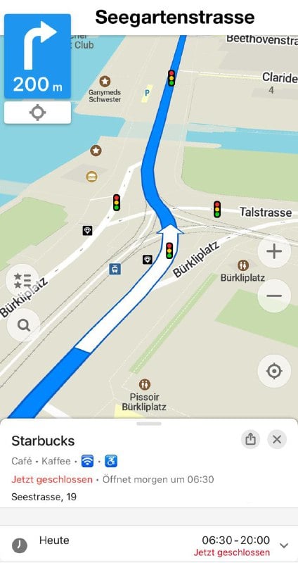
Organic Maps appeared again in the [Google Play store
Good news! Organic Maps appeared again in the Google Play store last night without any notifications or explanations after yesterday's removal. We are grateful for your feedback and support!
Stay tuned for the upcoming update, which is already available for iOS.
Let's make the best maps for everyone together ❤️ 🗺 🚀
Last night Organic Maps was removed from the Play Store without any warnings or additional details due to "not meeting the requirements for the Family Program"
On August 17 Organic Maps was removed from the Google Play Store without any warnings or additional details due to "not meeting the requirements for the Family Program". Compared to Google Maps and other maps apps rated for 3+ age, there are no ads or in-app purchases in Organic Maps, and no user information is collected. We have asked for an appeal.
As a temporary workaround for the Google Play issue, you can install the new upcoming Google Play update from this link.
Updated on August 19, 2024: We do not know why Organic Maps app was first removed and then restored in Google Play. One of our asssumptions is that it may be related to the password-based login to OpenStreetMap. Therefore, the login is temporarily disabled. We will try to find a solution ASAP.
Have you already installed a July release of Organic Maps? It introduces two major features funded through the NGI0 Entrust Fund
Have you already installed a July release of Organic Maps? It introduces two major features funded through the NGI0 Entrust Fund:
-
Better address search in the USA based on Topologically Integrated Geographic Encoding and Referencing system (TIGER) data (preprocessed by Nominatim project), implemented by Viktor Havaka. Addresses are stored, searched, and displayed as interpolations (lines along streets with a starting house number and ending house number), so don't expect to see buildings on the map (did you know that you can draw buildings and add addresses at OpenStreetMap.org yourself?). There is a heuristic to decide when to use TIGER data and when to use existing OpenStreetMap data. Map size for the whole USA has increased from 10Gb to 13Gb (including Wikipedia and elevation data, there are some ideas to split it to improve incremental map updates).
-
Proper rendering of texts in Indic (Devanagari, Bengali, Gujarati, Gurmukhi, Kannada, Malayalam, Oriya, Tamil, Telugu), Arabic (N'Ko, Syriac, Mongolian), Thai and Lao, Khmer, Myanmar, Tibetan, Hangul, Hebrew scripts, implemented by Alexander Borsuk by integrating Harfbuzz text shaping library with Organic Maps rendering engine (called "Drape").
There are other notable improvements, thanks to our beloved contributors:
- OpenStreetMap data as of July 2
- New Malayalam and Bengali fonts (please let us know if any other fonts need updating)
- Single tap now selects any point on the map, even if the map is empty -- by Sergiy Kozyr
- Changed long tap to toggle full-screen mode -- by Sergiy Kozyr
- Accidentally deleted bookmark on the map now can be restored immediately (Save button changes to Restore) -- by Kiryl Kaveryn
- Display major roads earlier on the world overview map -- by Konstantin Pastbin
- A selected place now shows more types/categories/amenities -- by David Martinez
- Clearer label for POI's building level -- by Antonin Delpeuch
- Display good quality fine gravel pedestrian paths as white dashed -- by Konstantin Pastbin
- Support more road/path surface types (bricks, stone, grass paver, soil) -- by Konstantin Pastbin
- More clear hints when building a route
Search -- kudos to Viktor Havaka:
- Mountain search also shows volcanoes
- Better search results for faraway places
- Search now finds places with a number in their names
- Find parcel lockers using their ref numbers
Android:
- Fix TTS FAQ link in the settings
- Fix GPX import from WhatsApp
- Save exported files to the local device storage -- by Kiryl Razhdzestvenski
iOS (many kudos to Kiryl Kaveryn):
- Use the Import button in Bookmarks and Tracks dialog to load KML, KMZ, GPX files
- Fix importing of bookmarks and tracks via the "Files" app on a cold start (you can tap a KML, KMZ, GPX or KMB file in any app, then "share" it using a rectangular icon with an up arrow at the bottom left, and then choose Organic Maps icon in the list of all apps)
- Added a TTS voice test button in navigation settings -- by Fabian Wüthrich
- Enable logs in settings to help us with bug fixing
- Open social media links in installed applications
- Removed a non-working traffic button from CarPlay -- by Fabian Wüthrich
- Replaced circle checkboxex with a rounded rectangle in the time editor
- Correct dark mode startup background color -- by Evgeny Fayvuzhinsky
Linux:
- Fix a generic Wayland icon displayed instead of an Organic Maps icon on some systems -- by Ferenc Géczi
Our translators and reviewers helped us to update Belarusian, Chinese, Dutch, Euskara, Hungarian, Polish, Portuguese, Russian, and Ukrainian translations.
We have also started to update the FAQ section on our website, any help with adding new articles and their translations is appreciated!
Please report all issues using Report a Bug button in the app, by sending us an email, or (the best!) by creating/updating an issue on our GitHub.
P.S. We're now working on the track recorder feature. Any help with ideas, testing, contributions and donations is warmly appreciated ❤️
Enjoy traveling with Organic Maps! 🚕 🛤 ✈️ 🏕 👣
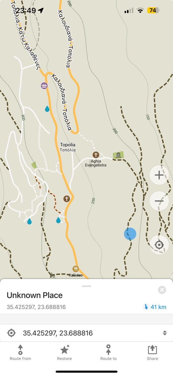

The major June update and a follow-up OSM data-only update (with a hotfix for the iOS app hanging) were successfully published and are available in all app stores and on our GitHub.
The major June update and a follow-up OSM data-only update (with a hotfix for the iOS app hanging) were successfully published and are available in all app stores and on our GitHub.
Thanks to Viktar Havaka, now you can search for the US zip codes and UK postcodes! The external address data is taken from the TIGER database and Ordnance Survey, and pre-processed by Nominatim project used in OpenStreetMap search.
Another major feature is street name announcements during the navigation, contributed by Will Bradley. Please enable it in OM settings, and let us know about any issues.
A long-awaited iOS iCloud synchronization is also available, thanks to Kiryl Kaveryn. Please enable it in OM settings (you will be offered to back up all your bookmarks and tracks first) and report any issues.
Bookmarks and tracks GPX export is also ready, in addition to the existing KML (KMZ) export. It will become very handy when we finish the long-awaited Track Recorder feature. Kudos to cyber-toad!
As always, thanks to everyone for your contributions, donations, support, and positive reviews. They motivate and inspire our team!
General changes and fixes:
- new OpenStreetMap data as of June 13
- search for US zip codes and UK (GB) postcodes -- by Viktar Havaka
- street name announcements in verbal TTS turn instructions (please enable it in settings) -- by Will Bradley
- export bookmarks and tracks in GPX file format -- by cyber-toad and Kiryl Kaveryn
- add, edit, and display web links to menus of restaurants, bars, and food services -- by Arthur Gayot and Kiryl Kaveryn
- fix missing addresses in fitness center details
- add "pastry" and "cakes" search keywords
- fix Wikipedia links that contain a question mark
Android:
- export bookmarks and tracks to a local device
- always show the next turn (in navigation mode)
- add an Exit button to navigation notifications
- improved OSM user profile settings page -- by Harry Bond
- fix display of stop points in the ruler and transit mode for RTL languages
Android Auto:
- use compass and location data from car sensors -- by Andrew Shkrob
- update the UI for the main and category screens -- by Andrew Shkrob
iOS:
- iCloud bookmarks and tracks synchronization (please enable it in settings) -- by Kiryl Kaveryn
- use the map when CarPlay is connected -- by Oleg Montak
- fix CarPlay text color in dark mode
- more TTS voice options
- TTS turn announcements interrupt podcasts instead of ducking them
- fix some buttons that disappeared when adding a place to the map
- fix place details not updated after a bookmark's edit
- fix the non-business hours button in the Editor to work after midnight
Mobile Linux and Desktop versions:
- improve selected place details dialog
Updated Czech, German, and Portuguese translations.
🚀 🚀 🚀 🚀 🚀
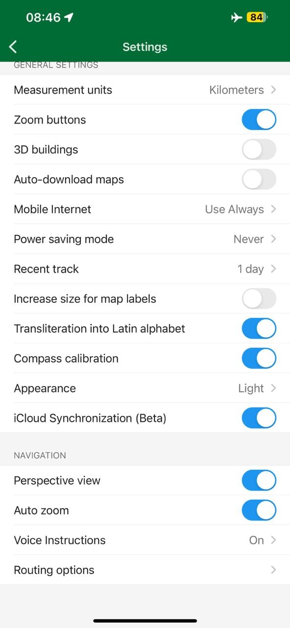

Both RSS and ATOM feeds are available to watch for our news and site updates
Now you can subscribe to RSS or ATOM news feeds in English (other languages are also available in corresponding /lang/ folders, but not all news articles are translater).
Any help to update the website is appreciated!
Organic Maps now with iCloud backup and sync
Organic Maps now backs up and syncs all bookmarks and tracks using iCloud! You can also use it on the Mac with the Apple Silicon processor.
Read the article in German: https://www.ifun.de/organic-maps-jetzt-mit-icloud-auch-fuer-den-mac-empfehlenswert-233696/
We are working on the Recent Track feature for Android and Record Track for iOS and Android
As we're working now on the Recent Track for Android and Track Recorder for iOS and Android, it would be great to hear your real use-cases, where and why do you need it, in more details. And how to make these features in the easiest-to-use way, so even your grandma and grandpa can use them.
The best ideas and examples from other apps are also welcome. Any feedback in our Telegram, Matrix or by email is appreciated ❤️❤️❤️
The May 2024 Organic Maps update with bookmarks and tracks sorting by name, better paved/unpaved paths colors, GPX import fixes, drive-thorough, and many other changes
The May 2024 Organic Maps update (get it here) supports bookmarks and tracks sorting by name, paved paths are white, and unpaved ones are brown. And there are so many other changes and fixes, thanks to our contributors! Update and enjoy, and don't forget to update maps too. And donate to support the open-source, community-driven, privacy-focused maps project!
General:
- upgraded to the new OpenStreetMap authentication method (OAuth 2). All previously authenticated users must re-login!
- new OpenStreetMap data as of April 29
- sort bookmarks and tracks in a list by name
- more feature types could be added to OSM now, e.g. marketplaces, taxi stands, kiosks, wilderness huts, garden centers, historic aircraft, cannons, boundary stones, tombs, etc.
- show the availability of Drive-through service for selected POIs
- ability to toggle Drive through in the OSM editor
- simplify handling of multiple languages feature names in the OSM editor and fix related bugs
- show "Can't find a suitable category?" message hint in the OSM editor
- elevator icon instead of "stairs" for displaying the level number of selected POI
- fix missing local language name versions for selected POIs
- better visible in dark mode $ emoji for paid map features
- improve bicycle routing for some cases
Android:
- import .gpx and .gpx.xml files from Google Files app
- retain routing origin point upon re-opening the app
- night theme fixes
- fix router mode always changing to public transport if the subway layer was active
- fix buttons overlap in landscape navigation mode
- fix freezes on Samsung A50
- fix the incorrect state of the "Keep Search History" setting if toggled two times
iOS:
- fix isolines reminder being displayed on top of other dialogs
- fix circular downloading progress bar layout in selected POIs
- fix On/Off button icons
- fix the alignment of RTL languages in the bottom menu
- fix bug allowing to add the same language two times in the OSM editor
- correct location of "more" menu in bookmark lists
- default email client is supported for bug reports
Mobile Linux and Mac (Windows is possible too!):
- add route marking buttons to place pages
- add an "Exit" menu option and keyboard shortcuts for all menu entries
- improve font clarity on MDPI screens
Map:
- display difficult or indistinct hiking trails as brown-dotted, extreme/expert or indiscernible ones as black sparse dotted
- dark blue lines for dedicated cycleways
- blue lines under white/brown dashes for shared bicycle/pedestrian paths, or over white dashes for segregated ones
- more consistency in displaying paved paths as white dashed lines, unpaved ones as brown dashed
- roads visible under semi-transparent bridge outlines
- added scree and shingle areas; better color of bare rock surfaces
- stop displaying vacant/unused shops
- added natural=stone (displayed as natural=rock), miniature golf
- separate public transport shelters, basic huts and lean-tos from generic shelters
- added icons for animal enclosures and dry cleaning; updated laundry icon
- fix too small font size for smaller cities
- make city labels visible at higher zooms
- reduce the opacity of indigenous lands hatching fill
- don't display nature reserves' hatching fill and icon/caption on very detailed zooms
Search:
- category search improvements (padel, subway stations, wilderness huts, etc.)
- searchable drinking water refills (participating cafes, etc.)
- made private swimming pools not searchable
- type ?wiki in the search to highlight Wikipedia articles on the map
- tuned category search ranking
Updated Basque, German, Greek, and Slovak translations
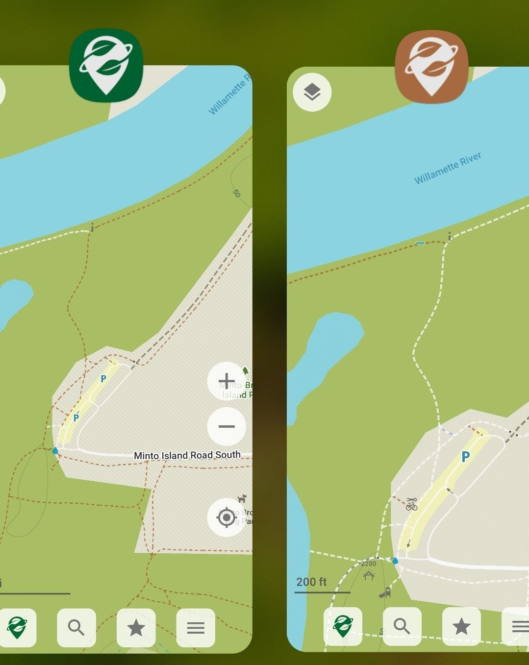
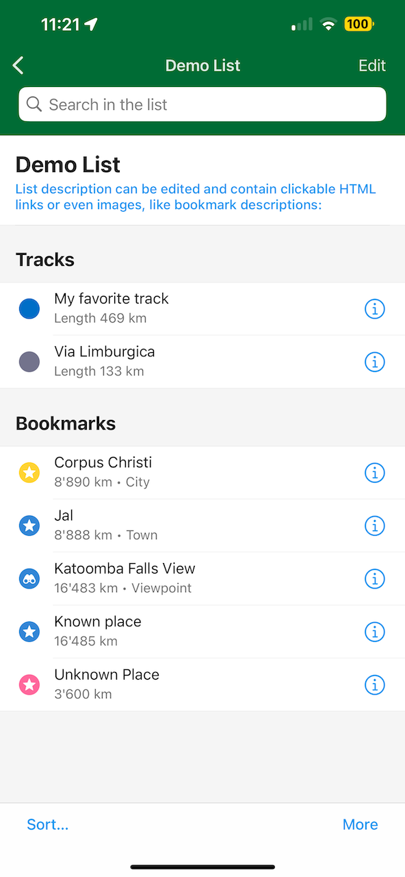
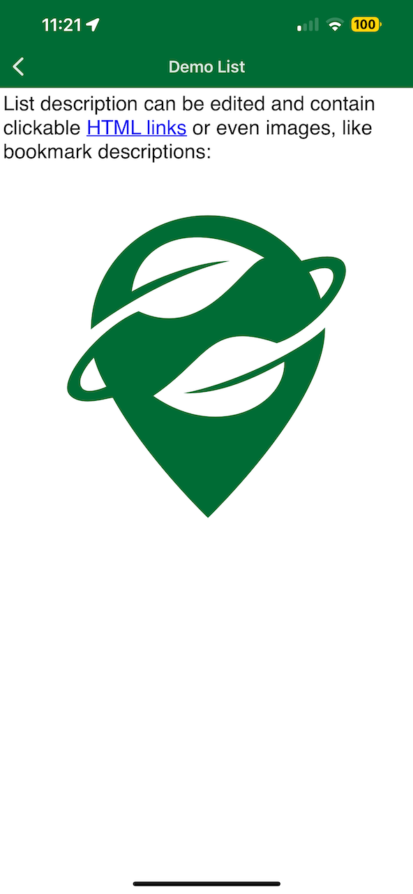
You can check the recording of the Zoom session organized by OpenStreetMap Ghana with Ilya Zverev presenting Organic Maps
You can check the recording of the Zoom session organized by OpenStreetMap Ghana with Ilya Zverev presenting Organic Maps!
Did you try Organic Maps on Linux? We use it on Mac and Linux for development, Windows PC desktop version is also possible
Did you try Organic Maps on Linux? We use it on Mac and Linux for development 🧑💻👨💻👨💻, so it's not yet as user-friendly as it is on iOS and Android.
https://www.maketecheasier.com/best-travel-tools-linux/
P.S. Windows version is also possible with a bit of love and support. Any volunteering help is welcome!
Can you guess the places we visited with Organic Maps? Enable sound to enjoy the full experience 🎵
Can you guess the places we visited with Organic Maps? Enable sound to enjoy the full experience 🎵
The full text and mp3 is here.
Thank you for inspiring and supporting us!
Please enjoy and share another song about Organic Maps 🎶
Please enjoy and share another song created by one of our users about Organic Maps, now in a different style 🎶
Did you like the previous one?
The anthem of community-driven privacy and freedom
(Verse 1)
Organic Maps, no tracking in sight,
Community-driven, with privacy right.
No ads, no traps, just maps with flair,
Navigate with freedom, we're beyond compare.

(Chorus)
No tracking! No crapware! No pesticides!
Organic Maps, where freedom resides!
Navigate with privacy, feel the vibe,
Community-driven, let's take the ride.

(Verse 2)
Open-source, no data grab,
Offline maps, with trails to nab.
Cycling routes, hiking trails, all in view,
Voice guidance, privacy true.

(Chorus)
No tracking! No crapware! No pesticides!
Organic Maps, where freedom resides!
Navigate with privacy, feel the vibe,
Community-driven, let's take the ride.

(Bridge)
Blazing fast, privacy intact,
Simple to use, that's a fact.
No tracking, just maps so clear,
Navigate with Organic, have no fear.

(Outro)
Try us out, see what's in store,
Freedom's our motto, now and forevermore.
Organic Maps, leading the way,
Navigate with privacy, every day.
Travel with Organic Maps song
One of our users has generated a song about Organic Maps. How does it sound to you? 😄
Update: there is also another song in a different style, hope you enjoy it too! 🎵🎵🎵
Travel with Organic Maps song
(Verse 1)
Beneath the twinkling stars, I stroll hand in hand,
With Organic Maps, exploring enchanted lands.
From Eiffel's gentle glow to Iceland's black sand shore,
Every step a melody, every sight, pure amore.

(Verse 2)
Through Rome's timeless Colosseum, echoes of history's might,
And Egypt's majestic pyramids, kissing the sun's light.
Organic Maps, a faithful guide, whispers tales of yore,
In its embrace, I find solace, forevermore.

(Chorus)
Travel with Organic Maps, a symphony of peace,
From OpenStreetMap's embrace, all worries cease.
Crafted with love, by volunteers' tender care,
Every destination, a moment rare.

(Outro)
So let's dance along, in this magical flight,
With Organic Maps, our hearts take flight.
In every corner of this earth we roam,
With Organic Maps, we'll always find home.
We''re also happy that we make our users happy 🙃
We're also happy that we make our users happy 🙃
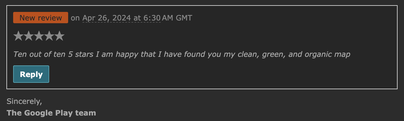
Meet new contributors and improved European elevation data in March/April release
Let us announce the March/April release (install here) and welcome new contributors:
- Isira-Seneviratne made their first contribution in #7494
- Mannivu made their first contribution in #7547
- Usland123 made their first contribution in #7571
- muralito made their first contribution in #7574
- renderexpert made their first contribution in #7618
- kavikhalique made their first contribution in #7664
- abhibana made their first contribution in #5047
- griffinonacid made their first contribution in #7734
- alnzrv made their first contribution in #7750
Don’t like or miss something in Organic Maps? Fix it, or ask your friends to fix it 😉
Here is the full list of changes. And don’t forget to rate Organic Maps in Google Play, AppStore, Huawei AppGallery and donate to support the development of the best maps app!
- Better isolines elevation data for European countries, thanks to Sonny
- OpenStreetMap data as of March 26
- Bookmark lists are sorted by modification time (recent at the top)
- Eye icons for visible/hidden bookmark lists
- Many new objects can be added to OpenStreetMap: various shops and crafts, BBQs, food courts, lang schools, cairns, money transfer points, etc.
- Add "wheelchair" to the search input to limit results to wheelchair-accessible
- Searchable orders pickup points (shop=outpost)
iOS:
- Distance and time do not freeze anymore in CarPlay
- Fixed wrong time and distance when switching planned route modes
- Fixed the wrong 'saved bookmark' icon
- Added a long tap back button menu
Android:
- OpenStreetMap login works again!
- Made the "View On Map" search results button bigger and with a caption -- by a new contributor kavikhalique!
- Fixed button overlaps in landscape route building for RTL languages -- also by kavikhalique
- Fixed crash when importing GPX, KML, KMZ from the Files app
- Serbian TTS voice
- Button to open system TTS settings in voice options
- Deleted bookmark lists are properly removed
- Removed ripples effect from sliding tabs in search
Android Auto 🚘:
- FreeDrive screen
- Navigation is automatically starting
- Faster bookmarks screen
Linux desktop/mobile version:
- Place information page is much more user-friendly
Map styling:
- Added wind turbines and power plant icons
- Reduced visibilities of many outdoors-specific POIs when in the main map style, e.g., waterfalls, mountain peaks, shelters, power towers, etc. (use the Outdoors style for those!)
- More consistent font sizes and caption appearances
Translations updates:
- Slovak, Italian, Spanish, Hindi
- Fixed police, parking, and sights category search for simplified Chinese
♥️ ♥️ ♥️ ♥️ ♥️
🌎 Six new languages have been added to
🌎 Six new languages have been added to https://organicmaps.app website.
- Estonian
- Galician
- Lithuanian
- Malayalam
- Telugu
- Welsh
All other languages have been updated from Weblate as well.
Kudos to everybody who contributed translations via Weblate (https://hosted.weblate.org/projects/organicmaps/).
Please kindly review website in your language and submit any corrections to https://hosted.weblate.org/projects/organicmaps/.
An article about Organic Maps for Android Auto, and OM advantages compared to other maps
An article about Organic Maps for Android Auto, and OM advantages compared to other maps: https://www.gearrice.com/update/the-best-open-source-map-app-also-works-on-android-auto-and-i-see-several-advantages-over-google-maps/
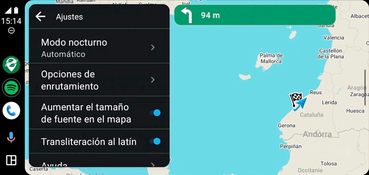
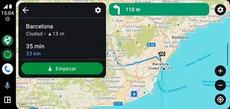
Let's build the best maps app together
Let's build the best Ad-Free, Open-Source, Privacy-First maps together!
We have added additional currencies and payment methods to our donation page to minimize transaction fees.
Visa, MasterCard, Apple Pay, Google Pay, PayPal:
- € 💶 Euro EUR
- $ 💵 US Dollar USD
- £ 💷 British Pound GBP
- ₣ 🇨🇭 Swiss Franc CHF
S€PA 🇪🇺 bank transfer with 0% fee:
| SWIFT/BIC: | TRWIBEB1XXX |
| IBAN: | BE39 9672 0031 0319 |
| Bank name: | Wise |
| Bank address: | Rue du Trône 100, 3rd floor, Brussels, 1050, Belgium |
See other currencies here.
Crypto:
BTC: bc1qjkq3tpy2gutsfdlcvys8slkempywk230u8rc8u
ETH: 0x1D59bBe5d4332e34116DccDE5c1a8c736E1C2810
USDT+TRX: TNQGZwAUCpwy1cuVSyu1vc6AT19nsmWqRF
See more networks here.
Donate via Telegram
Your donations are sponsoring the development and scaling of Organic Maps, and greatly motivate our team. Maintaining a project with more than one million users would not be possible without your support!
Can't donate now? Check other ways to support the project, or join our contributors team!
Interested in seeing public transport, satellite imagery, track recording, or other features in Organic Maps?
Interested in seeing public transport, satellite imagery, track recording, or other features in Organic Maps? We are open for Google Summer of Code 2024 proposals from motivated contributors/students, read more here
OpenStreetMap login was fixed in Google Play
OpenStreetMap login was fixed in Google Play. Please install the latest Organic Maps update, and enjoy updating the map! Don't forget that you can edit anything directly at the osm.org website.
Now everyone can back up or share all bookmarks and imported tracks as one KMZ file with just one click
Now everyone can back up or share all bookmarks and imported tracks as one KMZ file with just one click! And then import everything back from the same file.
Apple users can now edit colors of imported tracks and have a more convenient way of editing bookmarks. And don't forget to check our updated About dialog!
The March update is already available in all app stores. An apk for Android is also available on our GitHub if you want to install the latest Organic Maps version immediately when we publish the release, without any delays caused by slow reviews or publishing. This apk can be installed together with Organic Maps from other app stores! We also plan to add notifications about available GitHub apk updates, similar to what Obtainium already does.
Here is a more detailed list of changes:
- OSM map data as of February 28
- Share/export/backup all bookmarks as a single KMZ file readable by Organic Maps and Google Earth
- Show when drinking water is available 🚰 or not 🚱 when selecting an object
- Show elevation and recycling container types in search results
- Included wheelchair accessibility information on place pages
- Bus stops and platforms now display their number or letter
- The routing options panel is no longer displayed when using the Ruler
- Fixed wrong negative altitude display
- Routing properly ignores roads under construction
Android only:
- Our GitHub ("web") apk now can be installed in parallel to Organic Maps from other app stores
- Fixed import of one or more GPX/KML/KMZ files from File Explorer, GPS Logger, and some other apps
- Move Speed Cam preference into the Voice Instruction preference menu
- Fixed several crashes
- More app tips for the TTS test button
iOS only:
- Track colors can be edited
- Change a bookmark or track color by pressing the color icon in the list
- Easier editing of bookmarks and tracks using the (i) button in the Bookmarks and Tracks dialog
- Redesigned the About dialog
- Fixed several crashes
- Consistent search bars
- Updated the primary app color
- Renamed Night Mode to Appearance as it follows the system setting
- Bottom buttons are better tappable
Style improvements:
- Added Aboriginal Lands
- Made road tunnels more transparent
- Lighter buildings and labels in the Dark style
- Fixed small fonts for islands, bus stations and ferry terminals on detailed zooms
- Fixed inconsistencies in road labels
Our beloved contributors have updated French, Hebrew, Hungarian, Slovak, and Spanish translations.
Did you know we have started building a FAQ section on our website? You can help to populate and translate it!
We hope you are enjoying Organic Maps (we kindly call it OM) as we are enjoying it. Let's improve OM together! Your donations and support are warmly welcomed! They help to speed up the development, improvements and bugfixes.
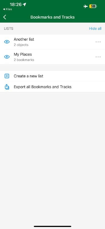
📣 Call for Participation
📣 Call for Participation: Seeking Technical Writers for Google Season of Docs 2024
Organic Maps is applying to participate in Google Season of Docs 2024 (https://developers.google.com/season-of-docs).
Are you passionate about clear communication and simplifying complex technical concepts? As a technical writer, you'll play a crucial role in shaping the user experience of our product. Your contributions will help users navigate our platform with ease and confidence. Whether it's creating user guides, writing FAQs, or crafting help documentation, your words will make a difference. Do you have a knack for crafting user-friendly guides and documentation? If so, we invite you to join us in an exciting opportunity!
Please follow the link below to learn how to participate in Google Season of Docs 2024 program:
👉 https://github.com/organicmaps/organicmaps/wiki/Google-Season-of-Docs-2024-Ideas
If you missed it, the February 2024 Organic Maps update is already available in Google Play, Huawei AppGallery, and AppStore.
If you missed it, the February 2024 Organic Maps update is already available in Google Play, Huawei AppGallery, and AppStore.
Thanks to our contributors ❤️, there is a big list of changes!
- OpenStreetMap data as of February 2
- Restroom emoji for places with toilets
- Display parking operator
- More precise turn notifications for small distances
- Fixed absent speed limit on some speed cameras
- Open Location Codes (OLC, Plus Codes) search shows results relative to the current position and to the screen center
- Fixed crash in search
- Name editing for playgrounds
- Parse coordinates from OpenStreetMap links
- Allow editing of Greek names for Cyprus
- Hindi support
- Better and more precise search on the map, more relevant search results in the list
- Removed "Continue detecting your location?" dialog, now location search can be stopped by pressing the "rotating radar" location button
Android:
- Fixed Spanish and Portuguese TTS languages
- Fixed KML, KMZ, GPX import crash
- Fixed KMZ import from WhatsApp
- Show what is copied to the clipboard on the lock screen for Android 13+
- Fixed blurry buttons on Android 5
Android Auto:
- Fixed indefinite loading
- Fixed World map download
- Show addresses on the Search Screen
iOS:
- Current position is properly updated when returning back to the app
- Improved the look of search bars
- Auto Light/Dark theme setting is synced with the system
- Properly display a longer cuisines list
- Fixed location services permissions request for the first app start
- Reduced the navigation screen top bar height
Map styles:
- Orange color for secondary roads
- Wider and brighter white tertiary roads
- Nicer looking on- and off-ramp road links joins
- Raised visibility of secondary and tertiary road links
- Less bright farmlands color
- Smaller mountain passes/saddles icons
- Reduced visibilities of mountain saddles (compared to passes)
- New ford icon
- Made hospital and clinic icons look different
- Reduced visibility of light rail stations
- Added Boston and updated Taipei subway icons
- Fixed Delhi subway entrance icons, Minsk & Spb subway captions on detailed zoom
- Increased font size of towns and suburbs labels and decreased for neighborhoods
- Fixed bookmark icon for water parks
- Adjust the visibilities of many POIs
Outdoors map style:
- Increased 50m & 100m contour lines visibilities
- Raised visibility of campsites, survey points, toilets, and touristic information features
- New power tower and flagpole/mast icons
- Made bridleways to be the same brown color as paths
- Increased contrast of footways on overview zooms
Car navigation map style:
- Added toilets, convenience stores
- Reduced visibilities of artwork features and subway station captions
- Bigger roundabout exit number
Updated Catalan, Chinese, Czech, Finnish, French, Romanian, Slovak, and Ukrainian translations
Donate to support the development and scaling of the better Google Maps alternative!
A list of articles about Organic Maps we have recently found on the web
A list of articles about Organic Maps we have recently found on the web. Read, enjoy, share! A bit of organic word-of-mouth marketing doesn't hurt 😉
- Organic Maps, an alternative to Google Maps https://www.todoandroid.es/en/organic-maps-una-alternativa-a-google-maps/
- Let Google Maps rest, this is the app that's coming to replace it, it's free and it doesn't spy on you https://www.smallcapnews.co.uk/let-google-maps-rest-this-is-the-app-thats-coming-to-replace-it-its-free-and-it-doesnt-spy-on-you-teach-me-about-science/
- Esta alternativa a Google Maps es de código abierto y permite la navegación GPS sin conexión https://www.20minutos.es/tecnologia/aplicaciones/google-maps-codigo-abierto-navegacion-gps-sin-internet-5207595/
- Adiós a Google Maps y Wikiloc: así es Organic Maps, la avanzada apps de mapas que no necesita conexión https://www.elespanol.com/elandroidelibre/aplicaciones/20230909/adios-google-maps-wikiloc-organic-avanzada-apps-mapas-no-necesita-conexion/792421133%5F0.html
- Abandona Google Maps con esta otra app que sí cuida tu privacidad en Android y iOS https://depor.com/depor-play/tecnologia/abandona-google-maps-con-esta-otra-app-que-si-cuida-tu-privacidad-en-android-y-ios-organic-maps-google-google-maps-mexico-espana-mx-noticia/
How to run Organic Maps on Windows
How to run Organic Maps on Windows: https://dimakorolev.substack.com/p/organic-maps-on-windows
Android Auto is finally available in Google Play
Android Auto is finally available in Google Play. Many thanks to the team and beta testers!
P.S. Don't forget to update maps after updating the app to see all improvements and avoid unexpected issues.
A humble request to the whole community
A humble request to the whole community: please enter detailed information about the bugs on our GitHub. Otherwise, it may be lost and the bugs may not be fixed.
If you can help someone else, please do. We are grateful for any saved bit of time 🙏
Is building routes easier or more complex in Organic Maps compared to other apps? Can it be done even more conveniently/with less clicks? How to make it easier for new users to discover the way to build a route in OM?
Is building routes easier or more complex in Organic Maps compared to other apps? Can it be done even more conveniently/with less clicks? How to make it easier for new users to discover the way to build a route in OM?
Here is an article with a user's opinion.
In 2023 Organic Maps got its first million users
In 2023 Organic Maps got its first million users. It would not be possible to scale without the help from our beloved community. A million thanks for your energy and time, your donations and support 🙏 ❤️ 🍃
In 2023:
- New features were added, including GPX import, Ruler tool, Outdoors map style, Background voice directions, Android Auto (in Google's review now), and others (see our news for details)
- 15 app updates and hotfixes were released
- A lot of improvements for the search and routing, map icons and styles, and general usability
- 4.6 average rating on Google Play from 7,372 users
- 4.8 rating on the AppStore from 2717 users
- 1992 commits from 167 contributors on Github
- 960 merged Pull Requests
- 724 closed issues (almost 2000 open issues left to fix/implement 💪)
- Total 7710 stars on GitHub
- More than a thousand support emails were answered
- Almost 9K edits and map contributions in OpenStreetMap
It's possible to do even more in 2024 if we get enough donations to scale the infrastructure, reward our contributors, or hire a full-time working team. One of our goals is to provide a privacy-focused map alternative to Google and Apple Maps. Another goal is to educate and engage more users in contributing to OpenStreetMap. Good map quality means happier hikers, cyclists, drivers, locals, tourists, and explorers. Happier everyone!
Check our Donations page to sneak-peak the roadmap, and subscribe to our Telegram Channel or to the matrix space for updates, or follow OM on Fosstodon, Mastodon.social, Facebook, X (Twitter), Instagram, Reddit, LinkedIn.
And finally, install the December 2023 release! We have prepared several Christmas 🎅 and New Year presents 🎁 for you:
- Android Auto is in review, you can test it by joining a beta program in Google Play after telling us your gmail 🤖 🚗 -- kudos to Andrew Shkrob
- Outdoors map style for hiking, cycling, and exploring Nature (make sure you've updated maps to the latest version!) 🥾 🏕️ 🚣 🚵 -- a long-time work by Konstantin Pastbin
- Search for village addresses without streets in Austria, Czechia, Germany, Poland, Slovakia, and some other countries (the addr:place OSM tag, and other search improvements too) -- by Viktor Govako
- Type "skiing" or "ski run" to find downhill and Nordic pistes ⛷️ 🏂 🚡
- OpenStreetMap map data as of December 13
- Fixed several crashes
- Multiple KML files can be imported from a single KMZ file, as the first pre-requisite to backup all bookmarks and tracks -- by cyber-toad
- A credit card 💳 is displayed for selected places with ATM
- A dollar emoji 💲 is displayed where a fee is required -- both by David Martinez
- Prettified website links in Place Page
- You can open a browser to check photos, reviews, and prices for some hotels. Every booking and every donation contribute to the development of Organic Maps!
Android
- We need your feedback on how to improve Android Auto! Tell us your gmail address and join the closed beta program on Google Play
- Open addresses from Contacts, Calendar, and other apps -- by Roman Tsisyk
- "Keep Search History" setting for better privacy -- by Bukkapatnam Sandilya
- Connect your phone to TV with Samsung DeX -- by Meenbeese
- Fix missing buttons when OM is restarted during navigation
- Minor interface fixes and improvements -- by Jean-Baptiste and Kiryl Kaveryn
- Fixed wrong voice language for the TTS Test button -- by Gonzalo Pesquero
Most iOS fixes by Kiryl Kaveryn
- Fixed freezing on iOS 13, 14
- "Zoom in to see isolines" message does not cover buttons
- CarPlay Search button now properly shows search results -- by Fabian Wüthrich
- Improved user interface for the Search on iPad
Styles -- a lot of fixes by Konstantin Pastbin
- Any feedback on the Outdoors style is appreciated
- Singapore metro icon -- RedAuburn
- Hackerspace -- RedAuburn
- Fix Porto metro icon -- Matheus Gomes
- Fixed residential leisure garden area fills disappearing on some zoom levels
- Display house numbers regardless of buildings' sizes
- Fine-tuned priorities of many POIs in the main style
- Less "gaps" in highways on the World map
- Removed very short ferry lines from the World map
Translations
- Improved Chinese, Dutch, Finnish, Polish, Russian translations
- Added Dutch, French, Polish, Romanian, and Russian translations for edition Opening Hours instructions
- Fixed missing parking translations
Linux
- Show Wikipedia articles in a separate dialog
- Touchscreen pinch-zoom support -- by Ferenc-
We wish you Organic Christmas and Organic New Year!
Thanks for the support
Thanks for the support! Someone got it right. Together with the OpenStreetMap community and you, our beloved users, we will create fast and easy-to-use, privacy-focused maps for everyone. 🚀

Does anyone use OpenCollective? Is it worth collecting donations there? Please share your experience
Does anyone use OpenCollective? Is it worth collecting donations there? Please share your experience!
In addition to other donation methods, you can support Organic Maps development there too: https://opencollective.com/organicmaps
A hotfix update of Organic Maps for iOS is available, it fixes freezes when any object is selected on the map on iOS 12, 13 and 14.
A hotfix update of Organic Maps for iOS is available, it fixes freezes when any object is selected on the map on iOS 12, 13 and 14.
Do you like that beautiful place on the OpenStreetMap?
On this International Volunteer Day, we are sharing our gratitude to everyone who helps us to develop and maintain Organic Maps, the community-built project
On this International Volunteer Day, we are sharing our gratitude to everyone who helps us to develop and maintain Organic Maps, the community-built project. Together, we can make the best OpenStreetMap-based maps for anyone on the Planet 🙏
Organic Maps November 2023 Release with outdoor map style preview
This release was delayed due to OpenStreetMap vandalism, and due to a longer testing of many fixes and changes prepared by our contributors.
Highlights
- New OpenStreetMap data as of November 13, 2023
- It is possible to zoom in deeper now and see more POIs in dense areas
- Outdoors map style preview (please read on to know how to activate it)
- Added an experimental referral link "Details on Kayak" for some hotels that are already present in OpenStreetMap. Booking a hotel using this link will give a few dollars to Organic Maps as a donation toward the project development. This is not expected to bring in much, but every dollar counts. Remember, that Organic Maps doesn’t collect or share any information about you or your device. Please be aware that Kayak may have tracking on their website like most other websites, including Facebook and Twitter.
- "Inertial" kinetic scroll improvements
- Removed max limit to search bookmarks
- Brands are displayed on the Place Page
Android
- Fixed import of bookmarks in KMB format from Maps.Me -- kudos to strump
- Fixed missing system location indicator at the right top of the Android screen -- rtsisyk
- Disabled the screen wake lock by default to improve power-saving -- rtsisyk
- Corrected the location search indication when the map is moved or zoomed -- rtsisyk
- Smoother corners for the place page -- Vinod Patil
- Landscape layout for About screen and other theme color fixes -- Jean-Baptiste
iOS -- most changes are done by Kiryl Kaveryn
- Removed the bottom tab bar to show more map on the screen
- Removed the unnecessary "route" button on the map (tap or long-tap a place on the map or select a search result to build a route using the "Route To" button instead)
- Highlighted the Route To button and hinted the FAQ for new users
- Fixed CarPlay dark/light mode colors
- Fixed keyboard input on iPadOS 15+ -- Keith Conger
Routing -- vng
- Don't route through access=emergency, military, agricultural, forestry
- Tuned ferry crossing estimations
- Improved cross-country and cross-region routing
- Improved residential routes
Search -- vng
- Process platz-pl like strasse-str
- Improved address matching
- Improved search of brands
Map Styling -- kudos to RedAuburn, pastk, map-per, dvdmrtnz, vng, RicoElectrico
- Added flowerbeds, rental shops, bicycle rentals, motorcycle repairs, petting zoo, prison areas, compressed air
- Added nature reserves and military zones rendering to the car navigation mode
- Added Docklands Light Railway, Porto metro
- Display names of ski pistes
- Tuned/updated icons of fitness center, yoga, theatre, artwork, statue, theme park, bbq, lighthouse, windmill, heliport & helipad, hunting stand, Kingdom Hall of Jehovah's Witnesses, paid & private versions of parking and parking entrances, convenience, deli, farm, grocery, health food, tobacco shops
- Better farmyard & garage landuse area fills
- Increased scrubs, alpine huts visibility
- Updated sanitary dump station icons and adjusted their priority
- Reduced visibility of cave entrances and improved the icon
- Increased visibility of standalone house numbers
- Reduced Tokyo subway visibility -- kudos to charlie2clarke
- Removed minor road markers/shields cluttering the map in Estonia
- Fix colors of Estonia and Germany road markers/shields
- Increased visibilities of road markers/shields on tertiary and residential roads
- Fixed "gaps" in some densely mapped lines
- Fixed "gaps" in the outlines of bridges and other compound lines
Outdoors map style preview
- Tailored for out-of-the-city outdoor activities like hiking, backcountry cycling/MTB, 4x4, etc.
- Emphasizes paths/tracks, cliffs, railways, powerlines, rivers and streams, water sources, peaks, mountain saddles and passes, waterfalls, lighthouses, caves, viewpoints, campsites, huts, shelters, picnic sites, gates, stiles, fords, etc.
- Make sure to update your downloaded maps!
- Enable by typing
?olightin the search field and return to the map; type?lightto switch back to the main style - Use
?odarkand?darkfor a dark style - Android and iOS developers wanted to help with adding a nice UI for style switching!
Translations
- Improved "avoid …" routing options wording
- Improved Arabic, Basque, Chinese, Czech, Danish, Finnish, Greek, Hungarian, Indonesian, Italian, Korean, Marathi, Polish, Romanian, Slovak, Spanish, Sweden, Thai, Turkish, Ukrainian, and Vietnamese translations

Checking in at SOTM EU 2023 in Antwerp
Checking in at SOTM EU 2023 in Antwerp. Organic Maps (OM) would not be possible without the OpenStreetMap (OSM) community. Thanks to everyone who volunteers and improves the Map!
We aim to create easy-to-use maps for everyone on the Planet while respecting privacy and keeping the code open. It is hard to do alone, so we are looking for motivated community members who can lead the development of the complex features (better OSM editor, Public Transport, traffic info, user-generated content, and many more), help with scaling app support, and promote OpenStreetMap and Organic Maps. The more users know about OM, the more users know about OSM. More OSM contributors mean better quality map data for everyone. That's a win-win!
P.S. The app update is coming soon, please stay tuned!
Organic Maps shares the 5th and 6th place on the list of most popular OSM editors together with Rapid
Organic Maps shares the 5th and 6th place on the list of most popular OSM editors together with Rapid!
Organic Crowdfunding and the September update
A short announcement before the details about the September Organic Maps release. We are looking for volunteers to help us in different areas. A lot of interesting and challenging work (did you already check 1800+ issues on Github? 💪) awaits on the open-source, community-built road to the best, fastest 🚀, easy-to-use 👴 👵 🧒, and privacy-focused maps. Want to help us with the app and website development, marketing, PR, financing, user support, or in any other way? Say [email protected].
If we get enough money, we can significantly speed up the development by hiring a full-time team and rewarding the most active contributors. If we get more users, we get more donations. Donate and spread the word 💸! Let's call it Organic Crowdfunding 💰
Several new features are available in the September update. You can easily measure distance and build straight-line routes in the same way as you are building other routes, and even simpler, with a single tap! We called it Helicopter Routing but then decided to rename into the Ruler to avoid confusion. Another new Android feature is background voice directions. Now Organic Maps can talk with you from your pocket 🙂
- New OSM maps data as of September 20
- Added new route type "Ruler" (aka Helicopter Routing) to measure straight distances quickly, many thanks to Sergiy @strump for bringing it to life!
- Set decimal and grouping separators depending on the system locale, thanks to Gonzalo @gpesquero
- Removed annoying zoom in route planning mode
- Parking entrances are searchable now
- Improved street matching and results relevance (thanks to Viktar @vng for all search improvements!)
- Search for grocery and houseware
- Caves can be added in the Editor
- Improved Arabic, Polish, and Spanish translations
Android
- Background voice and directions, thanks to Roman @rtsisyk
- Fixed "Wait..." dialog on startup on Android 13 with many downloaded maps on SD card (thanks to Viktar again!)
- Fixed distance on the route preview panel (thanks to Sergiy again!)
- Fixed the blue arrow icon on the location button on Android 5 and 6 devices, thanks to Michał @RicoElectrico
- Voice test in the settings menu (again, thanks to Gonzalo!)
- Fixed backurl API parameter
- Do not pause music when the screen is rotated (credits to Roman again!)
- Fixed bug with the invisible color of imported GPX tracks
iOS
- Fixed Open/Closed shown sometimes in gray color
Ferenc @Ferenc- made Linux improvements:
- Add positioning support via GeoClue2
- Use OpenGL ES 3.0 instead of desktop OpenGL
Map styling was done mostly by Konstantin @pastk, David @dvdmrtnz, Harry @RedAuburn, and @map-per:
- New or updated icons for factory, winery, bookcase, library, brothel, bicycle repair station, bicycle rental, bicycle parking, sauna, lottery, bookmaker, massage, sewing, books, underground parking, disabled parking space, gate, excrement bags vending, wholesale shop, outdoor seating, handicraft, grinding mill, caterer, HVAC, key cutter and locksmith. That's a long list, huh?
- Added vehicle inspection, public bath, strip club, gambling, cycle barrier, waterways (drain, ditch, moat, wastewater), aquarium, assembly point, adult gaming center, amusement arcade, Mormon churches, visitor center, industrial mine, historical objects (cannon, anchor, stone, aircraft, tank, mine, wreck, locomotive). Even longer list!
- Added bridges and tunnels rendering for cycleways, footways, paths, tracks, bridleways, steps
- Render barrier=ditch differently from waterway=ditch
- Reduced priorities of river names (and of other lower-importance lines) in navigation mode
- Tuned road names and road shield priorities
- Fixed icons display for parking buildings
- Reduced visibility of minor and private parking icons, removed area fill for underground parking
- Reduced fire hydrants visibility
- Display house numbers above icons and main POI captions, and don’t display house numbers for buildings that are too small for the current zoom level
- Don't display star icons for squares
- Fine-tune house numbers font and drawing priority
- Added highway-pedestrian, bridleway, and cycleway lines for detailed zooms (z18-) in navigation mode
- Pedestrian tunnels are not visible in navigation mode
We are infinitely grateful to everyone who helps us and donates. Organic Maps would not be possible without our users and our contributors ♥️ 🙏 🤟
Un artículo sobre Organic Maps en español.
Please vote for us again on HackerNews
Please vote for us again on HackerNews!
The referenced article provides an interesting perspective on Organic Maps from a user in the US.
The OSM data issue mentioned in the article should be fixed in the upcoming Organic Maps update. Stay tuned!
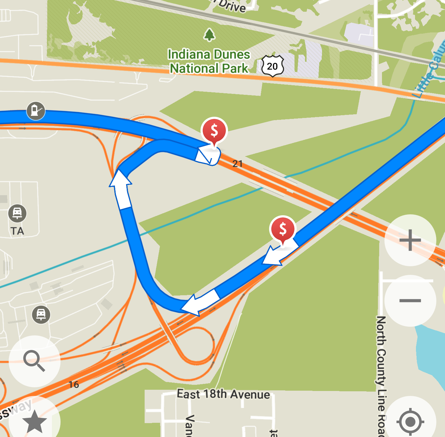
We are looking for someone (or for a team) experienced with zola or hugo static website generators to improve our current website for mobiles and desktops
We are looking for someone (or for a team) experienced with zola (or hugo) static website generators to improve our current website for mobiles and desktops. There are many tasks there from redesign to adding new sections, languages and translations. Please let us know if you are interested at [email protected]
The source code of the current website is available on Github.
Planned improvements are also there in the issues list, we will update it with more details soon.
While many are enjoying their holidays, our community and contributors are creating better maps
While many are enjoying their holidays, our community and contributors are creating better maps! Thanks ♥️ to everyone who helps and supports us, it motivates us more and more 🚀
August Organic Maps update is available in Google Play, Huawei AppGallery, AppStore, and soon should be available in FDroid too.
- New OpenStreetMap maps data as of August 14. We're grateful to the OSM for their work and congratulate the community on their 19th OSM birthday!
- Updated more than a year old Wikipedia articles, thanks to Evan Lloyd New-Schmidt, who replaced an old, rate-limited online Wikipedia parser with a new blazing-fast, offline wiki dump processing, written in Rust. Maybe someday we'll rewrite our core algorithms in Rust too 😂
- Added missing isolines for some regions of Argentina, Chile, Kazakhstan, Tibet, USA, and Russia (that obviously increased map sizes in these regions), made isolines denser in many other areas and reduced many other map sizes too. How? It's code magic 🪄 by Konstantin Pastbin
- Import comments from GPX cmt tag and treat GPX track segments as part of the singular track they belong to (all GPX joy comes from @cyber-toad contribution 🙏)
- Fixed a bug when editing social contacts, thanks to Sergiy Kozyr
- Dog Park can now be added in the Editor, thanks to our beloved and talented QA volunteer Jean-Baptiste!
- Updated Persian voice directions
Android
- Fixed blank screen bug on Nexus 5X
- Fixed “…more” buttons in bookmark lists
- Replaced the Twitter logo
iOS
- Fixed Wiki text in the dark mode, it's Artem Trukhanoff's first contribution!
Routing would not improve without our cofounder and algorithms guru Viktar Havaka!
- Updated road surface factors for car routing profile
- Better pedestrian routing in Turkey and Georgia
- Fixed cross-region routing when "avoid …" options are enabled
Search… guess what? It's also Viktar's work!
- Fixed search for addresses in Czech and Slovakia
- Improved street matching
- Do not filter duplicated search results except for very close bus stops
- Better ranking when searching by category
- Fixed search by a house name
- Faster search on the map screen
- RedAuburn, our contributor 🙏, has removed Tourist Information, Place of Worship, Park, Information Board, and Tourist Map from the Sightseeings category to avoid map cluttering
Styles have been greatly refactored by Konstantin on our way to separate styles for outdoor, cycling, driving, city tourism, and other activities:
- Added ferry routes to the World map
- RedAuburn removed the square background from parking icons and did many other parking improvements. It took a lot of time, but we did it together 👍
- Added separate icons for paid and private parking
- Made the bicycle parking icon differ more from the motorcycle one
- Updated parking entrance icon
- Street-side and lane parkings use a smaller icon and appear later when zooming in
- Added motorcycle parking and parking entrance icons to the navigation mode
- Fixed motorway=trunk links visibility in navigation mode
- Improved motorway=trunk colors
- Removed too small isolines at overview zoom levels
- Added Tehran metro icon
- Revamped priorities system, especially for POIs
- Many other fixes and enhancements
Follow our news at https://organicmaps.app/news/ , donate, and support us to build the fastest, most detailed, easiest-to-use maps together!
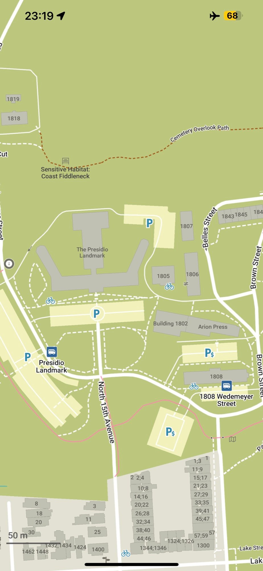
Read about 1700km, 5 months, 4 major South African rivers, solo canoe trip with Organic Maps
Read about 1700km, 5 months, 4 major South African rivers, solo canoe trip with Organic Maps! https://github.com/organicmaps/organicmaps/issues/4871
Meet the July release of Organic Maps
Meet the July release of Organic Maps! Note that this release crashes on Nexus 5X (and maybe on some other older devices), but we're working on a fix.
Get Organic Maps from App Store, Google Play, F-Droid, Huawei AppGallery.
Here is the full changelog:
- Fresh OpenStreetMap data as of July 10, 2023
- Fixed crash when rendering large OSM area objects
- GPX files with uppercase extension are properly imported
- Faster loading of bookmarks and tracks
- Support altitude, OsmAnd and Garmin colors in imported GPX tracks
- Fixed pedestrian ETA for big slopes
- Prefer tertiary roads to service roads in car routing
- Better Devanagari (Marathi) font
Android
- GPX files are open from some mail clients and file browsers
- Share button has been moved to the Place Page
- Fixed crash on bookmark when Place Page is closing
iOS
- Bookmark lists descriptions are now displayed and saved properly
- Show coordinates in Open Location Code (OLC), UTM, MRGS, and OpenStreetMap.org formats on click and copy coordinates on a long tap
Search
- Improved search results ranking
- Fixed shop categories search
- Fixed airport search results with empty names
Styles
- Improve visibility and findability of highway services and rest areas
- Added second-hand category, auction, collectors shops, turnstile & exit
- Fixed underwater tunnels not being visible
- Fixed areal water tunnels being drawn over other areas
- Introduced more detailed railway-rail-* types
- Fixed railway-abandoned/preserved bridges
- Added a bridge structure outline man_made-bridge
- Added community center, conference center, exhibition center, events venue
- Increased shop icons priority
- Added boundary=protected_area
Translations:
- Updated Catalan, Czech, Finnish, French, German, Italian, Polish, Spanish, Swedish, and Turkish translations
Mac and Linux:
- Use Qt6 instead of Qt5, please report any errors or issues
- Added preference for larger map font size
- Feature's layer is displayed in the Place Page
Donate and spread the word if you like Organic Maps!
Geospatial podcast with Roman Tsisyk
… OpenStreetMap is well known by the geospatial community, but does the average person use it? To help answer this question this week Ed welcomes Roman Tsisyk to the podcast. Roman, a co-founder of Organic Maps, the most widely used consumer-facing, OSM-based mapping service. In their discussion, Ed and Roman explain the differences users experience with Google Maps vs OSM and discuss how the two can work together. Organic Maps is a privacy-focused, open-source fork of Maps.me app. The offline feature makes it particularly convenient for travellers, hikers, and cyclists. Listen as Roman explains how he and his team use the power of community to keep evolving their maps, and why having "regular people" contribute to mapping is so important.
GPX import is now supported in Organic Maps
GPX import is now supported in Organic Maps! You don't need to convert your GPX tracks into KML anymore.
Many thanks to @cyber-toad, who patiently fixed all our review comments, polished and finished the code started by dvdmrtnz. And, of course, kudos ❤️ to all our users, community, and contributors who support us in many different ways. We can build the best maps together!
Get Organic Maps in the App Store, Google Play, and Huawei AppGallery. The F-Droid build, as usual, fails, but we hope it will be fixed soon.
Other notable changes in this release:
- New OpenStreetMap data as of June 2, 2023
- GPX import support
- Fixed disappearing bookmark lists when wrong characters were saved in a bookmark name or description
- Improved car and bicycle routing
Android:
- Fixed bug that prevented upload of OSM edits when on battery power
- MRGS and UTM coordinates support (tap on coordinates to change)
- Now compass works on devices without a gyroscope
- Prevent clicks through the navigation mode header and routing menu
- Fixed missing Wikipedia descriptions
- Decreased TTS (Text-To-Speech) voice speed
- Fixed non-working KML, KMZ, and GPX import notifications
iOS:
- Fixed non-working Portuguese (Brazil) and Spanish (Mexico) voice directions languages
- Fixed crashes for KML, KMZ, and GPX imports
- Fixed repeated imports of the same file
Styles:
- Fixed funicular icon
- Changed desert color in the dark mode
- Added Fish Pass
- New Icon for Parcel Locker
- Fixed icon for northernmost Munich underground station
Translations:
- Translations for opening hours picker
- Corrected Basque, Belarusian, British, English, and Ukrainian translations
Desktop
- Fixed bookmarks dialog color in the dark mode
Roman, co-founder of Organic Maps, speaks about FOSS (Free and Open-Source Software) and privacy-focused offline maps
Roman, co-founder of Organic Maps, speaks about FOSS (Free and Open-Source Software), our project, and other interesting things. Donate and spread the word to support the development of privacy-focused offline maps!
It was a busy time for our team and our beloved contributors
It was a busy time for our team and our beloved contributors. We prepared a new app and map data update for you. Also, this year, Organic Maps got 4 slots in the Google Summer of Code 2023 program, for the following features:
- Android Auto.
- Better user interface for mobile and desktop Linux, Mac, and Windows (Windows still require some. porting to build and run OM)
- Wikipedia parser to get fresh Wikipedia articles (now we use outdated dump as of spring 2022).
- Better map styling system to support Outdoor, Cycling, Driving, Tourism, and other custom layers.
We hope that our students will manage to finish their tasks this year and make Organic Maps better.
As always, please let us know about bugs and issues in the app, and fix all map-related issues at OpenStreetMap.org
- New OpenStreetMap data as of May 3
- Implemented search for interpolated odd/even house numbers
- Faster rendering of subway layer
- Fixed wrong postcodes in Paris
- Fixed Wikipedia links missing for some objects
- Fixed car routing via roundabouts
- Improved English, German, and Portuguese (Brazil) translations
Android
- Enabled TTS for Portuguese (Brazil) and Español (México)
- Fixed location detection over a network on some devices
- Fixed cut text in some dialogs
- Fixed some crashes
- Fixed the non-working "hide zoom buttons" settings option
iOS
- Enabled TTS for Basque, Marathi, and Norwegian (Bokmål). Portuguese (Brazil) and Spanish (Mexico) TTS will be fixed in the next update.
Styles
- Changed gate icon
- Changed the Lyon subway icon
- Fixed road shields for some interstate roads in the US
- Fixed priority of water areas overlapping other features
- Added camera shop, interior_decoration, antiques, art, cheese shop
Linux:
- Fixed OpenGL issues on some devices. Organic Maps should now work on Wayland devices.
Install Organic Maps from here: https://omaps.app/get
You can easily find the nearest cannabis 🌿 store with the latest Organic Maps update
You can easily find the nearest cannabis 🌿 store with the latest Organic Maps update! Android users can test the experimental lanes suggestion while driving (don’t forget to add lanes in your city if they are not added yet in OpenStreetMap.org). Navigation directions should now display correctly on iPads. This update introduces new shops, such as pet grooming, motorcycle repair, and locksmithing among others. Together with our beloved contributors, we’re constantly improving Organic Maps to make it The Best Maps App! Please check out the full list of improvements:
- New OpenStreetMaps data as of March 29
- Localized links for the OSM wiki page
- Correctly import KML bookmarks with track data
- Allow adding music and musical_instruments in the Editor
- Sewing shops and haberdasheries are searchable
- Distinguish supermarkets and convenience stores
iOS
- Navigation directions are now correctly displayed on iPad
- Replaced uphill and downhill icons with more clear arrows
- Disable 3D buildings preference if power saving is enabled
Android
- Experimental lane assistant
- Fixed wrong location arrow position during navigation
- Fixed Bookmark's color picker in RTL mode
- Properly display speed and distance in navigation mode
- Fixed Crosshair API
- Replaced uphill and downhill icons with more clear arrows
- Disable 3D buildings preference if power saving is enabled
- Zoom buttons can be hidden from the settings
- Enable Hebrew and Indonesian app localizations for Android 13+
- Improved error handling for advanced opening time editor
- Enabled displaying of bookmark list description
- Rotation doesn't break the World Map download for FDroid
- Fix crash in OsmLoginFragment
- Use dark theme for the Alert dialog
- Do not close the bottom sheet when opening bookmarks
Styles
- New shop types: agrarian, appliance, bed, outpost, gas, key cutter, locksmith, carpet, motorcycle repair, pet grooming, hi-fi, bathroom furnishing, curtain, fashion accessories, cannabis, herbalist
- Added money transfer, bicycle charging stations, power plant
- Made captions mandatory for capitals with a star icon
- Made park, forest, and scrub colors different
- Added metal construction icons
- Improved aerial ways, cable cars, power lines, fences
- Reduced Barcelona subway visibility
- Fixed isolines that are drawn over buildings, roads, etc.
- Fixed some POI captions displayed earlier than their icons
Translations:
- Improved German, Turkish, Belarusian, Hungarian translations
- Improved Arabic TTS instructions
Desktop
- Changed displayed name to Organic Maps
- OM version is selectable in About
Install Organic Maps from the AppStore, Google Play, Huawei AppGallery, FDroid or Flathub!
Finally, iPad users can use their keyboards without Organic Maps freezing, and Android users can enjoy reading Wiki articles for bookmarked places 😉 We''ve also improved the search function, particularly for users who search by categories
Finally, iPad users can use their keyboards without Organic Maps freezing, and Android users can enjoy reading Wiki articles for bookmarked places 😉 We've also improved the search function, particularly for users who search by categories. Specifically, we've separated vegan and vegetarian cuisine searches 🌱and added some new POI types, such as psychotherapist, speech therapist, audiologist, and blood donation center, which were previously grouped under one 'healthcare' tag.
Here's a complete list of what's new in this version, which is available in the AppStore, Google Play, FDroid, Huawei AppGallery:
🗺️
- New OpenStreetMap data as of February 27
- Fixed and improved search
- Split vegan and vegetarian cuisines in search
- Fixed styles for airports, land uses, waterways, and hatching fill areas
- Some smaller areas are not obscured by large ones anymore
- Added healthcare specialists: alternative, audiologist, blood_donation, optometrist, podiatrist, psychotherapist, sample_collection, speech_therapist
- Added communication towers, loading docks, solar, wind, gas, and hydropower generators
- Fixed the Bilbao metro icon
- Historic ruins can now be added in the Editor
- Improved Arabic, Norwegian, Portuguese, and Turkish translations
iOS
- Fixed freeze on iPad when a keyboard is connected
- Fixed unnecessary double click on the route button
- Removed duplicated floors and zip/postal code cells
- Enabled OpenStreetMap editor notes for all selected places
Android
- Wiki articles are now clickable and visible for bookmarks
- Fixed opening email from the Place Information Page (PP)
- Fixed several crashes
- Removed the "Description" label and "More" button when a POI is selected on the map
- Redesigned the Help dialog
- Fixed some not displayed complex opening hours
- Correctly display multiline names in the Download Maps dialog
- Fixed missing Traditional Chinese localization
We are grateful 🙏 to everyone who contributes the code, translations, or supports us with good reviews and donations!
OpenStreetMap and Organic Maps helped Dr
OpenStreetMap and Organic Maps helped Dr. Bilgehan Çevik, a Turkish doctor, to get to the damaged areas in the first hours after the earthquake in Turkey and Syria. His message to the mappers: “Thank you all, you are doing really great work”.
How was your adventure with Organic Maps? Please share your stories, they motivate us and our contributors to improve Organic Maps
How was your adventure with Organic Maps? Please share your stories, they motivate us and our contributors to improve Organic Maps! Here is one: https://github.com/orgs/organicmaps/discussions/4514
This release includes the updated map data for Turkey and Syria, including the Humanitarian OpenStreetMap Team changes after the recent earthquake
This release includes the updated map data for Turkey and Syria, including the Humanitarian OpenStreetMap Team changes after the recent earthquake. Accurate maps are crucial in disaster response, as they may assist with better planning and navigation for those who help on the ground. We appreciate everyone who has ever contributed to the OpenStreetMap. If you would like to start contributing now, please follow this link.
The list of changes in this Organic Maps release:
- New OpenStreetMap data as of February 10
- Filtered incorrect search results in both the list and on the map
- Improved next-turn notifications for shorter distances
- Better icons for main and secondary building entrances
- Improved Persian and fixed some errors in the Polish and German translations
Android
- Fixed crash on opening
- Fixed not visible error messages in the Editor
iOS
- Fixed crash when opening om:// and https://omaps.app/ links
- Show the shared POI's name in om:// and https://omaps.app/ links
See more examples of our API and URL schemes for both Android and iOS at https://omaps.app/api
Přinášíme aktualizaci Organic Maps pro leden 2023
Přinášíme aktualizaci Organic Maps pro leden 2023! Doufáme, že jste měli skvělé prázdniny a užili si cestování, navštěvování zajímavých míst a potkávání zajímavých lidí.
Tady je celý seznam změn:
- Nová OpenStreetMap data z 21. ledna 2023
- Opraven import některých KML tras
- Automatické hledání aktuální pozice po 30 hodinách neaktivity místo 8 hodin
- Vylepšeny výsledky vyhledávání kategorií
- Austrálie je napsaná správně ve výsledcích vyhledávání
- leisure=track je nyní vyhledatelné
- Opraveny neviditelné nápovědy v Nastavení v tmavém režimu
iOS 🍏
- Opraveny neviditelné textové nápovědy v Nastavení v tmavém tématu
Android 🤖
- Povolení baskičtiny, běloruštiny, chorvatštiny, norštiny, maráthštiny a svahilštiny v TTS
Směrování
- Správně zpracovat převýšení pro pěší turistiku a cykloturistiku
- Opraveno mezi-regionální směrování
- Opraveno směrování skrz některé mosty
- Autobusové trasy jsou podporovány
- Přidáno Chorvatsko do schengenského prostoru
Styly
- Opraveny Buenos Aires & Bilbao ikonky metra
- Přidána Bowlingová dráha
- Opraveny historic=fountain a tourism=information-office ikonky
- Stejná velikost ikonek pro prameny
Editor
- Povoleno upravování jmen s /\°[] symboly
- Přidána amenity=public_bookcase
- Zvýšen maximální upravitelný počet poschodí z 25 na 50
Překlady
- Upravena brazilština, čeština, francouzština, maďarština, španělština (mexická), turečtina
- Opraveny TTS překlady pro finštinu a portugalštinu
Linux
- Importovat KML a KMZ soubory psané velkými písmeny na linuxových souborových systémech, jež rozlišují malá a velká písmena.
- Používat Organic Maps server pro zjištění, jestli je připojení naživu.
We are looking for volunteers who can help us to prepare and translate Whats New for upcoming releases for all app stores and for our website on a more or less regular basis
We are looking for volunteers who can help us to prepare and translate Whats New for upcoming releases for all app stores and for our website on a more or less regular basis. Or for any other ways to help us speed up the translation process not only for Whats New, but also for other texts. Any ideas and help are appreciated! Want to peek at the full list of changes?
The full list of languages is available here for Android and here for iOS. We can add all languages to our website (its other pages are translated now using Weblate).
Drop us an email if you are interested at [email protected]
Congratulations to the OpenStreetMap.org with 10M registered users
Congratulations to the OpenStreetMap.org with 10M registered users! Organic Maps would not be possible without OSM. https://osmstats.neis-one.org/?item=members&date=19-1-2023
Is there anyone speaking Hindi, who can help with proof-reading the translations?
Is there anyone speaking Hindi, who can help with proof-reading the translations?
How are you planning your trips? Which tools, apps, or web services are you using? Please share it with us, and let''s brainstorm how Organic Maps can be improved.
How are you planning your trips? Which tools, apps, or web services are you using? Please share it with us, and let's brainstorm how Organic Maps can be improved.
Přejeme vám veselé Vánoce 🎅 a šťastný nový rok 🎄
Přejeme vám veselé Vánoce 🎅 a šťastný nový rok 🎄! Nejlepším dárkem je pro nás vědomí, že děláme Správnou věc a že náš čas a úsilí někomu na planetě pomáhají 🌎. Tady je náš malý dárek 🎁 pro vás: novoroční vydání Organic Maps je dostupné v AppStoru, Google Play, Huawei AppGallery a FDroidu!
Musíme vyřešit hodně problémů a implementovat mnoho funkcí (momentálně 1200+ na našem GitHubu). Mnoho z nich je o vylepšování aplikace. Některé funkce jsou komplexní a mohou být tvořeny jako samostatné, nezávislé otevřené projekty. Například fotky a recenze míst, databáze silničního provozu, veřejná doprava, synchronizace a záloha v cloudu, online mapy, webový editor na plánování výletů, editor stylů mapy, cestovní průvodce, API/SDK pro další aplikace atd. Zde můžete pomoct darováním, účastněním se, nebo dokonce vedením takového projektu!
Hlavní cíl projektu Organic Maps je vytvoření otevřené a soukromí-respektující alternativy k existujícím proprietárním (nesvobodným) mapám. S vašimi dary, pomocí a podporou můžeme dosáhnout tohoto cíle dříve, při poskytování všech služeb zadarmo pro každého. Také nám prosím dejte vědět, pokud víte o nějakých grantech, které by mohly pomoct s vývojem Organic Maps. Například tento grant může být použit přispěvateli v Německu.
A nakonec, tady je seznam změn v novoroční aktualizaci:
Nejdůležitější:
- Nová OpenStreetMap data z 16. prosince 2022
- Vylepšen směrovací algoritmus
- Nesměrovat přes highway=construction :)
- Podpora několika geometrických stezek v KML souborech
- Opraven KML 2.3 import stezek z OpenTracks
- Rychlejší zpracování a vykreslování komplexních KML stezek
- Povoleno přidávání obchodů, galerií, hudebních škol v Editoru
- Upraveny hranice měst ve výsledcích vyhledávání
Android:
- Vyřešen "Povolte Polohu" systémový dialog v některých případech
- Vyřešen pád v režimu rozdělené obrazovky & při otočení obrazovky na šířku/výšku
- Více spolehlivá šipka kompasu
- Vylepšeno zobrazení textu v Nápovědě
- Nová ikonka Mastodonu
iOS:
- Nadpisy nastavení & možností směrovače jsou nyní viditelné v Tmavém režimu
- Vyřešen pád aplikace při zobrazování menu
Styly Mapy:
- Vylepšené, méně světlé ikonky v Tmavém režimu
- Opraveny ikonky metra v některých městech
- Správně kreslit bariéry pro plochy a relace
- Odstraněny duplikované názvy ze světové mapy
- Aktualizovány ikonky jeskyní, horských průsmyků, vrcholů, volkán, tísňových telefonů, historických lodí, zmrzlin, nočních klubů, hudebních obchodů, stadionů, videoher
- Opraveny nesprávné priority leisure=pitch, historic, post office
- Více konzistentní vyplněné/kulaté ikonky (kulaté značí nějaký obchod/službu)
Překlady:
- TTS (Text-To-Speech) pro brazilštinu, mexickou španělštinu a norštinu
- Upraveny německé a maďarské řetězce pro vyhledávání
- Aktualizováno TTS pro portugalštinu a brazilštinu
- Aktualizovány české, španělské překlady
Děkujeme naší komunitě za vaši neocenitelnou pomoc, a děkujeme našim uživatelům za výběr Organic Maps! 🙏 🙏 🙏
🎇 🎈 🎉 🎊 🎄 🎆
The Hiking Club recommends Organic Maps to its clients
It's inspiring to know that what we do helps people. Organic Maps is great for many outdoor activities, including hiking. If you are considering the Alps 🏔 for mountain hiking, you can turn to the experts on this subject: The Hiking Club. They have a successful history of preparing and planning for long mountain trips.
The Hiking Club recommends Organic Maps to all their clients, so they can easily import a thoroughly prepared KML file with all significant features and descriptions. And that's great, because the most important thing in the mountains is not to get lost, and to save your device's battery. And here we are (in our humble opinion 😉) the best!
It is easy to import/open bookmarks and tracks/trails in Organic Maps. Select KML or KMZ file (zipped KML), then "Open with..." and select Organic Maps app. Or, for Android, you can select "Import Bookmarks" from Bookmarks dialog, and then choose a drive or a folder with your KML/KMZ. By the way, GPX support is also planned.
In the future, we want to make route and trip planning even more convenient. Stay tuned for our news and updates. And many thanks to everyone who supports our free app and our small team of enthusiasts with words, deeds, and donations!
Meet the second November update of Organic Maps
Meet the second November update of Organic Maps! Enjoy your travels and share your experience with us. Let's make the best privacy-focused, fastest and easiest to use offline maps together!
What was done in this release:
- New OpenStreetMaps data as of November 19
- Added Organic Maps Mastodon account to follow in Help dialog
- Fixed bug in a wrong bicycle's speed used for routing algorithm
iOS
- Secondary title in the local language is now displayed on the Place Page
- Fixed Organic Maps Matrix room link in Help dialog
- Fixed opening URLs with # and ? symbols
- Update About menu item
- Removed gray line from the menu
- Place Page properly displays 1 hour left before the place closes
Android 🤖
- The blue arrow is properly centered inside the position icon
- Links to our website in Help dialog are localized (en, ru, it, tr are supported at the moment, please help us with site translations)
- Fixed navigation menu visible under navbar in some cases
- The distance to search results in the list is now properly displayed
Styles 🗺️
- Added healthcare=physiotherapist
- Fixed some wrong icons displayed on top of each other
- Added highway=busway type
- place=island and place=archipelago are now visible on the World map
- Fixed leisure area style
- Properly render waterway=dam as a background area
- Fixed water incorrectly drawn over the pier
Translations 🌐
- Added Estonian translations, thanks to Aulo Aasmaa @auloaasmaa!
- Updated Czech, Italian, Norwegian, Spanish, and Turkish translations
- Fixed missing RV category translations for search
- Fixed non-working Catalan categories search
- Use Metro instead of Subway for en-GB
Desktop 🖥️ (Linux, Mac OS X, Windows)
- Fixed build errors on GCC-12
- Fixed map dragging using the mouse
- "+" key zooms in the map
- Use high-resolution icons on high-DPI displays on Macs
- Improve documentation about running WSL and desktop app (native Windows version is still in progress, please let us know if you are interested in it)
Now, in addition to Telegram, [matrix], Twitter, Facebook and Instagram, you can follow us on Mastodon
Now, in addition to Telegram, [matrix], Twitter, Facebook and Instagram, you can follow us on Mastodon. Well, actually on Fosstodon 😉
After a one-week review delay, Organic Maps October/November update is finally available in Google Play
After a one-week review delay, Organic Maps October/November update is finally available in Google Play. See the detailed list of changes and improvements on our web site. Your feedback and support are appreciated 🙏
October/November update of Organic Maps with many fixes and improvements is avaliable in FDroid
October/November update of Organic Maps with many fixes and improvements is avaliable in FDroid. See the full list of changes on our web site or in Telegram. Many thanks to all our users and contributors. Your donations and support are motivating and helping us to improve the fastest maps app in the world 😉
For those impatient, here is the Google Play APK, the same as was uploaded several days ago in Google Play for review
For those impatient, here is the Google Play APK, the same as was uploaded several days ago in Google Play for review. It should install on top of your existing Google Play version without conflicts. And it should be 100% compatible with the upcoming Google Play release (if it is approved by Google, of course).
Finally, after fixing some critical issues, the November Organic Maps update is available in the Apple Store, Huawei AppGallery, and on our Github
Finally, after fixing some critical issues, the November Organic Maps update is available in the Apple Store, Huawei AppGallery, and on our Github. Google Play and FDroid are coming soon too.
Here is the full list of improvements, kudos to our contributors and our small team:
- New OSM data as of October 29
- Minor performance improvements
- Dump corrupted KMLs to the log on startup
- Do not strip non-ASCII characters from exported bookmark files
- Simplify/smooth road altitudes chart
Routing and Navigation:
- Show "Roads to avoid" options and warnings on the route also for walking, cycling, and metro routes
- Fixed some routing issues, including wrong routing via highway exits/links
- Enable Catalan TTS
- Show speed camera on tap
Search:
- Show all found results on the map screen
- Improved villages search
- Show only matched categories if they were selected from the list, not names
- Fixed street synonyms for nordic languages
Styles:
- Use regional metro/subway icons for entrances and stations
- Added brewery, plumber, tailor, carpenter, sawmill, beekeeper, blacksmith, electrician, painter, and other craft icons
- Added natural=shrubbery, natural=desert, leisure=dance, amenity=charging_station-motorcar, and more barrier types
- Draw international airport icon on z7-9
- Draw metro for major cities starting from z12
- Do not draw railway station icon for building=train_station
- Updated icons for garden, park, forest, national park, nature reserve, power, chimney
- Add historic battlefield, gallows, pillory, memorial cross, stolperstein and war_memorial
- Fixed historic=* priority
- Support sauna=yes tags
- Better colors for natural=scrub
- Draw entrance icon instead of a dot
Android
- Improved detecting current position
- Crossed out target icon means that you need to press it to detect current position
- Suggest turning on networking location service if it is disabled
- Hide system bars in full-screen mode
- On Android 13+ you can change OM language
- Use non-bold font in the Place Page title
- Properly handle notch on Android 8.1+
- Keep transparent status bar only on the map screen
- Fix crash on exit split screen
- Fix crash on login to OSM
- Fix crash in the "Location is disabled" dialog
- Crosshair API now supports "cll=lat,lon" argument to center the map
- Remove unused BATTERY_STATS system permission
- Use numbers for transit intermediate points
- Add missing icons in the editor
- Improve Wikipedia description in the Place Page
iOS Place Page:
- Use system 12/24h time format
- Show Wikipedia and Wikimedia Commons links
Mac & Linux Desktop version:
- Fixed search indicator in Viewport mode
- Fixed search table update, now old results are always replaced by new ones
Translations:
- Use larger, more geographically significant names for Oregon maps in Downloader
- Updated Catalan, Chinese, Dutch, Finnish, German, Hungarian, Italian, Polish, Portuguese (European and Brazilian), Turkish translations
Finally, the September update was approved by Google and is available in the Google Play Store
Finally, the September update was approved by Google and is available in the Google Play Store. Please see the full changelog here. It was a long delay, but we didn’t wait and worked hard together with our community on many issues. Please stay tuned for the upcoming October update 😉
Organic Maps is participating in Hacktoberfest
Organic Maps is participating in Hacktoberfest. You are welcome to contribute to the development of free, privacy-friendly, open-source maps that work offline anywhere and have so many map details thanks to OpenStreetMap. Choose any issue in our 1K+ issues list, and contribute! There are also other ways to support the project, including donations. We are very grateful for all your feedback and support.
As some of you have already discovered, a new September update of Organic Maps is already available in AppStore, AppGallery, and F-Droid.
As some of you have already discovered, a new September update of Organic Maps is already available in AppStore, AppGallery, and F-Droid. Google Play update is delayed because we hot-fixed a few interface-related issues. Hopefully, it will also be available in the upcoming days!
The coolest change is a fresh new look for Android (kudos to Arnaud Vergnet and all other contributors!), but let's check the full list of changes (and don’t forget to support us in many ways, including donations):
- New OSM maps data as of September 12
- Fixed wrong elevation data between -1,-1 and 1,1 latitudes and longitudes
- Fixed crash on startup after editing some OSM objects
- Bookmark lists are now sorted by recently modified time (sorting by name is planned!)
- Improved displaying of the next street name directions
Search:
- Show features in the viewport at the top of search results
- Significantly speedup some search scenarios
- Improved category ranking & address search.
- Fixed highlighted hotel search results icon on the map
- Improved German category search
Android:
- Replaced bottom toolbar with buttons for better UX and map visibility (now you see more map than before!)
- Improved toolbars, buttons and their positioning in different modes (please report any misalignment, we’ll fix it!)
- Fixed "gray location arrow" when device's time is incorrect (it’s better to sync your device’s time with network servers)
- Splash screen respects the dark mode
- Themed icon for Android 13
- Fixed displaying hotel rating in search results
- Fixed Search dialog appearance animation
- Note to OSM editors is not covered by a keyboard anymore
- Increased the font size of the exit number
- Improved OSM login page UX and OSM profile
iOS:
- Partially fixed annoying "Continue detecting location" dialog when returning to OM
- Use the same system font everywhere
- Use the default mail app on iOS 14 to report a bug
- Enabled Catalan translations
Localizations:
- Added missing translations for craft=* and residential gardens
- Added/fixed Dutch, Portuguese (Brazil), Italian, Catalan, Turkish, Belarusian translations
- Enabled Catalan TTS (Text-To-Speech)
- Localized some Telegram and Instagram links
Styles and icons:
- Added driving_school, music_school, language_school, archaeological_site, craft-painter
- Removed backgrounds from historic cemetery icons
- Added different castle types: castrum, fortified_church, fortress, hillfort, kremlin, manor, palace & shiro
- Increased visibility of education & some sports
- Separated furniture & kitchen types
- Better looking leisure=track
- Fixed vending=fuel icon
We have updated donation methods, now it’s even easier to support the development of Organic Maps
We have updated donation methods, now it’s even easier to support the development of Organic Maps! https://organicmaps.app/donate/
🤖Finally, Organic Maps August update is also available in Google Play, Fdroid, Huawei AppGallery, and Flathub (iOS version passed review earlier).
🤖Finally, Organic Maps August update is also available in Google Play, Fdroid, Huawei AppGallery, and Flathub (iOS version passed review earlier). Thanks to all our contributors, supporters, and users, the app goes better and better with each update 😉
Highlights:
- New data as of August 16
- Longer routes are calculated faster
- Search should work way better and faster now
- Reduced size of mwm files
- Restored WunderLINQ support (yes, we have an API! Check omaps.app/api)
- Disabled Vulkan for Mali-G71 to fix path rendering
- Support wikimedia_commons tag
- Fixed crash when selecting some objects on the map
User Interface:
- Unified Place Page and Editor UI layout
- Replaced altitude difference to ascent and descent
- Show POI level in Place Page
- Show "Map data from OpenStreetMap" in the splash screen. Yes, many users don't get it.
- Fixed advanced timetable editor layout
Navigation:
- Fixed roundabout number
- Increased visibility of next street
- Fixed font in navigation progress bar
Search improvements:
- Fixed issue when some found objects were not highlighted on the map
- Removed common street search synonyms like parkway, path, line, walk, trail, etc.
- Fixed coordinates search if the query contains a newline
- Ignore non-relevant search results for coordinates
- Better search for capitals
- Treat 'emergency' as a last-choice feature type
- Added Catalan street search synonyms
- Properly filter equal streets in search results
Map styles:
- Improved visibility of military areas and boundaries
- Show disabled parking spaces
- Do not draw icon for residential gardens
- Render farm yard
- Add parking_entrance
- Add playground and internet cafe icon
- Add second_hand and charity
- Add table_tennis, volleyball, beachvolleyball, skateboard, chess, padel, handball, futsal, hockey, badminton, pelota
- Removed background circles from non-business icons
Translations:
- Updated Arabic translations and TTS texts
- Added missing translations for place=*
- Belarusian translations of countries
- Added missing Turkish translations
🍏 Meet many improvements in the Organic Maps update for iOS
🍏 Meet many improvements in the Organic Maps update for iOS!
Highlights:
- New data as of August 16
- Longer routes are calculated faster
- Search should work way better and faster now
- Reduced size of mwm files
- Restored WunderLINQ support (yes, we have the API!)
User Interface:
- Unified Place Page and Editor UI layout
- Replaced altitude difference to ascent and descent
- Show POI level in Place Page
- Social media contacts are displayed on Place Page and Editor
- Show "Opens in"/"Closes in" in Place Page
- Fixed animation for side buttons
Navigation:
- Improved speed limit displaying for CarPlay (red for overspeed)
- Fixed roundabout number
- Increased visibility of next street
Search improvements:
- Fixed issue when some found objects were not highlighted on the map
- Removed common street search synonyms like parkway, path, line, walk, trail, etc.
- Fixed coordinates search if a query contains a newline
- Ignore non-relevant search results for coordinates
- Better search for capitals
- Treat 'emergency' as a last-choice feature type
- Added Catalan street search synonyms
- Properly filter equal streets in search results
Map styles:
- Improved visibility of military areas and boundaries
- Show disabled parking spaces
- Do not draw icons for residential gardens
- Render farm yard
- Add parking_entrance
- Add playground and internet cafe icon
- Add second_hand and charity
- Add table_tennis, volleyball, beachvolleyball, skateboard, chess, padel, handball, futsal, hockey, badminton, pelota
- Removed background circles from icons
Translations:
- Updated Arabic translations and TTS texts
- Added missing translations for place=*
- Belarusian translations of countries
- Added missing Turkish translations
Finally, Organic Maps 2022.07.27 is also available on Google Play
Finally, Organic Maps 2022.07.27 is also available on Google Play. Release notes are here.
Organic Maps 2022.07.27 is available on FDroid
New update 2022.07.27 is already available in AppStore and Huawei AppGallery but is still reviewed in other stores
New update 2022.07.27 is already available in AppStore and Huawei AppGallery but is still reviewed in other stores. The detailed changelog for all platforms:
- New OSM data as of July 18, 2022
- Added missing shop types from OpenStreetMap tags: antiques, art, baby_goods, bag, boutique, charity, cheese, craft, dairy, deli, electrical, farm, fishing, grocery, health_food, houseware, interior_decoration, kitchen, lottery, medical_supply, nutrition_supplements, paint, pastry, perfumery, second_hand, sewing, storage_rental, tobacco, trade, watches, wholesale
- Properly select max speed in some routing cases
- sport=* tags have higher priority than leisure=pitch
- Fill transit mark place page with feature info
- Show text info about the next turn's street longer
- Use building:min_level for 3D buildings
- Allow removing cuisines from selection in the Editor
- Fix Belarusian, German, Russian, and Ukrainian translations
- Add missing translations for OSM natural=* and amenity=events_venue types
Android:
- Fixed and updated API support. Now you can select a point on the map and return it back to your app. See https://omaps.app/api for more details, check our API examples for Android, or let us know if you are interested in integrating Organic Maps with your app.
- Fixed invisible paths and trails on Mali-G72 Huawei devices
- Fix Facebook URLs validation
- Limited bottom sheet menu title to max 3 lines
- Show only one back arrow in bookmark search
- Fixed padding of bookmark categories
iOS:
- Show "Open"/"Opens in"/"Closes in" in search results
- Show speed limit near the current speed in navigation mode
Linux:
- Fix assertion failure in ES3 scenario on Linux, now OM should work on mobile Linux too
FDroid update 2022.07.01-6-FDroid with a crash fix for Public Transport is finally available
FDroid update 2022.07.01-6-FDroid with a crash fix for Public Transport is finally available. We also got several reports from users that paths/tracks are not drawn in some map areas in the most recent version. Please let us know if you encounter it.
Google Play and FDroid updates are also available
Google Play and FDroid updates are also available. Please note that FDroid build is not the latest one, it crashes with public transport routes. The fix should be available in upcoming days. The changelog is here.
New app update 2022.07.01 is available on AppStore and AppGalery.
New app update 2022.07.01 is available on AppStore and AppGalery.
Changelog for all platforms:
- Prettify pattern lines drawing (also fixes crash on some older devices)
- Icons for information=board/map
- Fixed categories search with stop words
- Made all existing sports searchable
- amenity=parking can be added on the map via Editor
- Fixed place=square visibility at 16+ zoom level
- Made streams & rivers visible on the beach
- Made hedges and power lines less contrast
- Improved Portuguese (Brasil), Spanish, Italian, French, and Euskara translations
- Enabled Marathi translation
Also for Android:
- Updated Place Page style
- Show "Opens in"/"Closes in" in search results
Fdroid and Google Play updates are finally available
Fdroid and Google Play updates are finally available. Please let us know about any issues. And even better, please, contribute and donate! Organic Maps is Open Source, and there are many ways to support the development. Have a safe traveling! 🗺️
The June release is available only in the AppStore and Huawei AppGallery, the FDroid update is delayed for technical reasons and the Google Play update is still in review for more than one week
The June release is available only in the AppStore and Huawei AppGallery, the FDroid update is delayed for technical reasons and the Google Play update is still in review for more than one week. Maybe it’s not so bad, as we expect potential crashes on some older Android devices in that release and forgot to activate Marathi translations. No worries, these and other issues have already been fixed and soon will be available in another update 😉
Here is the changelog for the June update:
- New OSM data as of June 13, 2022
- Improved routing and fixed many cross-region issues when the route failed with the error
- Nicer fences, city walls, paths/tracks, waterfalls, fountains & drinking_water
- Added icons for guidepost, plaque, bicycle rental
- Typing category like "food" in the search also matches features' names
- Added cliffs, embankments, bicycle repair stations, graves, water tunnels, craft=*
- Townhalls and some crafts can be added in the Editor
- Road shields for Cyprus
- Better displaying of the next turn street
- [iOS] Layers of area styles are rendered properly
- [Android] Logs fallback to internal storage
Please send us some examples of KMZ and GPZ files with embedded icons, it will help to properly implement custom icons feature
Please send us some examples of KMZ and GPZ files with embedded icons, it will help to properly implement custom icons feature: https://github.com/organicmaps/organicmaps/issues/2785
A hotfix Android release (May 31) is available in stores
A hotfix Android release (May 31) is available in stores:
- Fixed disappearing of downloaded maps files bug introduced in the last release. If you were affected, please open "Save maps to" in OM settings and switch to "Internal private storage" (with a /data/data/... path). Then tap OK to move maps, and all your disappeared maps will be back shortly! After that, you can switch to a storage option of your choice.
- Fixed crash for some routes.
- Do not draw place=region on the World map.
Please see previous release notes for more details.
Meet the May Organic Maps update
Meet the May Organic Maps update! Here is the changelog:
All platforms:
- New OSM data as of May 15, 2022
- Improved car and pedestrian directions
- Improved cross-region routing
- Fixed some pedestrian/bike/car routing issues
- Some performance optimizations
- Fixed some translations
- Added Marathi language
- Added Devanagari font
Android:
- Allow using emulated storage for downloads
- Fixed GPS search on start
- Fixed accidental position jumps near WiFi
iOS:
- Fixed low memory crash for car routing
- Fixed opening non-ASCII URLs and URLs without http(s)
Note that the FDroid version is still not published, we're working on it.
A new April update of Organic Maps is live in all stores
A new April update of Organic Maps is live in all stores!
Here is the changelog:
- Updated OSM maps data as of April 15, 2022
- Experimental Wikipedia articles everywhere
- Improved car route directions
- Some speed and battery optimizations
- Many routing improvements
- Fixed subway routing in some cities
- Added Euskara (Basque) translations
- Improved Italian and DE translations
- More often oneway arrows
- Removed town halls and gardens from sightseeing
- Get phone from "mobile" OSM tag
- Add more vending_machine types
- Added landuse=education
- Fixed school and kindergarten area priorities and fills
- Fixed Recycling category search
- Fixed Internet access displaying
- Fixed descriptions serialization in the edits.xml
- Fixed text heights rendering
- Follow our news in "?"
Android
- Show SD card even if there is not enough space on it
- Fixed check for free space when updating maps
- Fixed annoying "location disabled" dialog
- FDroid users now can update World files
- Fixed button to view search results on a map on Android 8 and lower
- Fixed menu colors and the refreshed navigation menu
- editor.config can be overridden (if you have root)
- Added matrix, email, OSM links
- Don't mirror the next turn sign in the LTR layout
- Fixed RTL zoom buttons covered by Search and Bookmarks in Routing mode
Desktop (yes, Organic Maps can run on Mac and Linux, Windows is almost ready too)
- Improved Routing settings dialog
- Flathub, AppStream, Repology support
- Improved selection toolbar layout
- Use XDG path for settings
GSoC 2022 reminder
Some guidelines for Google Summer of Code 2022 (GSoC) participants who want to become open-source contributors to Organic Maps
Some guidelines for Google Summer of Code 2022 (GSoC) participants who want to become open-source contributors to Organic Maps:
- Check the list of our ideas for GSoC and the long list of issues and feature requests from our users. Select what you like or propose your own idea. Discuss it with us if you have any questions.
- Start by reading Organic Maps project documentation.
- Set up the development environment. Try to build the project and run unit tests or run it on your device/simulator.
- Optionally, try to fix or debug an existing issue.
- If you are ready to proceed, please register as a contributor on the GSoC website and create a formal proposal to participate. Some guidelines are available here.
The last day to submit a proposal is April 19.
A new Organic Maps update is available in all stores.
A new Organic Maps update is available in all stores.
AppStore | Google Play | Huawei AppGallery | FDroid
- New OSM data as of March 14, 2022
- Wikipedia articles for well-known places
- Search for organic shops, cafes and restaurants!
- Improved search suggestions
- Brighter roads in night mode
- Darker farmlands and parkings
- Properly display parkings and parks over hospital grounds
- Synced visibility for steps and footways
- Fixed visibility of community_centre
- Display parkings, parks, etc. over hospital grounds
- Added bubble_tea and water_well
- Removed transparent circles from some icons
- Fixed museum icons
- Fixed some routing issues
- Improved and fixed Arabic, Romanian, Spanish translations
Android 🤖
- Use Material3 style for bottom sheet menus
- GPS waits for a few seconds for accurate locations on device unlock
- Fixed layers button overlapping the compass in RTL layout
- Improved show on map behavior in search and bookmarks
iOS
- Fixed appearance of date pickers when editing opening hours
- Fixed rare crashes after downloading maps
- Select a proper light/dark CarPlay theme on the startup
- Automatically switch CarPlay dark/light mode based on the system notification
- Add date and time to My Position bookmarks
- Fixed crash on the menu click after hiding the interface
Known issues: Recycling search doesn't work properly. We'll fix it in the next update.
From the AppStore review.
From the AppStore review.

Organic Maps is participating in the Google Summer of Code 2022 program
Organic Maps is participating in the Google Summer of Code 2022 program. It motivates university students (and anyone else) to contribute to open-source software.
We started to make a list of features you can work on as a student. You can also add your ideas! We have many other feature requests on our GitHub.
- Android Auto
- Track Recorder
- GPX Format
- Alternative Routes
- Public Transport
Please read more details about GSoC and let us know if you are interested.
🤖 February update of Organic Maps is finally also available in Huawei AppGallery and FDroid
🤖 February update of Organic Maps is finally also available in Huawei AppGallery and FDroid! The changelog is the same as for the Google Play version.
Finally, meet the updated Organic Maps in Google Play
Finally, meet the updated Organic Maps in Google Play!
Here is the list of most important changes:
- New OSM data as of February 4, 2022
- Fixed an old and annoying issue with a broken place information page on Android 11
- Fixed invalid routes for car & bike
- Respect "Avoid" setting for bike & walking routes
- No unlock is needed when OM is active (you can disable it from settings)
- Search for Water, RV Facilities, and Recycling categories
- Added some new types: parcel pickup, excrement bags, quay, marina, caravan, dump station, mast, flag pole, funeral directors
- Fixed not rendered HTML in some bookmark's description
- Store date and time for My Position bookmarks
- Refresh AGPS data once per day for faster GPS positioning
- Fixed some capitals incorrectly marked as cities on a World map
- Improved German, Italian, and Turkish translations
- Added FAQ in Turkish 🇹🇷
- Draw fewer house numbers in navigation mode
- Fixed towns and cities visibility/priorities on 10-11 zoom levels
- Prioritized parking over other areas like forests
- Improved rendering of piers, dams, cutlines
- Improved train stations and highways visibility
- Made national parks & military fills less obtrusive
…and many other changes and improvements from our contributors!
Meet new Organic Maps update 2022.02.11 for iOS
Meet new Organic Maps update 2022.02.11 for iOS!
Android update is delayed by Google reviewers, we hope it becomes available soon too.
Here is the changelog:
- New OSM maps data as of February 4, 2022
- New Help/About dialog on the main screen
- Hide bottom toolbar on tap at the empty map
- Transparent bottom toolbar background
Routing:
- Fixed routing bugs with unnecessary exits from the highway
- Fixed some cyclist routing bugs
- Respect "Avoid roads" setting for bicycle and pedestrian routes
- Fixed bug with invalid cross-region routing
Map:
- Added search categories for Water, RV Facilities and Recycling
- Added parcel pickup, excrement bags, quay, marina, caravan, dump station, mast, flag pole, funeral directors
- Better displaying of house numbers in navigation
- Select linear objects instead of area ones on long tap
- Towns and cities are properly prioritized on 10-11 zoom levels
- Prioritize parking over other areas like forests
- Improved rendering of piers, dams, cutlines
- Improved train stations visibility
- Made national parks & military fills less obtrusive
- Adjusted highways visibility
- Fixed some capitals incorrectly marked as cities on a World map.
- Corrected some icons
Translations:
- Fixed German, Italian and Turkish translations
- FAQ in Turkish
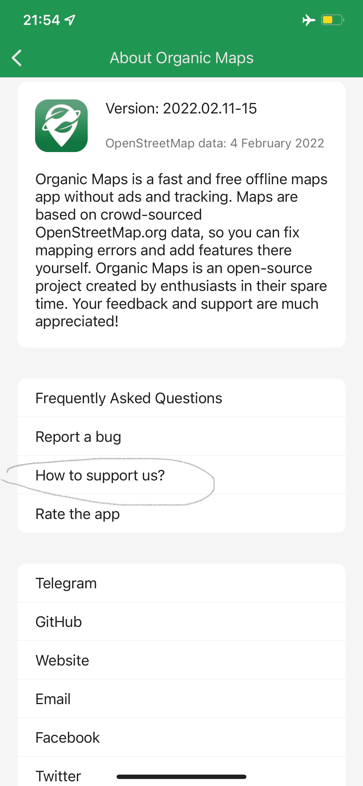
There are many ways to help us and other users of Organic Maps
There are many ways to help us and other users of Organic Maps: https://organicmaps.app/support-us/ Spread the word and share your ideas with us, let's make this World 🌎 a bit more Organic 😉
We have created a Telegram group for Turkish users, moderated by @MetehanOzyurek
We have created a Telegram group for Turkish users, moderated by @MetehanOzyurek Join @OrganicMapsTR or use this link.
The latest data update also includes an updated subway/metro map
The latest data update also includes an updated subway/metro map. Please check issues in your cities and fix them in OpenStreetMap for the next data update: https://cdn.organicmaps.app/subway/
Finally, FDroid update is available too
Finally, FDroid update is available too: https://f-droid.org/en/packages/app.organicmaps/
There is a regression with KML import on Android
There is a regression with KML import on Android. No worries, the fix is already in review.
Update: it’s already available as of January 16.
Meet new January Organic Maps app update, with many improvements from our beloved contributors 🙏
Meet new January Organic Maps app update, with many improvements from our beloved contributors 🙏!
- New OSM maps data as of January 3, 2022
- Improved search results ranking
- Fixed hundreds of "capitals" on the World map
- Fixed some invalid inter-region routes (more fixes in the next update!)
- Search recognizes rd/st/ct=road/street/court synonyms
- Consistent naming for Bookmark Lists
- Updated German, Italian, Romanian, Russian, Ukrainian, Turkish translations
- Added incomplete Hebrew and Swahili translations
Also for Android:
- Duck played music when announcing directions
- Copy most of the POI info using a long tap
- Fix non-working FAQ on Android 5 and 6
- Added Bulgarian translation
Also for iOS:
- Added Belarusian and Persian translations
- Slightly changed Find map in Download Maps dialog
Meet Organic Maps app update 21.12.01
Meet Organic Maps app update 21.12.01 🤖 + 🍏
- New OSM maps data as of November 22
- Fixed routing between map regions, please test and report to us any issues!
- Type "water" or "drinking water" in search to find it around yourself
- Updated Russian, Finnish, German, French, Spanish, Ukrainian, Belarusian and Chinese translations
🤖 Android:
- Long tap on a POI/bookmark name/address to copy them into clipboard
- Reworked opening hours UI
- Restored "maps update is available" indicator
- Added LINE contacts to the place page
- Reduced APK size
- Updated Vulkan driver libraries
iOS:
- Fixed opening of https://omaps.app/ and om:// links on the cold start
Here is the link to hourly updated OSM data validator related to Public Transport in Organic Maps (subways and light rails)
Here is the link to hourly updated OSM data validator related to Public Transport in Organic Maps (subways and light rails). Please, help us to fix red cities in OpenStreetMap and include their subways into the next maps update: https://cdn.organicmaps.app/subway/
19:36
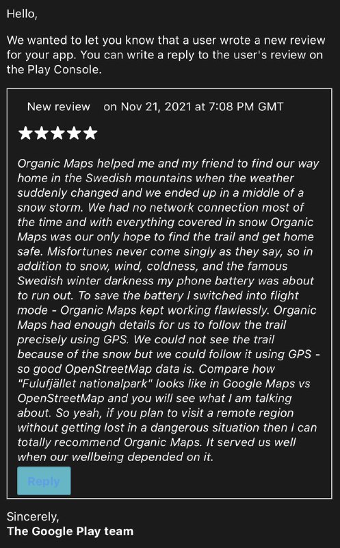
Tell your stories to us and other users
Tell your stories to us and other users. They ignite and inspire us!

Meet November 4 Organic Maps update
Meet November 4 Organic Maps update!
- New OSM maps data as of October 22
- Added mountain saddle, mountain pass, silo, storage tank, chain barrier, swing gate map types
- Fixed some icons and translations
🤖 Android-only:
- Moved❓Help dialog on the main toolbar for a better new user experience, and to avoid negative feedback from non-geeks. We'll add news there too!
- APK now has x86_64 arch for Chromebooks and some old Intel Atom devices
Please help with translating Organic Maps into $your_language 🗺️
Please help with translating Organic Maps into $your_language 🗺️
Read more details in our GitHub Discussions.
In 21.10.15 Google Play update we
In 21.10.15 Google Play update we:
- Fixed crash for Public Routing in some cities
- Added workaround for the nasty Android 11 layout bug when the bottom toolbar was screwed up
- Fixed some translations
- barrier=swing_gate is now visible on the map
Fdroid is not ready yet, stay tuned.
A new app update is available
A new app update is available!
- New OSM maps data as of 02.10.2021
- Added healthcare=laboratory type
- Fixed some map icons and their visibility
- Fixed rare routing crash
- Fixed junction, building=hotel, power=substation, railway=subway, tourism=artwork types
- Fixed missing addresses for some buildings
- Minor localization fixes
Also for Android:
- Editable Facebook, Instagram, Twitter and VK links for places
- Copy OSM and Open Location Code coordinates links
- Fixed black screen on PowerVR Rogue G6110 chips
Sorry, the latest 21.10.07 release for Android has a bug
Sorry, the latest 21.10.07 release for Android has a bug: if you clicked before on coordinates in the place info (to switch coordinates format), then you'll have a crash on startup. Only reinstall can help (but you'll loose your bookmarks!). If you have root access, then close the app and delete /data/data/app.organicmaps.app/files/settings.ini file.
If you didn't click on coordinates before, then it should work.
Good news: the fix is already on it's way into app stores! After updating to the latest 21.10.09 version everything will work back again.
Here is the fixed Google Play apk which can be installed manually (the same as is waiting for review now): https://t.me/organicmaps/8486
Here is the list of OpenStreetMap metro/subways validation results
Here is the list of OpenStreetMap metro/subways validation results:
https://cdn.organicmaps.app/subway/ (hourly) or https://maps.mail.ru/osm/tools/subways/latest/ or https://alexey-zakharenkov.github.io/subways/rapid/
You can help us by fixing red metro lines directly in OpenStreetMap. Then every @OrganicMaps user will have an updated Public Transport map (subways and S-Bahn at the moment).
Some general instructions are here:
https://wiki.openstreetmap.org/wiki/Metro%5FMapping
And here is info how to validate a separate city:
21.09.14 app update is available in Google Play
21.09.14 app update is available in Google Play. We:
- Fixed missing buttons on the toolbar after the search on Android 11, very annoying bug 🐞!
- Updated some translations, thanks to our contributors ❤️
- Fixed incorrectly toggled WiFi when editing a phone number
ℹ️ The latest 21.09.01 update is available in Google Play, App Store and AppGallery with updated OSM maps 🗺️ data snapshot, made on 25th of August.
ℹ️ The latest 21.09.01 update is available in Google Play, App Store and AppGallery with updated OSM maps 🗺️ data snapshot, made on 25th of August. FDroid version is not available yet, because there are some build issues. But with the help of the community they should be resolved soon 🤞
With the help of our community ❤️, in the 21.08.26 update we
With the help of our community ❤️, in the 21.08.26 update we:
- Increased maximum number of intermediate stops from 3 to... try to guess 🙂
- Fixed rare crash when downloading maps
- Made farmlands more visible on the map
- Updated 🇧🇷 Brazil and 🇵🇹 Portuguese translations
On Android, in addition:
- Finally, maps download should work for everyone! You don't need to enable Internet access for Download Manager anymore!
- Bookmark button ⭐ shows "Save" and "Delete" instead of just "Bookmark"
Get it here: https://omaps.app/get
Some highlights about Organic Maps in the French article
You can read some highlights about Organic Maps in the French article.
A new experimental Android beta version with improved map downloader is available for testing
A new experimental Android beta version with improved map downloader is available for testing.
This version should fix 0% download issue once and for all! Please let us know if you still have any issues with maps downloading, or any other issues. We will fix them ASAP!
A minor update is available in Google Play
A minor update is available in Google Play https://omaps.app/gp
- Fixed download progress stuck at 0% and made it fractional
- Fixed metro/subway entry icons in some cities
- Added "Report a bug" button in the main menu
- Fixed invisible button in the navigation panel on Android 6+
Please let us know if you still have any issues with maps downloading, or any other issues. We will fix them ASAP!
Organic Maps is back on Google Play after a temporary problem 🎉
Organic Maps is back on Google Play after a temporary problem 🎉
We have a temporary issue with Google Play app availability
We have a temporary issue with Google Play app availability. Hopefully it will be fixed soon 🤞
News for anyone who wants to support the development of free, open-source, offline, privacy-focused maps for travelers, hikers, motorists, and cyclists
News for anyone who wants to support the development of free, open-source, offline, privacy-focused maps for travelers, hikers, motorists, and cyclists. We're accepting 💰donations for servers and new features for your favorite app. Read more here: https://organicmaps.app/donate/
Meet a new app August 2021 update
Meet a new app update with:
- 🗺️ Updated OpenStreetMap data
- Added 🇧🇬Bulgarian and 🇧🇷Brazil translations (thanks to our contributors!)
- 🍖Picnic tables are on the map!
- Wrong regions are not offered anymore for cross-region routing
- Improved ETA for remote tracks and roads
- Fixed FAQ
🍏 iOS:
- You can now edit/move/delete tracks and bookmarks
- CarPlay map is properly aligned
- Failed downloads are now resumed
- Aligned bottom bar buttons
🤖 Android:
- Fixed layout bugs, including RTL languages
- Fixed some non-working search queries
- Fixed wrong encoding in bookmark description
- Fixed import of KML/KMZ files
- Silence media volume while announcing navigation directions
- Display and edit multiple phone numbers
- Reduced apk size
As always, we're counting on your feedback about bugs and issues. Have a happy weekend!
Updated OM 🧘 version 2021.07.08 is here!
Updated OM 🧘 version 2021.07.08 is here!
Both platforms:
- Finally, meet the updated OSM map data!
- Fixed failing OSM login due to OSM backend changes
- Resized car repair, charging station, museum icons
- Updated hostel, kindergarten, clothes, dentist icons with a white filling
- Reduced timeouts for map downloads
- Fixed crash in the search on regions boundaries
- Fixed routing crash when point doesn't belong to any map file (in a gap between)
- Fixed texts in the FAQ
Android:
- Removed annoying top panel when selecting a place on the map
- Fixed issue when new bookmark set is not assigned to the bookmark after creation
- Enabled DownloadManager notifications
- Replaced icons for adding and removing bookmarks
- Fixed "Mobile Internet" settings
iOS:
- Disabled backup for map files
- Removed non-working traffic button in Navigation mode
- Added gradient to the app icon
A new 2021-06-24 update is available on Google Play 📦
A new 2021-06-24 update is available on Google Play 📦
In this update we:
- Improved maps downloading speed for certain regions
- Fixed uploading of map edits to OpenStreetMap
- Fixed bookmark sharing from Bookmarks (Categories) screen
🍃 🗺
A list of maps data mirrors (supported by community enthusiasts) for those in need is available here
A list of maps data mirrors (supported by community enthusiasts) for those in need is available here: https://cdn.organicmaps.app/
🚗 iOS update with a (finally!) working CarPlay is live
🚗 iOS update with a (finally!) working CarPlay is live. Happy driving!
Please don't forget, as there are 0 (zero, none) analytics and statistics libraries in Organic Maps, we rely entirely on your detailed feedback about issues you encounter.
There are already many requests from users to add public transport support
There are already many requests from users to add public transport support. It would be great to start using that existing OpenStreetMap data and add/update transport schedules directly from the app. For anyone interested to volunteer, there is also a good starting point here.
To import bookmarks from MapsMe and other apps which support KML/KMZ on Android, open Bookmarks menu from the bottom toolbar and press Import button.
To import bookmarks from MapsMe and other apps which support KML/KMZ on Android, open Bookmarks menu from the bottom toolbar and press Import button.
Automated import from iOS is not technically possible, so here is a small guide
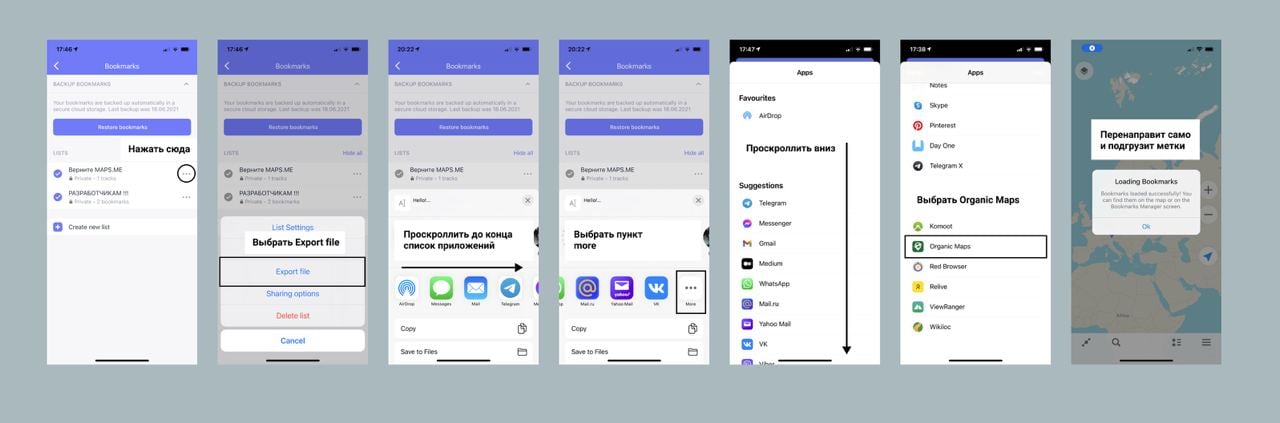
Android 5 support, OSM login, bookmarks export, and some other fixes are already in review, as the CarPlay for iOS
Android 5 support, OSM login, bookmarks export, and some other fixes are already in review, as the CarPlay for iOS. Please be patient, or install the latest betas.
🍃 Organic Maps is live!
🍃 Organic Maps is live!
iOS:
Android:
Please give us ⭐ ⭐ ⭐ ⭐ ⭐ on AppStore and Google Play to help this project survive! 🔥
——
Organic Maps is an open-source Android & iOS offline maps app for travelers, tourists, hikers, and cyclists based on top of crowd-sourced OpenStreetMap data and curated with love by MAPS.ME founders.
Organic Maps is pure and organic, and free from trackers and other bad stuff:
✅ No ads
✅ No tracking
✅ No data collection
✅ No phoning home
✅ No annoying registration
✅ No mandatory tutorials
✅ No noisy email spam
✅ No push notifications
✅ No crapware
✅ No pesticides 😇
🔗 Telegram Channel for Updates
🔗 Telegram discussions
🔗 Telegram для русскоговорящих
🔗 Our website
🔗 Our GitHub
New GitHub page 🗺
New GitHub page 🗺
https://github.com/organicmaps/organicmaps#readme
Organic Maps is pure and organic, made with love:
☘ Respects your privacy 🌱 Saves your battery 🍃 No unexpected mobile data charges
Organic Map is free from trackers and other bad stuff:
✅ No ads ✅ No tracking ✅ No data collection ✅ No phoning home ✅ No annoying registration ✅ No mandatory tutorials ✅ No noisy email spam ✅ No push notifications ✅ No crapware ✅ No pesticides 😇
👉 Reject surveillance - spread the word about Organic Maps!
Organic Maps app is now available on F-Droid!
Organic Maps app is now available on F-Droid!
A new beta version 2021-05-21 is out.
A new beta version 2021-05-21 is out.
The version contains bug fixes and stability improvements.
Please use updated links:
Android:
iOS:
A new version 2021-05-08 is availiable for iOS and Android.
A new version 2021-05-08 is availiable for iOS and Android.
This update fixes several bugs and includes the latest May data.
iOS:
- Fixed crash in bookmarks
Install from TestFlight
Android:
- Fixed crash in Settings
- Fixed random crashes in the background
Get it on Google Play Download APK from GitHub
No more trackers according to the latest Exodus Privacy Report!
No more trackers according to the latest Exodus Privacy Report!
Install Organic Maps from: