Organic Maps November 2026 update: 3D terrain, ocean depths, imported areas, and route reversal
November 11, 2026
Explore 3D terrain and ocean depths, reverse routes, and view imported areas and track direction arrows. Android adds detailed public transport directions, a redesigned speed display, and a track recording widget. See all improvements below.
Get Organic Maps at get.omaps.org and spread the word. Thanks to all our users, contributors, donors, and supporters!
Release notes
Map and places
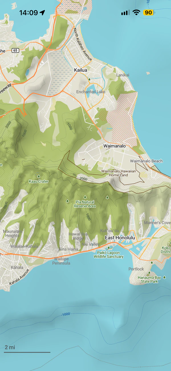
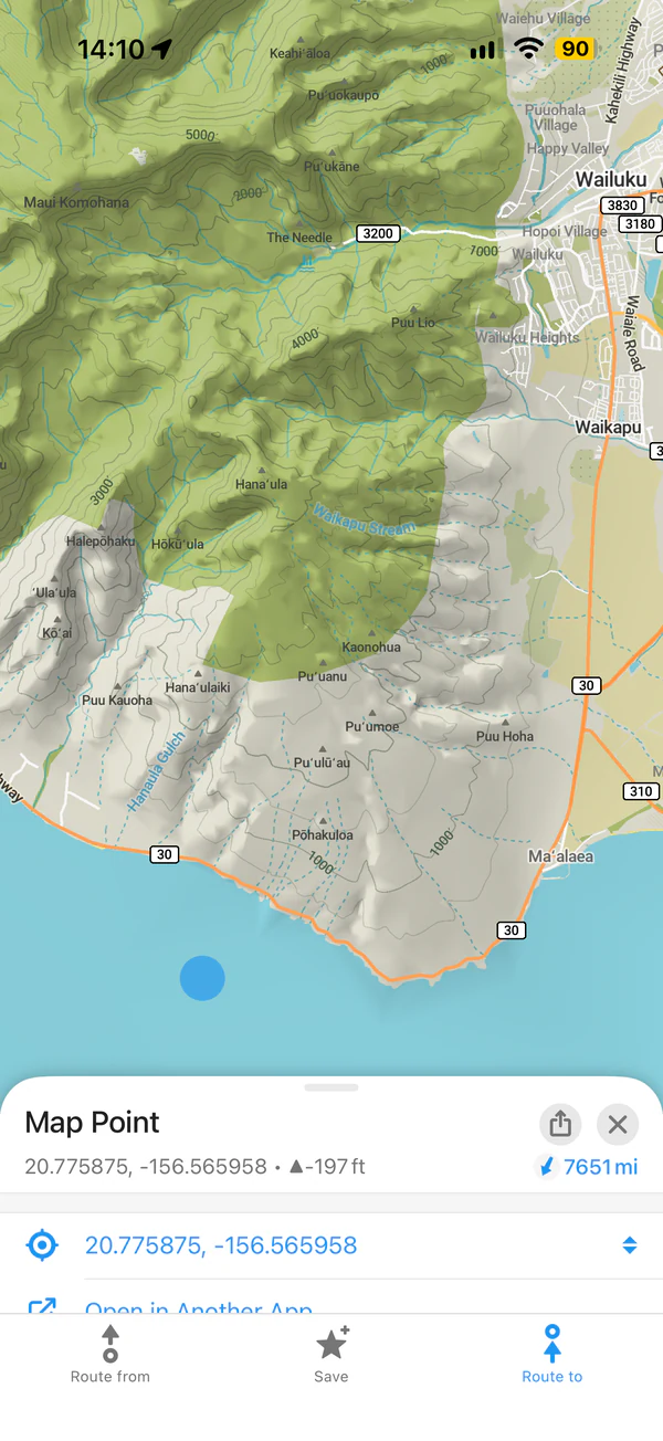
- NEW! 3D terrain, ocean depths, contour lines in meters and feet, and elevation anywhere on the map (Viktor Govako, Alexander Borsuk)
- OpenStreetMap data as of November 10, 2026
- Wikipedia articles as of November 1, 2026
- Improved water colors, widened rivers, and added subtle outlines to water labels (David Martinez, Viktor Govako)
- Improved display of intermittent rivers, canals, drains, and other waterways (Alexander Borsuk)
- Added bridge outlines for trams, monorails, funiculars, and narrow-gauge railways (Alexander Borsuk)
- Added barbers, Pilates studios, window installers, waterworks, and covered reservoirs (Viktor Govako)
- Fixed gaps in filled areas, including missing water near the Arctic (Viktor Govako)
- Fixed transliteration (Alexander Borsuk)
- Improved performance and reduced memory use (Viktor Govako)
- Fixed a crash and rendering errors when switching map styles (Mikhail Listratsenka)
- Corrected download region boundaries (Viktor Govako, Alexander Borsuk)
- Search suggestions now keep original spelling, accents, and capitalization (Alexander Borsuk)
- Removed unrelated beauty salons from hairdresser and barber searches (Viktor Govako)
Bookmarks, tracks, and areas
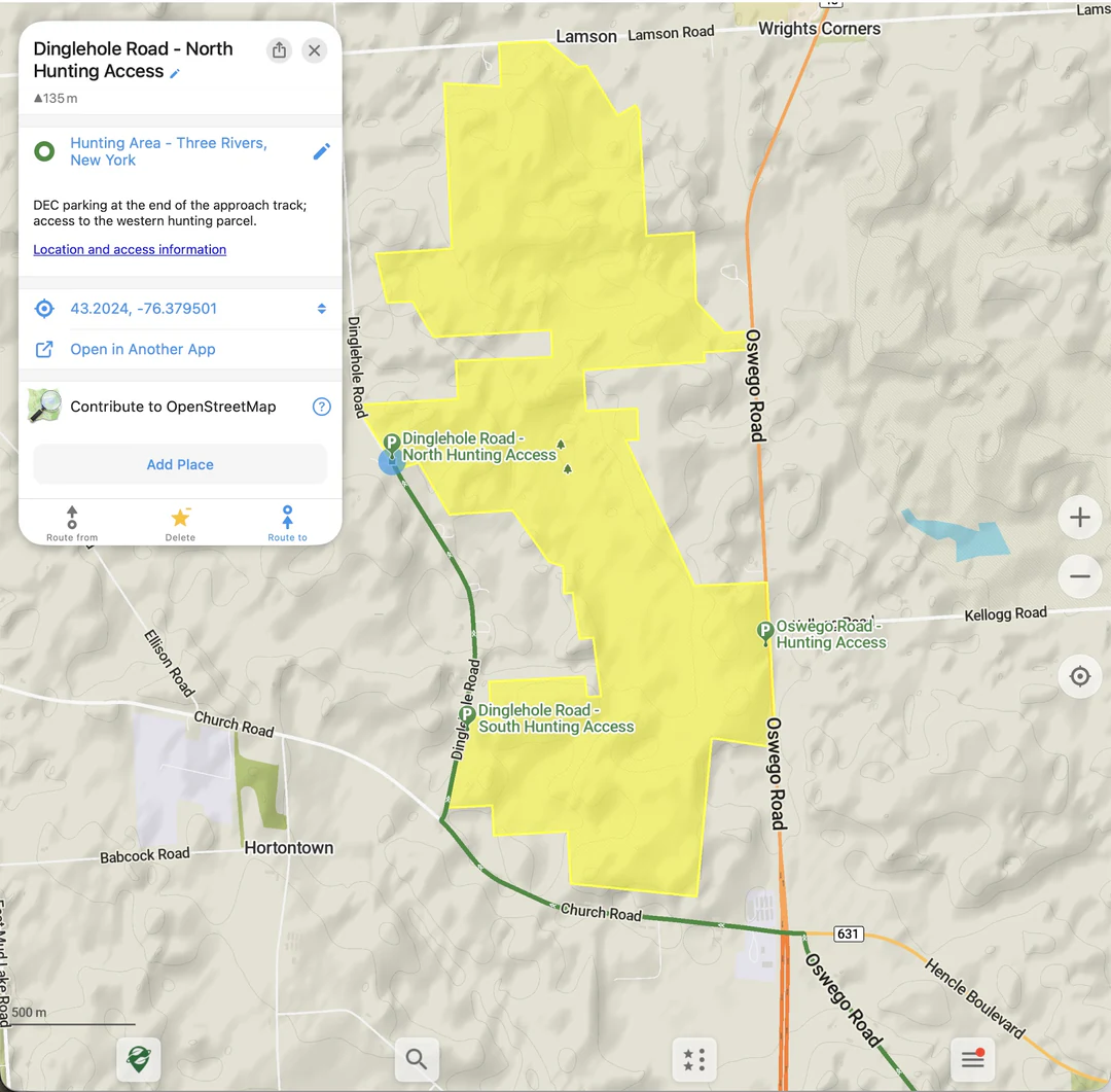
- NEW! Import and display KML, KMZ, and GeoJSON areas with colored outlines, fills, and holes (Alexander Borsuk, Viktor Govako)
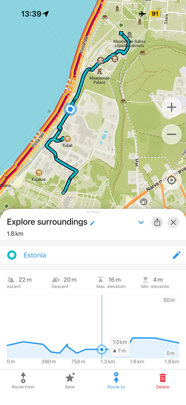
- Added track direction arrows (Alexander Borsuk)
- Selected tracks are now highlighted (Alexander Borsuk)
- Opening a track from a list selects its start (Alexander Borsuk)
- Bookmark and track names now sort correctly for your language (Alexander Borsuk)
- Bookmark list names, descriptions, and images now update after reload (Kiryl Kaveryn, Alexander Borsuk)
- Saved KML routes keep intermediate stops and travel mode. GPX and GeoJSON exports include stops as waypoints (Alexander Borsuk)
- Fixed crashes when deleting edited tracks or returning to an open deletion dialog (Viktor Govako)
- Track recordings now save every minute for crash recovery (Viktor Govako)
- Fixed duplicate map counts and inflated download sizes in update summaries (Alexander Borsuk)
Routing and navigation
- NEW! Separate route avoidance settings for driving, cycling, and walking (Alexander Borsuk, Mikhail Listratsenka)
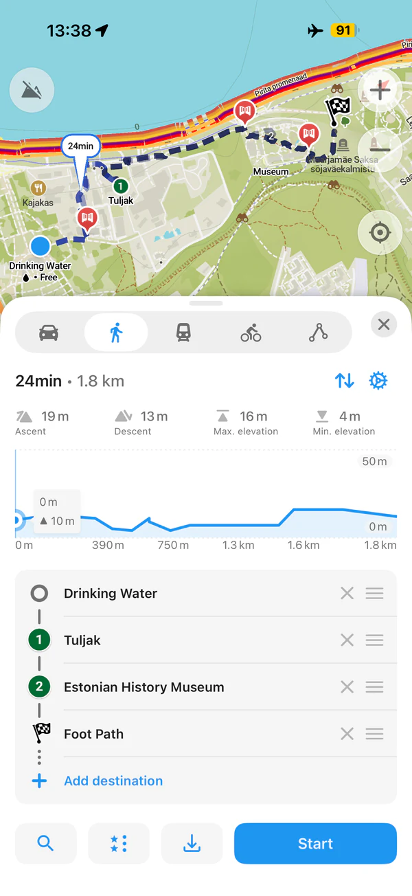
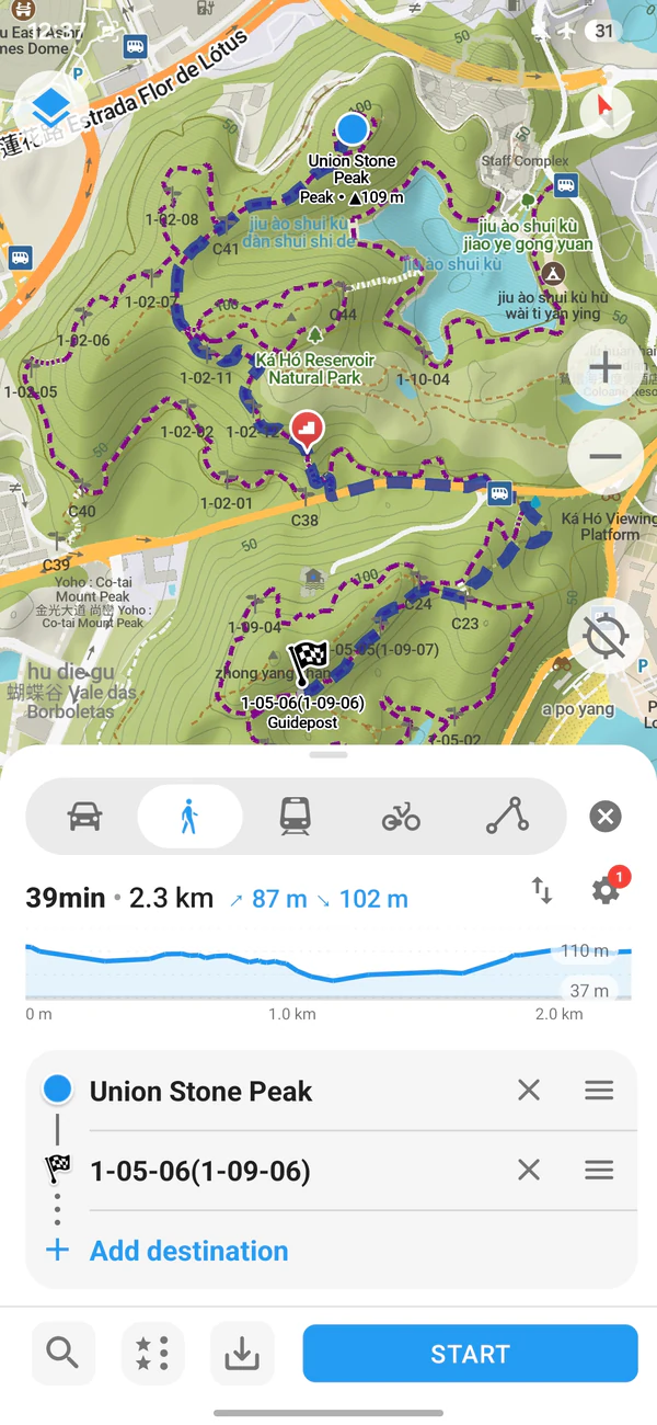
- Connected route point icons and clarified “Add destination” labels on Android and iOS (Kiryl Kaveryn, Mikhail Listratsenka)
- You can add destinations even if route calculation fails (Kiryl Kaveryn)
- Improved routing algorithm (Viktor Govako)
- Improved route recalculation (Alexander Borsuk)
- Fixed mismatched route durations on the map and information panel (Alexander Borsuk)
- Fixed outdated speed camera warnings and delayed speed limit updates (Alexander Borsuk)
- Fixed issues with saved routes (Alexander Borsuk)
- Improved route restoration (Alexander Borsuk, Mikhail Listratsenka)
- Improved public transport arrival estimates, walking connections, and station entrance markers (Alexander Borsuk)
OpenStreetMap editor
- Improved category search (Alexander Borsuk)
- Cuisine names now sort correctly for your language (Alexander Borsuk)
- Fixed category sorting (Alexander Borsuk)
Translations
- Added Welsh: app interface, place types, search categories, and download region names (Carl Morris, Alexander Borsuk)
- Added system language options: Android (Asturian, Galician, Croatian, Armenian, Icelandic, Lao, and Albanian) and iOS (Asturian, Canadian French, Galician, Croatian, and Icelandic) (Alexander Borsuk)
- Corrected Slovenian search categories (Alexander Borsuk)
- Improved Ukrainian, Czech, Swedish, and Korean translations; fixed wording and brand spelling in other languages (Nnifria, Alexander Borsuk, bilykralik16, Jonatan Nyberg, Dmitry Gribenchuk, M)
- Corrected distance and duration units and public transport platform labels (Alexander Borsuk)
- Improved Arabic and Czech spoken directions; fixed Catalan, Danish, and Galician navigation distances (Alexander Borsuk, Anquanna)
- Fixed Norwegian Bokmål place names and uploads of edited names (Alexander Borsuk)
- About page links now open the correct language groups (Alexander Borsuk)
iOS
- NEW! Added a button to reverse routes with all stops (Kiryl Kaveryn)
- Remove any route point from the planner, including the start and destination (Kiryl Kaveryn)
- Improved navigation voice sorting and added missing preview phrases (Alexander Borsuk, Kiryl Kaveryn)
- Fixed dark mode readability for ruler distances and pressed route point labels (Alexander Borsuk)
- Improved public transport previews: more symbols, clearer line colors, wrapped line numbers, and better right-to-left layouts (Alexander Borsuk, Kiryl Kaveryn)
- Fixed the compass button in right-to-left layouts (Kiryl Kaveryn)
- Fixed place details that stayed open after dismissal, moved during drags, or disappeared when opening another map link (Kiryl Kaveryn)
- Fixed a crash when map downloads update place details before loading finishes (Kiryl Kaveryn)
- Highlighted the main action in place details (Kiryl Kaveryn)
- Fixed menu and Settings links, including scrolling to and highlighting options (Kiryl Kaveryn)
- Fixed confirmation buttons with large text when starting navigation for the first time (Kiryl Kaveryn)
- Fixed route point replacement at the stop limit and replacement labels for saved tracks (Kiryl Kaveryn)
- Fixed elevation profiles after returning to the map, selecting a track’s start, or viewing flat or zoomed sections (Kiryl Kaveryn)
- CarPlay bookmark lists refresh after edits and reloads, show all items that fit, and handle deleted entries (Kiryl Kaveryn, Alexander Borsuk)
- Fixed the routing settings indicator being cut off in previews (Kiryl Kaveryn)
- Improved canceling, retrying, and resuming downloads, including in the background (Viktor Govako)
Android
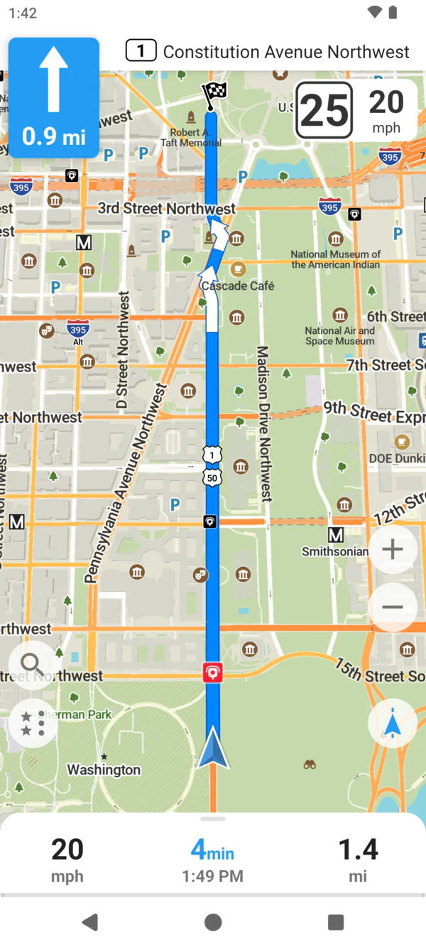
- NEW! Redesigned speed and speed limit display, including in Android Auto (Andrei Shkrob)
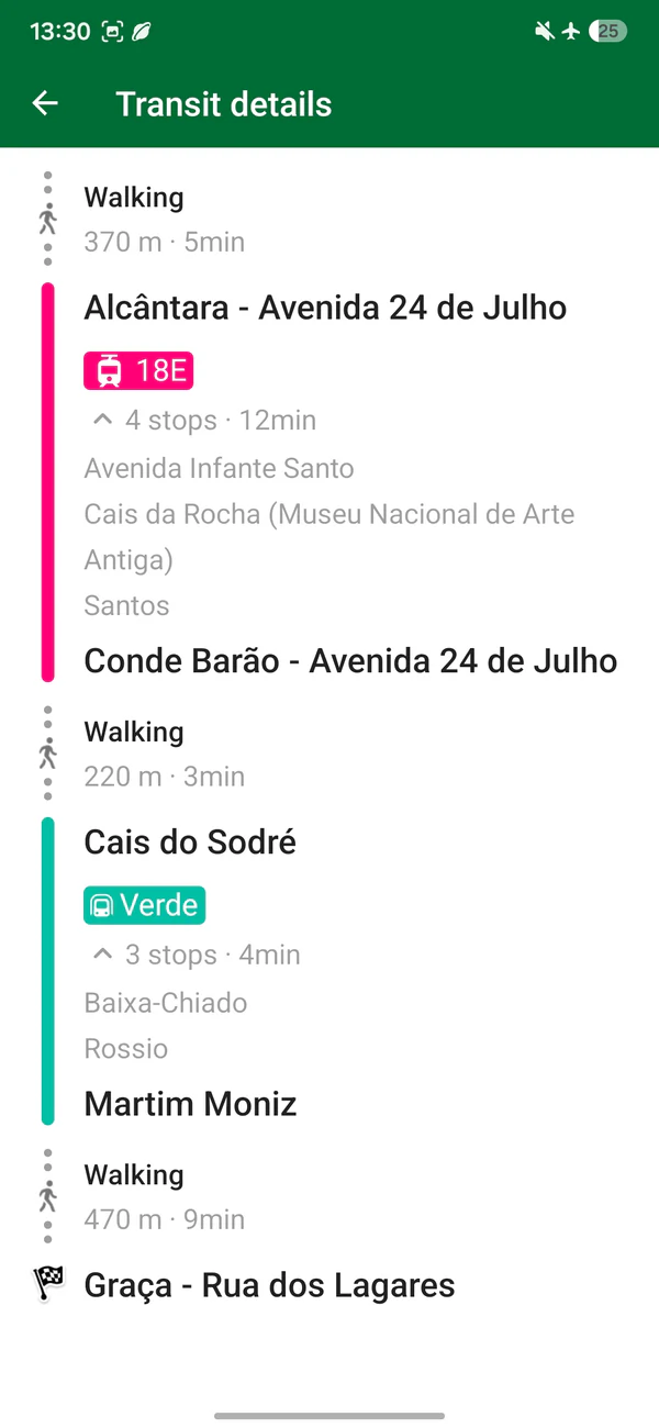
- NEW! Full-screen public transport directions: boarding stops, transfers, exits, and expandable lists of intermediate stops (Paal Williams)
- NEW! Home screen widget to start track recording and show elapsed time, distance, and elevation (Mikhail Listratsenka)
- NEW! Added a button to reverse routes with all stops (Mikhail Listratsenka)
- NEW! Display and record altitude relative to mean sea level (MSL) (Alexander Borsuk)
- Added a one-time reminder to check battery restrictions when starting track recording, with a system settings shortcut. See https://dontkillmyapp.com (Harsh Mishra, Alexander Borsuk)
- Remove any route point from the planner, including the start and destination (Mikhail Listratsenka)
- Fixed interface issues and highlighted the main routing action in place details (Mikhail Listratsenka)
- Fixed Android Auto crashes (Andrei Shkrob, Mikhail Listratsenka)
- Category search results now clear when you tap Search again or stop navigation (Mikhail Listratsenka)
- Country folder icons now open their regions; old search results no longer replace open folders (Mikhail Listratsenka)
- Added “Bookmarks and Tracks backup” to Privacy settings, opening Android’s backup settings (Mikhail Listratsenka)
- Improved readability of bookmark and track descriptions in light and dark themes (Mikhail Listratsenka)
- Fixed editing of opening hours spanning 24 hours (Alexander Borsuk)
- Fixed arrival times across daylight saving time changes (Alexander Borsuk)
- Fixed editor crashes when tapping street or self-service options twice (Kevin Coughlin)
- Fixed crashes and incomplete imports of missing or unsupported bookmark files shared by other apps (Darafei Praliaskouski)
- Fixed Vulkan rendering errors and crashes when the graphics context changes (Alexander Borsuk)
Desktop
- Translated the interface and place types; improved language fallback and right-to-left layouts (Alexander Borsuk)
- Fixed non-Latin links and description previews in place details (Alexander Borsuk)
- Fixed saving cuisine choices and deleting places in the OpenStreetMap editor (Alexander Borsuk)
- Fixed a crash when closing the map download window during searches (Alexander Borsuk)
- Fixed map rendering when resizing the window (Alexander Borsuk)
- Improved location updates and fixed the “My Position” button after location errors (Alexander Borsuk, Vladislav Shadiuk)
Try new features and help test them at https://beta.omaps.app.
Thanks for using and supporting Organic Maps!
Your Organic Maps Team